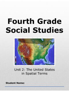
Fourth Grade Social Studies
mountain range a row of connected mountains Example: The Rockies and the Appalachian are two major mountain ranges in the United States. Big Ideas of Lesson 2, Unit 2 • Place is an important theme in geography. • Geographers investigate both the physical and human characteristics of a place.
Download Fourth Grade Social Studies

Information
Domain:
Source:
Link to this page:
Documents from same domain
Lesson 1: What is a Good Citizen? - Social Studies Curriculum
flintsocialstudiescurriculum.weebly.comLesson Sequence 1. Review the characteristics of a community which have been developed throughout the all units by using the “Connecting Back” graphic organizer located in the Supplemental Materials (Unit 6, Lesson 1) or the large version of the organizer you created on chart paper in Lesson 1 of Unit 3. 2.
Fifth Grade Social Studies: Integrated Early American History
flintsocialstudiescurriculum.weebly.com1, mercantilism 2, colonial competition, and religious aspiration. Their arrival to North America was met by a varied indigenous response that contributed …
Seventh Grade Social Studies: Ancient World History
flintsocialstudiescurriculum.weebly.comThis unit introduces students to the disciplines of anthropology and archaeology in the context of studying human origins and prehistoric human societies. Students begin with a literacy-rich lesson in which they are introduced to the importance of metacognition – being aware of …
Fourth Grade Social Studies
flintsocialstudiescurriculum.weebly.com4th Grade Michigan Studies Unit 1: Foundations in Social Studies Michigan Citizenship Collaborative Curriculum Page 18 of 32 Lesson 3 Graphic Organizer Limited Resources Unlimited Wants Natural Capital Human Scarcity causes which means people can’t have all the Goods and Services they want. So people have to make Choices
Lesson 1: Scarcity and Choice - Social Studies Curriculum
flintsocialstudiescurriculum.weebly.comMichigan Citizenship Collaborative Curriculum, 2010. Numeroff, Laura. If You Give a Pig a Pancake. New York: HarperCollins Publishers, 1998. - optional Numeroff, Laura, If You Take a Mouse to School. New York: Harper Collins, 2002. - optional Lesson Sequence Using Word Cards #1-#3 and the “Connecting Back” organizer, located in the
Fourth Grade Social Studies - Weebly
flintsocialstudiescurriculum.weebly.comFourth Grade Social Studies Unit 2: The United States in Spatial Terms Student Name: 4th Grade United States Studies Unit 2: The United States in Spatial Terms Michigan Citizenship Collaborative Curriculum Page 1 of 61 Big Picture Graphic Overarching Question: How does the geography of the United States affect the way people live? ...
Third Grade Social Studies
flintsocialstudiescurriculum.weebly.comUse the chart below to write or draw about these questions. Things I Know Questions I Have . ... The Early History of Michigan ... was built. In 1869, the first church building, a Baptist church, was built. Before this, church services were held in people’s homes.
Related documents

Birth of the Mountains - USGS
pubs.usgs.govin the Appalachian Mountains. Examples include Blowing Rock in northern North Carolina and Red Top Mountain in northern Georgia. Figure 5. The location of rocks over 1.1 billion years old (red) in southeastern Canada and the eastern United States. These rocks are remnants of an ancient supercontinent. From Rankin and others, 1989. The ...
The Northeast Region - Bellefonte Area School District
www.basd.netthe Appalachian Mountains are smooth and rounded. The longest hiking trail in the world is the Appalachian Trail. It goes from Maine to Georgia, along the spine of the mountain range, through more than 2,000 miles of valleys, hills, and rivers. The Appalachian Trail is a very popular place to hike. There are many people who have hiked the ...

Bear Mountain State Park Trail Map
parks.ny.govAI Appalachian Trail - 6 Miles BP - Bike Path - 2 Miles BL - Brooks Lake Trail - 1 Mile CM - Cornell Mine Trails - 2 Miles FT - Fawn Trail - 0.2 Miles MW - Major Welch Trail - 2.5 Miles P G -op lg en rT a i1.8 M s RD - Ramapo-Dunderberg Trail - 4.4 Miles S -k iTra l5.8 M es SBM - Suffern Bear Mountain - 2.7 Miles TT - Timp-Torne Trail - 6.5 Miles
ABBREVIATIONS, SIGNS, AND SYMBOLS - USGS
pubs.usgs.govAppalachian Basin, SAF for San Andreas Fault, or MVTD for Mississippi Valley-type deposits. Abbreviations are used freely in tables, partly because of tight space limitations. Abbreviations used in tables are defined in bracketed headnotes. In general, abbreviations for scientific terms and for terms of measurement are not followed by periods;

State Game Lands 106 Map - Pennsylvania Game Commission
www.pgc.pa.govrange from a high of 1600' along the ridge top of the Blue Mountain to 500' along the Schuylkill River near Port Clinton. ... foliage tours, and heavy usage of …

NEW YORK STATE DEPARTMENT OF HEALTH Bureau of …
www.health.ny.govAdirondack-Appalachian Big Lakes Central New York Finger Lakes Hudson-Mohawk Hudson Valley Midstate Monroe-Livingston Mountain Lakes Nassau North Country New York City Southern Tier Southwestern Suffolk Susquehanna Westchester Wyoming-Erie. …
The Transportation Revolution - American Experience
americanexperience.si.eduopened up the land west of the Appalachian Mountains to settlers. The idea of the canal was proposed as early at the mid-eighteenth century. Its purpose was two-fold: to enable settlers easy access across the Appalachians and to provide a trade route across the mountains. The