
How to Read a Topographical Map - USDA
A topographic map illustrates the topography, or the shape of the land, at the surface of the Earth. The topography is represented by contour lines, which are imaginary lines. Every point on a particular contour line is at the same elevation. These lines are generally relative to mean sea level. The illustration above on the
Download How to Read a Topographical Map - USDA

Information
Domain:
Source:
Link to this page:
Documents from same domain
Planting Guide - USDA
www.nrcs.usda.govPlanting Guide Plant Materials <http://plant-materials.nrcs.usda.gov/> ... The Quicksand, Kentucky Plant Materials Center has relocated to Alderson, ...
[Federal Register: August 31, 2007 (Volume 72, …
www.nrcs.usda.gov[Federal Register: August 31, 2007 (Volume 72, Number 169)] ... From the Federal Register Online via GPO Access ... DEPARTMENT OF AGRICULTURE .
Urban Hydrology for Small Watersheds - Home | …
www.nrcs.usda.govNatural Resources Conservation Service Conservation Engineering Division Technical Release 55 June 1986 Urban Hydrology for Small Watersheds TR-55
NATIONAL ENGINEERING HANDBOOK 210-VI …
www.nrcs.usda.govNATIONAL ENGINEERING HANDBOOK 210-VI STRUCTURAL ENGINEERING PART 636 AMENDMENT WY-1 SUBJECT: ENG – CHAPTER 52, “STRUCTURAL DESIGN OF FLEXIBLE CONDUITS” Purpose: To provide all field offices a copy of Chapter 52 and supplemental information
Community Garden Guide - USDA
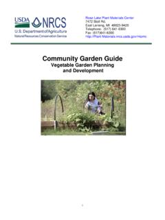
www.nrcs.usda.gov(You will need a planting guide to determine recommended spacing, depth etc. Contact your extension office if you need a guide.) If you’ve made adjustments to the per person needs in column 2, you can estimate the amount to plant using column 4.
Tillage Equipment - USDA
www.nrcs.usda.govAbout this guide... The purpose of the guide is to help you identify commonly used farm equipment. Its color photos and line drawings will facilitate communication between NRCS and our clients by
Dealing with Difficult People - USDA
www.nrcs.usda.govDifficult People Defined and Explained The Hostile Aggressive The bully that always needs to be right. They tend to be abusive, abrupt, accusatory, intimidating,
Soil Data Viewer 6.2 User Guide - USDA
www.nrcs.usda.govSOIL DATA VIEWER OUTPUT ... relieving the user from the burden of querying the soil database, processing the data and then linking the ... After downloading this ...
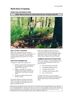
November 2008 Multi-story Cropping - USDA
www.nrcs.usda.govNovember 2008 The diagram above identifies the effects expected to occur when this practice is applied according to NRCS practice standards and specifications.
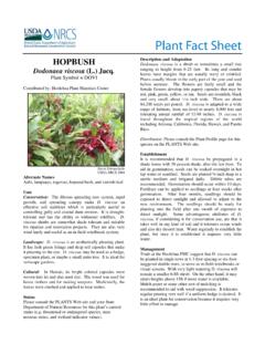
hop bush Plant Fact Sheet - USDA
www.nrcs.usda.govbefore summer. The flowers are fairly small and the female flowers develop into papery capsules that may be red, pink, green, yellow, or tan. Seeds are roundish, black and very small; about 1/16 inch wide. There are about 84,200 seeds per pound. D. viscosa is adapted to a wide range of habitats, from sea-level to nearly 8,000 feet and
Related documents

FEATURES SHOWN ON TOPOGRAPHIC MAPS - USGS
pubs.usgs.govtopographic maps of the Survey. b. Planimetric map. --A planimetric map is similar to a topographic map, except that it does not portray relief in a measurable form. The Survey publishes some planimetric maps for use until they can be replaced by topographic maps. 1 The number 1 B 3 signifies Book 1, Part B, Chapter 3 of the

Chapter 2 Reading Topographic Maps and Making Calculations
www.honolulu.hawaii.eduTopographic maps do not show the latitude/longitude lines – just the tick marks. The numbers next to the tick marks indicate degrees (°), minutes (') and seconds ("). On 1:24,000 scale maps, latitude and longitude tick marks are indicated every 2.5 minutes.

TOPOGRAPHICAL SURVEY REPORT - PART OF L.R No. …
www.iucn.orgA topographic map or plat shall be prepared that shall be of a scale, size and accurately to clearly show the results of the survey. 7. DATA The surveyor shall locate and show on the topographic survey map or plat the following information:
Topographic Maps: The basics - NRCan
www.nrcan.gc.caTOPOGRAPHIC MAPS: The basics Topographic maps produced by Natural Resources Canada (NRCan) offer detailed information on a particular area and are used for several types of . activities such as emergency preparedness, urban planning, resource development and surveying to camping, canoeing, adventure racing, hunting and fishing.

How to Determine Latitude and Longitude from Topographic …
www.oregon.govTOPOGRAPHIC MAPS Latitude is the distance north or south of the equator. Longitude is the distance east or west of the prime meridian (Greenwich, England). Latitude and longitude are measured in seconds, minutes, and degrees: 60″ (seconds) = 1′ (minute) 60′ (minutes) = 1° (degree) To determine the latitude and longitude of your facility,

Topographic Surveying - PDH University
www.pdhuniversity.comTopographic surveying is performed to determine the planimetric location and topographic relief of features in three dimensions. Topographic surveys are performed for detailed large-scale site plan drawings or maps at scales equal to or larger than 1 inch = 100 feet (1:1,200).
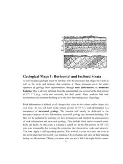
Geological Maps 1: Horizontal and Inclined Strata
www.southalabama.edutopographic maps (Figure 1). Marine geologists who wish to investigate the floors of oceans would consult bathymetric maps (Figure 2). Both of these maps use contour lines in order to represent changes in altitude or water depth. Your instructor(s) may discuss these maps in more detail during one or more of your labs. There is also an

Six Maps FAQ - Spatial Services
www.spatial.nsw.gov.auQ11. How current is the cadastral and topographic data displayed in SIX Maps? The data displayed in SIX Maps is sourced from NSW Foundation Spatial Data Framework Data Themes. Information within these datasets is updated daily and automatically uploaded to SIX Maps to provide users with the most up to date information. Q12.