maps: Draw Geographical Maps
Package ‘maps’ September 25, 2021 Title Draw Geographical Maps Version 3.4.0 Date 2021-09-25 Author Original S code by Richard A. Becker and Allan R. Wilks. R version by Ray Brownrigg. Enhancements by Thomas P Minka and Alex Deckmyn. Description Display of maps. Projection code and larger maps are in separate packages ('mapproj' and 'mapdata').
Download maps: Draw Geographical Maps

Information
Domain:
Source:
Link to this page:
Documents from same domain
Package ‘segmented’ - R
cran.r-project.orgPackage ‘segmented’ November 30, 2017 Type Package Title Regression Models with Break-Points / Change-Points Estimation Version 0.5-3.0 Date 2017-11-22
gap: Genetic Analysis Package - R
cran.r-project.org2 gap: Genetic Analysis Package from patients su ering with di erent diseases to identify common genetic variations for each condition. It is hoped that by identifying these genetic signposts, researchers will
Package ‘season’ - R
cran.r-project.orgPackage ‘season’ May 20, 2018 Type Package Title Seasonal Analysis of Health Data Version 0.3.6 Author Adrian Barnett and Peter Baker Maintainer Adrian Barnett <a.barnett@qut.edu.au>
Package ‘medicalrisk’ - The Comprehensive R …
cran.r-project.orgPackage ‘medicalrisk’ ... 2016 Type Package Title Medical Risk and Comorbidity Tools for ICD-9-CM Data Version 1.2 Date 2016-01-23 Description Generates risk estimates and comorbidity flags from ICD-9-CM ... Adapting a clinical comorbidity index for use with ICD-9-CM administrative data: differing perspectives. Journal of clinical ...
Package ‘testthat’ - R
cran.r-project.orgPackage ‘testthat’ December 13, 2017 Title Unit Testing for R Version 2.0.0 Description Software testing is important, but, in part because it is
Package ‘forecast’ - The Comprehensive R Archive …
cran.r-project.orgPackage ‘forecast’ June 21, 2018 Version 8.4 Title Forecasting Functions for Time Series and Linear Models Description Methods and tools for displaying and analysing
Package ‘emma’ - R
cran.r-project.org2 emma-package Index 21 emma-package Designing experiments for process optimization Description The evolutionary model-based multiresponse approach (EMMA) is a procedure for process opti-
Package ‘WeibullR’ - cran.r-project.org
cran.r-project.orgPower" presentations in Appendix D of "The New Weibull Handbook, Fifth Edition". For validity of a 3rd parameter optimization on a given model over its 2 parameter fit, only the Likelihood Ratio Test will be applied. This validity check requires an LRT-P greater than 50 Value
Package ‘psycho’ - The Comprehensive R Archive Network
cran.r-project.orgPackage ‘psycho’ September 13, 2018 Type Package Title Efficient and Publishing-Oriented Workflow for Psychological Science Version 0.3.7 Maintainer Dominique Makowski <dom.makowski@gmail.com>
Package ‘network’
cran.r-project.orgnetwork-package 3 Details The networkpackage provides tools for creation, access, and modification of networkclass objects. These objects allow for the representation of more complex structures than can be readily handled
Related documents

Outline Maps - NASA
er.jsc.nasa.govOutline Maps Outline Map of Asia Outline Map of Antarctica Outline Map of the Eastern Hemisphere Outline Map of the Former Soviet Union Outline Map of the Mediterranean Outline Map of Middle America Outline Map of North America Outline Map of South America Outline Map of Southeast Asia Outline Map of U.S.-Mexican Border Outline Map of the ...
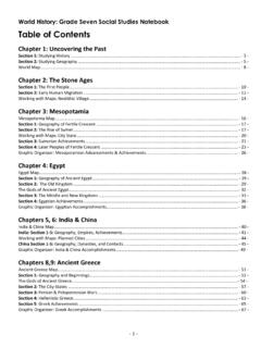
World History: Grade Seven Social Studies Notebook
carrithers7ss.weebly.com- 16 - Mesopotamia Map Complete the map below following the directions at the bottom of the page. Find and label these locations: Step 1: In Green - Outline and Color in the area of Mesopotamia Step 2: In Red - Label the following countries: o Turkey, Syria, Iraq, Iran, Kuwait, Saudi Arabia, Jordan, Egypt, Israel, Lebanon

Strategy Maps and Balanced Scorecards
images.template.netFacilitate world-class research, teaching and learning through leadership in the creation, access, use, and preservation of information and knowledge for scholars at the University of Virginia University of Warwick Library Strategy Map 2009/10

Maps and Cartography - Ball State University
lib.bsu.edudiscovery of the world, and maps are a critical component of geography. Learning more about cartography and the common elements of maps will enhance the understanding of the world. Maps really are a geographer’s most important tool.
Permian Basin - Energy Information Administration
www.eia.govSep 13, 2018 · maps (such as Figure 1) or as interactive layers of the . U.S. Energy Mapping System. Data sources include ... and the world (EIA, 2017). Regional tectonic setting and geologic framework . The Permian Basin is a complex sedimentary system located in the foreland of the Marathon–Ouachita
World reference base for soil resources 2014
www.fao.orgIUSS Working Group WRB. 2015. World Reference Base for Soil Resources 2014, update 2015 International soil classification system for naming soils and creating legends for soil maps. World Soil Resources Reports No. 106. FAO, Rome. product. Except where otherwise indicated, material may be copied, downloaded and

Europe Countries - Free World Maps – Atlas of the World
www.freeworldmaps.neticeland norway sweden united kingdom ireland portugal spain france germany poland finland russia ukraine belarus lithuania latvia estonia czech republic switzerland
Maps and Map Learning in Social Studies
www.socialstudies.orginterpret, and produce maps. Teaching with maps means using maps to help students learn key social studies concepts and relationships. Teaching with maps enables students to learn through maps— that is, to think spatially—in various reasoning and problem-solving contexts in the classroom and real world.10 A recent survey completed by mem-
Google Maps - Tutorialspoint
www.tutorialspoint.comGoogle Maps i About the Tutorial Google Maps is a free web mapping service by Google that provides various types of geographical information. Google Maps has a JavaScript API to customize the maps and