PROJECT PROCEDURE MANUAL
803 Symbols, References and Schedules 804 Miscellaneous CHAPTER 9 – ... 1308 Property and Topographic Surveys 1309 Subsurface Utility Investigation 1310 Fuel Feasibility Study 1311 Coal Fuel Non-Use Justification 1312 Conducting an Indoor Air …
Download PROJECT PROCEDURE MANUAL

Information
Domain:
Source:
Link to this page:
Documents from same domain

Part I Chapter 22 “Green” Procurement A. 1. - dgs.pa.gov
www.dgs.pa.govPt I Ch 22 – Pg 1 of 5 . Part I Chapter 22 “Green” Procurement. ... of Energy and US Environmental Protection Agency’s Energy Star Program. 4. “Electronic Product Environmental Assessment Tool (EPEAT) registration” - a product that meets the environmental performance criteria

PART V - CONTRACT TERMS and CONDITIONS
www.dgs.pa.govPART V - CONTRACT TERMS and CONDITIONS PART V - CONTRACT TERMS and CONDITIONS V.1 CONTRACT-001.1b Contract Terms and Conditions (Nov 30, 2006) The Contract with the awarded bidder (who shall become the "Contractor") shall include the following terms and
STANDARD CONTRACT TERMS AND CONDITIONS - dgs.pa.gov
www.dgs.pa.govSTANDARD CONTRACT . TERMS AND CONDITIONS – PAPER CONTRACT . 1. TERM OF CONTRACT . The term of the Contract shall commence on the Effective Date (as defined below) and shall end on the Expiration Date identified in the Contract, subject to the other provisions of the Contract.
How to Pre-Qualify as an ITQ Supplier - dgs.pa.gov
www.dgs.pa.govRev. 4/10/18 1 How to Pre-Qualify as an ITQ Supplier Once registered on the Commonwealth of Pennsylvania JAGGAER Supplier Management System, you can then pre-qualify as an ITQ supplier.
New Vendor Registration Guide - Home | Department of ...
www.dgs.pa.govagain or change any information. An e-mail titled “W9 Form for Vendor” will be sent to the e-mail address submitted in Phase 1 requesting a signed and dated IRS W9 form. Please be sure to write the vendor number at the top of the W9 prior to returning it via fax or include the vendor number somewhere within the returning email.
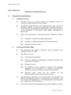
Part I Chapter 06 Methods of Awarding Contracts A. 1. a. b.
www.dgs.pa.govMethods of Awarding Contracts . A. Competitive Sealed Bidding. 1. Conditions for Use. a. Contracts must, as a general practice, be awarded through the competitive sealed bidding method of award. b. Competitive sealed bidding is the traditional and usual method of contractor selection. It is normally used when the supply, service, or

COSTARS PROGRAM PARTICIPATION - Pennsylvania …
www.dgs.pa.govTable of Contents . ONE OVERVIEW Page 6 . 1.1 Legislative History 1.2 Contracts 1.3 Member-Specific Benefits of COSTARS Participation 1.4 Supplier-Specific Benefits of COSTARS Participation 1.5 Frequently Asked Questions . TWO MEMBERS Page 8 . 2.1 Member Eligibility 2.2 Member Registration 2.3 Member Participation 2.4 Purchasers
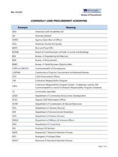
COMMONLY USED PROCUREMENT ACRONYMS
www.dgs.pa.govQA Quality Assurance QPL Qualified Products List RFI Request for Information RFP Request for Proposal RFQ Request for Quotation RTKL Right to Know Law SAP "Systeme, Anwendungen, Produkte" (Systems, Applications and Products). The German-originated software which is the foundation of the Commonwealth’s IES. SBA
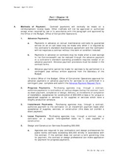
Part I Chapter 18 Contract Payments A. Methods of Payment ...
www.dgs.pa.govpromptly initiate action to recover any unexpended funds in the contractor's possession in accordance with Management Directive 310.10, Collection Requests for Write-Off of Delinquent Claims. C. Reimbursing Contractors for Travel and Per Diem. When the Commonwealth finds it appropriate to reimburse contractors for travel, lodging, and meals, a
Related documents
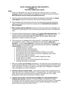
SOCIAL SCIENCES (HISTORY AND GEOGRAPHY) TEACHER’S …
www.wcedcurriculum.westerncape.gov.zaStep 1: Use topographic maps to introduce the following concepts: eight cardinal points, co-ordinates, grid reference, map symbols. Step 2: Introduce topographic maps (a copy or an authentic version), and use them to identify and explain the following terminology: direction, latitude, longitude, degree measurements.

US Topo Map Symbols - EDRnet
edrnet.comSymbols on US Topo Maps The underlying orthoimage for each US Topo map shows those features on the Earth’s surface that are visible to the eye. Because each map is made at a scale of 1:24,000 (one inch on the map represents 24,000 inches or 2,000 feet on the ground), selected featur es are also

FEATURES SHOWN ON TOPOGRAPHIC MAPS
pubs.usgs.govsigns, symbols, lines, and patterns, which are printed in appropriate colors and identified by names, labels, and numbers. The chart facing page 22 shows the standard symbols used on the topographic maps of the Survey. b. Planimetric map. --A planimetric map is similar to a topographic map, except that it

Explanatory Notes to - Buildings Department
www.bd.gov.hkSymbols . Additional symbols and descriptions are needed, compared to the 2004 Code. The nomenclature has been developed following ideas on notation introduced by NJ Cook for BS 6399-2, but broadly follows previous practice. Where practical, upper case letters are used with lower-case subscripts. This enables the nomenclature to be written in

TOPOGRAPHICAL SURVEY REPORT - PART OF L.R No. …
www.iucn.orgA topographic map or plat shall be prepared that shall be of a scale, size and accurately to clearly show the results ... G. Legend depicting the symbols and abbreviations used on the drawing. H. Spot elevations covering the entire survey limits showing high points, low points, grade changes, and at ...

How to Read a Topographical Map - Home | NRCS
www.nrcs.usda.govSymbols are used to indicate features on the map. For example, major highways are red lines, while other roads and streets are black lines. House and buildings are usually black boxes, rectangles, or other geometric shapes. When reading a topographical map, try to utilize a map index that contains the symbols commonly used on the maps.
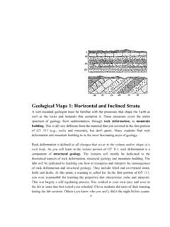
Geological Maps 1: Horizontal and Inclined Strata
www.southalabama.eduGeological Maps: Horizontal and Inclined Strata 2 system of nomenclature consisting of Groups, Formations and Members. The fundamental unit in stratigraphy is the formation which was defined as: “a lithologically distinct rock unit that possesses recognizable upper and lower contacts