
Spherical Coordinate Systems - NASA
Spherical Coordinate Systems . Exploring Space Through Math . Pre-Calculus . let's examine the Earth in 3-dimensional space. The Earth is a large spherical object. In order to find a location on the surface, The Global Pos~ioning System grid is used. The Earth is conventionally
Download Spherical Coordinate Systems - NASA

Information
Domain:
Source:
Link to this page:
Documents from same domain

Q: What do you do on the International Space …
www.nasa.govQ: What do you do on the International Space Station (ISS)? A: Astronauts and cosmonauts on the space station stay busy.There’s lots of work to operate the many science experiments on board.

NEPA RECORD OF ENVIRONMENTAL …
www.nasa.govDec 13, 2012 · JSC Form 1119 (Revised January 25, 2011)(MS Word October 2010) NEPA RECORD OF ENVIRONMENTAL CONSIDERATION (REC) Complete this form if you answered “yes” or “unknown” on any JF 1138 entries and if
Use of XSLT to transform the output of multiple …
www.nasa.govNASA IV&V International Workshop 2014 1 Use of XSLT to transform the output of multiple Static Code Analysis tools into a consistent analysis spreadsheet format
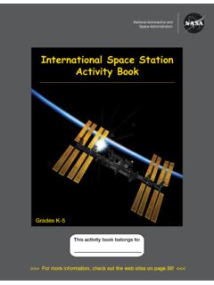
International Space Station Activity Book
www.nasa.govNational Aeronautics and Space Administration . Grades K-5 . This activity book belongs to: International Space Station Activity Book >>> For more information, check out the web sites on page 30!
Gravity, Who Needs It
www.nasa.govGravity, Who Needs It? ... six months on the space station versus three years on a Mars mission? No. ... human, being more isolated ...
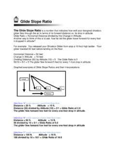
Glide Slope Ratio
www.nasa.govGlide Slope Ratio The Glide Slope Ratio is a number that indicates how well your designed shoebox glider flies through the air in terms of its forward distance vs. its drop in altitude. Glide Ratio = Horizontal Distance divided by the Change in Altitude.
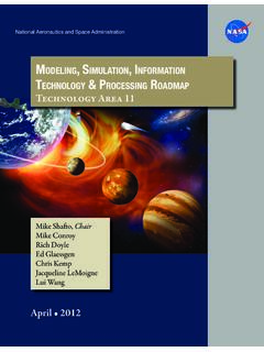
Modeling, SiMulation, inforMation technology & …
www.nasa.govTA11-1 exeCuTive Summary Figure 1 is an initial draft strategic roadmap for the Modeling, Simulation, Information Technol-ogy and Processing Technology Area.
NASA Technology Roadmaps
www.nasa.gov2015 NASA Technology Roadmaps TA 11: Modeling, Simulation, Information Technology, and Processing TA 11- 2 July 2015 Foreword NASA is leading the way with a balanced program of space exploration, aeronautics, and science research.

A Journey to Inspire, Innovate, and Discover
www.nasa.govReport of the President’s Commission on 2 Implementation of United States Space Exploration Policy Transmittal Letter June 4, 2004 The Honorable George W. Bush
National Aeronautics and Space Administration Headquarters
www.nasa.govGEMS is a Category 3 project (less than $250M) in Phase B, and was requesting transition from Formulation to Implementation (Phase C) where the official Agency baseline is established and external commitments are made
Related documents
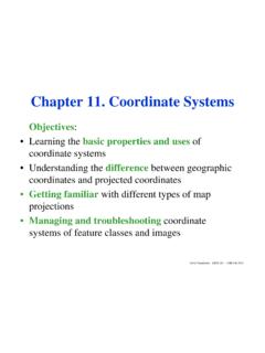
Chapter 11. Coordinate Systems - umb.edu
www.faculty.umb.edu• A coordinate system is a standardized method for assigning numeric codes to locations so that locations can be found using the codes alone. • Standardized coordinate systems use absolute locations. • In a coordinate system, the x-direction value is the easting and the y-direction value is the northing. Most systems make both values ...

Projected Coordinate Systems - ArcGIS
desktop.arcgis.comTable 2: Projected coordinate systems: well-known IDs and areas of use Name WKID Area of Use Minimum Latitude Minimum Longitude Maximum Latitude Maximum Longitude Abidjan_1987_TM_5_NW 2165 Cote d'Ivoire (Ivory Coast) - offshore 1.020 -7.550 5.190 -3.110 Abidjan_1987_UTM_Zone_29N 2043 Cote d'Ivoire (Ivory Coast) - west of 6°W
Other Coordinate Systems - MIT OpenCourseWare
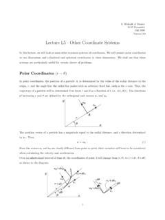
ocw.mit.eduLecture L5 - Other Coordinate Systems In this lecture, we will look at some other common systems of coordinates. We will present polar coordinates in two dimensions and cylindrical and spherical coordinates in three dimensions. We shall see that these systems are particularly useful for certain classes of problems. Polar Coordinates (r − θ)

ArcGIS 10.1 Projected Coordinate System Tables
resources.arcgis.comTable 2: Projected coordinate systems: well-known IDs and areas of use PCS Name WKID Area of Use Minimum Latitude Minimum Longitude Maximum Latitude Maximum Longitude Abidjan_1987_TM_5_NW 2165 Cote d'Ivoire (Ivory Coast) - offshore 3.900 -7.550 5.130 -2.750 Abidjan_1987_UTM_Zone_29N 2043 Cote d'Ivoire (Ivory Coast) - west of 6°W

6. NYSDOT COORDINATE SYSTEMS AND DATUMS
www.dot.ny.govNYSDOT COORDINATE SYSTEMS AND DATUMS 6-38 2/4/2009 6.1 INTRODUCTION Surveys are performed on the irregular surface of the earth, and are then transformed into a plane rectangular coordinate system for ease of use in engineering and surveying computations. In a state as large as New York, there is a need for a consistent,
Three-Dimensional Coordinate Systems - USM
www.math.usm.eduThree-Dimensional Coordinate Systems Over the course of the next several lectures, we will learn how to work with locations and directions in three-dimensional space, in order to easily describe objects such as lines, planes and curves. This will set the stage for the study of functions of two variables, the graphs of which are surfaces in space.
Overview of Coordinate Reference Systems (CRS) in R
www.nceas.ucsb.educoordinate systems begin with this description. A Globe The Datum: Defines origin and orientation of the coordinate axes (as well the size/shape of Earth) A Map A 2D representation of the 3D Earth with Easting/Northing coordinates An overview of ellipses, datums, and projections The Projection: Project the globe onto a 2D surface There are lots of
Lecture 3: Coordinate Systems and Transformations
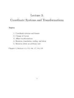
www.uio.noCoordinate systems and frames Recall that a vector v 2 lR3 can be represented as a linear combination of three linearly independent basis vectors v1, v2, v3, v = 1v1 + 2v2 + 3v3: The scalars 1, 2, 3 are the coordinates of v. We typically choose v1 = (1;0;0), v2 = (0;1;0), v3 = (0;0;1) . v2 v1 v3 α1 v = α1v1 + α2v2 + α3v3 2

12.1 Three-Dimensional Coordinate Systems
www.usna.edu12.1Three-Dimensional Coordinate Systems. 2 3D Space To locate a point in a plane, two numbers are necessary. We know that any point in the plane can be represented as an ordered pair (a, b) of real numbers, where a is the x-coordinate and b is the y-coordinate.