
Spherical Coordinate Systems - NASA
latitude lines. The equator is the center line of latitude. Each line is measured in degrees to the North or South of the equator. Since there are 360 degrees in a …
Download Spherical Coordinate Systems - NASA

Information
Domain:
Source:
Link to this page:
Documents from same domain
Q: What do you do on the International Space …
www.nasa.govQ: What do you do on the International Space Station (ISS)? A: Astronauts and cosmonauts on the space station stay busy.There’s lots of work to operate the many science experiments on board.
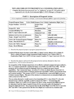
NEPA RECORD OF ENVIRONMENTAL …
www.nasa.govDec 13, 2012 · JSC Form 1119 (Revised January 25, 2011)(MS Word October 2010) NEPA RECORD OF ENVIRONMENTAL CONSIDERATION (REC) Complete this form if you answered “yes” or “unknown” on any JF 1138 entries and if
Use of XSLT to transform the output of multiple …
www.nasa.govNASA IV&V International Workshop 2014 1 Use of XSLT to transform the output of multiple Static Code Analysis tools into a consistent analysis spreadsheet format
International Space Station Activity Book
www.nasa.govNational Aeronautics and Space Administration . Grades K-5 . This activity book belongs to: International Space Station Activity Book >>> For more information, check out the web sites on page 30!
Gravity, Who Needs It
www.nasa.govGravity, Who Needs It? ... six months on the space station versus three years on a Mars mission? No. ... human, being more isolated ...
Glide Slope Ratio
www.nasa.govGlide Slope Ratio The Glide Slope Ratio is a number that indicates how well your designed shoebox glider flies through the air in terms of its forward distance vs. its drop in altitude. Glide Ratio = Horizontal Distance divided by the Change in Altitude.
Modeling, SiMulation, inforMation technology & …
www.nasa.govTA11-1 exeCuTive Summary Figure 1 is an initial draft strategic roadmap for the Modeling, Simulation, Information Technol-ogy and Processing Technology Area.
NASA Technology Roadmaps
www.nasa.gov2015 NASA Technology Roadmaps TA 11: Modeling, Simulation, Information Technology, and Processing TA 11- 2 July 2015 Foreword NASA is leading the way with a balanced program of space exploration, aeronautics, and science research.
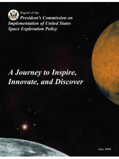
A Journey to Inspire, Innovate, and Discover
www.nasa.govReport of the President’s Commission on 2 Implementation of United States Space Exploration Policy Transmittal Letter June 4, 2004 The Honorable George W. Bush
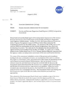
National Aeronautics and Space Administration Headquarters
www.nasa.govGEMS is a Category 3 project (less than $250M) in Phase B, and was requesting transition from Formulation to Implementation (Phase C) where the official Agency baseline is established and external commitments are made
Related documents

Maps Unit - Medford School District
www.medford.k12.or.usLocate and label the four hemispheres on a world map. Locate and label the Prime Meridian and Equator on a world map. Apply the use of lines of latitude and longitude to determine a location on a map. Apply the use of a key/legend on a map. Apply scale by …

Map & Globe Skills Only - Nystrom Education
www.nystromeducation.comMap & Globe Skills Hands-on Social Studies Program I can read graphs too. Check your region of the United States. NYSTROM HERFF JONES EDUCATION DIVISION

GRADE 8 TERM 1 GEOGRAPHY MAPS AND GLOBES 1. MAPS …
holycrosshigh.co.zaWhen we combine these latitude and longitude position of a place, we are giving their coordinates. Therefore the coordinates of Point A are 21°30’S 29°10’E. NB: Always give the latitude position before the longitude position. Because South Africa is in the Southern and Eastern Hemispheres of the Earth, we follow

OUR COUNTRY – INDIA
www.ncert.nic.inand western hemispheres, which hemisphere would India belong to? Due to great longitudinal extent of ... the local time of longitude of 82°30'E has been taken as the Indian Standard Time. ... The latitude that runs almost halfway through India is _____. Map skills 1. On an outline map of India, mark the following. ...

Latitude, Longitude and Time
www.ncert.nic.inLatitude, Longitude and T ime eastern and western hemispheres. In other words, the sun traverses 15 0 of longitudes per hour or one degree of longitude in every four minutes of time. It may further be noted that the time decr eases when we move fr om west to east and incr eases with our westwar d movement.

GRADE: 6 SUBJECT: SOCIAL SCIENCES (GEOGRAPHY) TERM …
www.wcedcurriculum.westerncape.gov.zaLines of longitude runs from s- pole to the N- pole and come together at the poles. Lines of latitude runs from east to west , they ate parallel and never crosses each other, the distance between these lines stay the same distance from each other. (2) 6. A.

National Geographic Geography Handbook
www.boone.kyschools.usLatitude Lines of latitude, or parallels, circle the earth parallel to the Equator and measure the distance north or south of the Equator in degrees. The Equator is at 0° latitude, while the North Pole lies at latitude 90°N (north). Longitude Lines of longitude, or meridians, circle the earth from Pole to Pole. These lines measure distances east

Maps and Globes - Mrs. Wecker's Classroom
mrswecker.weebly.comlongitude. These lines are called meridians, and measure how far east or west an object is. In Summary ~ Latitude and Longitude Latitude Lines of latitude are also called parallels. Parallels are equal distances apart from the equator to the poles. The equator is zero degrees latitude while the North and South Poles are 90 degrees latitude.

Geographical Vocabulary – KS2
www.stthomasceacademy.comhemispheres. An imaginary line around the centre of the earth at O° latitude. Factory KS1 A building or group of buildings containing a plant assembly for the manufacture of goods. A place of work that produces goods to be sold. Farm KS1 A tract of land, usually with house and buildings, cultivated as a unit or used to rear livestock.

Mapping the sphere - Rice University
math.rice.edusphere into two hemispheres, called the northern and southern hemispheres. P θ O φ S N R E Figure 1. Latitude and longitude. Given any point P on the sphere, which is differentfrom the poles, there is a unique great circle through P and the two poles. The half of that great circle containing P and.