
Understanding Map Projections - Esri
4 • Understanding Map Projections SPHEROIDS AND SPHERES The shape and size of a geographic coordinate system’s surface is defined by a sphere or spheroid. Although the earth is best represented by a spheroid,
Download Understanding Map Projections - Esri

Information
Domain:
Source:
Link to this page:
Documents from same domain

Water Utilities Data Model - Esri
downloads2.esri.comWater Utilities Data Model Data Model User Group Join the data model user group if you are an existing ArcGIS customer and want to learn more
Esri Product Life Cycle Support Policy
downloads2.esri.comESRI Product Life Cycle Support Policy 2 | P a g e J u n e 2 0 , 2 0 1 7 TABLE OF CONTENTS Esri Product Lifecycle Support Policy Esri Product Lifecycle Support Policy Overview 3

Using Python in labeling and field calculations
downloads2.esri.comPython is a powerful scripting and programming tool, but you need to know the basic rules of the game before you start playing. This tutorial presents a summary of the components most commonly

Tips and Tricks for Performance - downloads2.esri.com
downloads2.esri.comPerformance Tips and Tricks for ArcGISŽ Desktop 8.1 An ESRI ... Professional GIS, ArcInfoŠThe World’s GIS, ArcAtlas, the ArcAtlas logo, the ArcCAD logo, the ArcCAD WorkBench logo, ArcCatalog, the ArcData logo, the ArcData Online logo, ArcDoc, ArcEdit, the ArcEdit logo,

Deprecation Plan for ArcGIS 10.3 and ArcGIS 10.2 - Esri
downloads2.esri.com• [Updated November 22, 2013] ArcGIS 10.2.1 will be the last release that supports Microsoft Windows Server 2003 and Windows Server 2003 R2 in ArcGIS for Desktop, ArcGIS Engine, and

Answer key for chapter questions in - Esri
downloads2.esri.comAnswer ey 1 Answer key for chapter questions in Getting to Know ArcGIS, 4th edition Exercise 3a Q: Two countries display populations greater than 500 million. Can you name them? A: China and India Q: Does high pollution always correlate with high population? What might be some reasons for this? A: No. One reason may be that countries with higher populations also have
Related documents

Geografia Classe Seconda Cartine mute e sovrascritte dell ...
www.bibliolab.it•le carte successive a quelle mute valgono quale materiale di studio, di supporto e di approfondimento; •la terza carta di ciascun tipo può e deve essere utilizzata dagli allievi stessi, trascinando e mettendo al loro posto adeguato i diversi …

Polizia di Stato - Home page | Polizia di Stato
www.poliziadistato.itCreated Date: 3/8/2007 12:41:28 PM
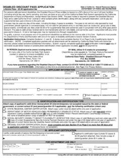
DPR 818 DISABLED DISCOUNT PASS APPLICATION
www.parks.ca.govDISABLED DISCOUNT PASS APPLICATION (Continued) PRIVACY NOTICE. Section 1798.17 of the Civil Code requires this notice be provided when collecting personal information from …

GLI IMPIANTI A PANNELLI RADIANTI - Caleffi
www.caleffi.comuso corrente. Si è cercato di evitare il più possibile il ricorso ad abbreviazioni: quelle di cui si è fatto uso sono specificate caso per caso. UNITA’ DI MISURA Non si è applicato in modo rigoroso il Sistema Internazionale. Spesso sono state pre-ferite le …
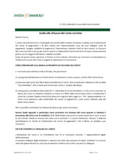
Guida alla chiusura del conto corrente - Intesa Sanpaolo
www.intesasanpaolo.comrestituite le carte di pagamento collegate al Può tuttavia accadere che il termine di 12 giorni venga talvolta superato se, per la definizione di alcuni rapporti o servizi, la banca deve acquisire dati da soggetti terzi (esempio: se al conto è collegata una carta emessa da una banca del Gruppo Intesa ...

P E SCE FRE S C O LARG AL F E R R I DEL G IORNO
dongiovanni.uk.comantipasti e insalata olive v 4.25 nocerella olives palline di panÉ v 6.95 homemade dough balls served with a pesto dip panÉ all’aglio garlic bread plain v 8 .45 garlic bread with tomato & garlic v 8.95 garlic bread with mozzarella 8.95 garlic bread ½ cheese ½ tomato 8.95 focaccia specialÉ v 10.45 fresh rosemary, rock salt, rocket, parmesan shavings,
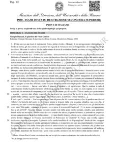
P000 - ESAMI DI STATO DI ISTRUZIONE SECONDARIA …
www.istruzione.itAvevo avuto la bella idea – cominciai a raccontare – di trasferirmi con carte e libri nella sala di consultazione della Biblioteca Comunale di via Scienze: un posto che bazzicavo fino dagli anni del ginnasio, e dove mi sentivo un po’ come a casa. …
BANDOVOUCHER “INDENNIZZI” AGENTI DI COMMERCIO
www.caor.camcom.it46.15.04 -Agenti e rappresentanti di vernici, carte da parati, stucchi e cornici decorativi; 46.15.05 - Agenti e rappresentanti di mobili e oggetti di arredamento per la casa in canna, vimini, giunco, ... di impegnarsi a restituire l’importo del voucher erogato, maggiorato degli interessi legali ...