Understanding the Residential Development Standards …
residential development standards. ... 6 metres for streets in a Road Zone, Category 1, and 4 metres for other streets. Not applicable The site is on a corner. If there is a building on the abutting ... a verandah, a garden shed, a footpath, a swimming pool, outdoor paved areas, a driveway or any other sealed
Download Understanding the Residential Development Standards …

Information
Domain:
Source:
Link to this page:
Documents from same domain

Using the residential zones - Planning
www.planning.vic.gov.auThe General Residential Zone is a three-storey zone with a maximum building height of 11 metres. The General Residential Zone should be applied to areas where housing development of three storeys exists or is planned for. It is inappropriate to apply the General Residential Zone to areas where a planning authority seeks to respect the existing
Apartment Design Guidelines for Victoria - Planning
www.planning.vic.gov.auAlternative design solutions may be proposed and the responsible authority will assess how an alternative solution meets the objectives. This is an important aspect of innovation. Purpose of the guidelines The Apartment Design Guidelines for Victoria provide assistance to applicants, architects, building designers and planners for designing
Rural Residential Development - Planning - Planning
www.planning.vic.gov.auPlanning Practice Note 37 | Rural Residential Development 5 The proposal must include an assessment of the locality’s natural resources, the impact of the proposal on these resources and the measures to be taken to protect the resources, including a description of: • …

Population Projections 2016 to 2056 July 2019
www.planning.vic.gov.auVictoria in Future 2019 (VIF2019) is the official state government projection of population and households. Projections are used by decision makers in government, business and the community to understand the growing and changing population. Population projections are estimates of the future size, distribution and composition of the population.
SCHEMES PLANNING PLANNING SCHEMES
www.planning.vic.gov.auThe zones and overlays needed to implement these are then selected and appropriate local provisions are written to support the zones and overlays (the schedules). 1.3 What is a zone? The planning scheme zones land for particular uses, for example, residential, industrial, business or other. The zones are listed in the planning scheme and each
Applying the Rural Zones - Planning
www.planning.vic.gov.auSound strategic planning for rural areas is essential to ensuring that land use and development achieves the planning authority’s vision, objectives and desired outcomes for an area. It can help ensure that: • use and development in rural areas fits into the …
Reformed Residential Zones - Planning - Planning
www.planning.vic.gov.auNeighbourhood Residential Zone and the General Residential Zone. They provide greater certainty to the community about residential change in their neighbourhoods. Neighbourhood …
Using the Car Parking Provisions - Planning
www.planning.vic.gov.auof car parking spaces, a planning permit may be granted under Clause 52.06-3 to provide some or all of the car parking space on another site. Can the requirement for car parking be ... accessible when needed. For example, two-hour restricted car parking is …
Sense of Place: urban design principles for the ...
www.planning.vic.gov.audeveloped a Metropolitan Strategy to set a clear vision for Melbourne’s future liveability and prosperity and, importantly, its long-term sustainability. ... This technical report entitled, Sense of Place: urban design principles for the metropolitan strategy,October 2002, has

PLANNING PERMITS
www.planning.vic.gov.auPERMITS PLANNING PERMITS 3 Contents 3.1 Overview ... planning scheme requirements and any other decision guidelines in Clause 65 of the scheme. Planning scheme controls can relate to the use of the site, to all development on the site or to …
Related documents
NEW JERSEY PROPERTY TAX SYSTEM LEGEND BUILDING …
www.vitalgov.net16 Port Authority of N.Y.-N.J. 226 Reservoir 410 Coast Guard Station 704 Road 925 Canal House 17 Tri-State Comm. 229 Well 415 Naval Station 707 Parkway 929 Tidewater Basin 18 S. Jersey Port Commission CODE 232 Water Supply 420 Armory 710 Thoroughfare 933 Water Way 19 Waterfront Comm.

Guidelines for Erosion & Sediment Control on Building Sites
www.environment.nsw.gov.auSweep the road and footpath every day and put soil behind the sediment controls. Hosing down roads and footpaths is ... or to the building alignment for all residential or sub-division sites. ... Where the entry/exit area slopes toward the road, a diversion hump . the side where it can be filtered by a sediment fence.
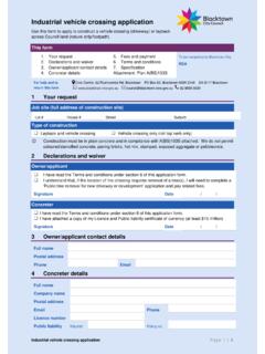
Residential vehicle crossing application
www.blacktown.nsw.gov.auResidential vehicle crossing application ... and/or layback across Council land (nature strip/footpath). Residential vehicle crossing application Page 2 | 11 3 Owner/applicant contact details Full name Postal address Phone Email 4 Contractor details ... the road adjacent to the lip of the gutter so that the correct edging tool can be used. If ...

Appendix 2 - Street Mail Service Conditions of Delivery
auspost.com.auSingle residential or commercial premises A single mail box on the boundary of the property with the footpath or road. The mail box aperture must face the footpath or road. If the door of the building abuts the footpath, the mail box aperture may be in the door. A postal delivery officer must be able to place

Access to Single Houses and Small Housing Developments
www.highland.gov.ukproperty about to join the public road, you look to the right and left across the verge and land adjacent to the road, to see if there is any approaching traffic. The areas shown by the darker shaded areas are called the Visibility Splays. 4.2.3 The purpose of Visibility Splays is also to allow traffic on the public road to see,
DRIVEWAY STANDARDS AND SPECIFICATIONS
www.penrithcity.nsw.gov.auadjoining footpath with 12mm galvanised dowels (starting 350mm from each side then at 900mm centres). Laybacks shall be poured separately to the crossing. • Driveways are to be a minimum of 3 metres wide, maximum of 6 metres (unless otherwise s tated), for residential areas.