Understanding the Residential Development Standards …
Working out the slope of a building site Where the slope of the ground is 2.5° or more across an 8 m section of the building site, this is equal to a ratio of 1:23 or, expressed as a rise or fall over an 8 m section, is equal to 350 mm. Graduating height between new and existing dwellings.
Download Understanding the Residential Development Standards …

Information
Domain:
Source:
Link to this page:
Documents from same domain

Using the residential zones - Planning
www.planning.vic.gov.auThe General Residential Zone is a three-storey zone with a maximum building height of 11 metres. The General Residential Zone should be applied to areas where housing development of three storeys exists or is planned for. It is inappropriate to apply the General Residential Zone to areas where a planning authority seeks to respect the existing
Apartment Design Guidelines for Victoria - Planning
www.planning.vic.gov.auAlternative design solutions may be proposed and the responsible authority will assess how an alternative solution meets the objectives. This is an important aspect of innovation. Purpose of the guidelines The Apartment Design Guidelines for Victoria provide assistance to applicants, architects, building designers and planners for designing
Rural Residential Development - Planning - Planning
www.planning.vic.gov.auPlanning Practice Note 37 | Rural Residential Development 5 The proposal must include an assessment of the locality’s natural resources, the impact of the proposal on these resources and the measures to be taken to protect the resources, including a description of: • …

Population Projections 2016 to 2056 July 2019
www.planning.vic.gov.auVictoria in Future 2019 (VIF2019) is the official state government projection of population and households. Projections are used by decision makers in government, business and the community to understand the growing and changing population. Population projections are estimates of the future size, distribution and composition of the population.
SCHEMES PLANNING PLANNING SCHEMES
www.planning.vic.gov.auThe zones and overlays needed to implement these are then selected and appropriate local provisions are written to support the zones and overlays (the schedules). 1.3 What is a zone? The planning scheme zones land for particular uses, for example, residential, industrial, business or other. The zones are listed in the planning scheme and each
Applying the Rural Zones - Planning
www.planning.vic.gov.auSound strategic planning for rural areas is essential to ensuring that land use and development achieves the planning authority’s vision, objectives and desired outcomes for an area. It can help ensure that: • use and development in rural areas fits into the …
Reformed Residential Zones - Planning - Planning
www.planning.vic.gov.auNeighbourhood Residential Zone and the General Residential Zone. They provide greater certainty to the community about residential change in their neighbourhoods. Neighbourhood …
Using the Car Parking Provisions - Planning
www.planning.vic.gov.auof car parking spaces, a planning permit may be granted under Clause 52.06-3 to provide some or all of the car parking space on another site. Can the requirement for car parking be ... accessible when needed. For example, two-hour restricted car parking is …
Sense of Place: urban design principles for the ...
www.planning.vic.gov.audeveloped a Metropolitan Strategy to set a clear vision for Melbourne’s future liveability and prosperity and, importantly, its long-term sustainability. ... This technical report entitled, Sense of Place: urban design principles for the metropolitan strategy,October 2002, has

PLANNING PERMITS
www.planning.vic.gov.auPERMITS PLANNING PERMITS 3 Contents 3.1 Overview ... planning scheme requirements and any other decision guidelines in Clause 65 of the scheme. Planning scheme controls can relate to the use of the site, to all development on the site or to …
Related documents
Chapter 13: Drainage - Wisconsin Department of …
wisconsindot.govFebruary 15, 2022 Page 1 TABLE OF CONTENTS Chapter 13: Drainage FACILITIES DEVELOPMENT MANUAL . Wisconsin Department of Transportation . Section 13 …
DESIGN OF RETAINING WALLS - Los Angeles County, …
dpw.lacounty.govSurface slope of Retained material Horizontal to vertical* Cantilever equivalent Fluid weight (active pressure) (pcf) LEVEL 5 to 1 4 to 1 3 to 1 2 to 1 30 32 35 38 43 * If the retained earth has a surface slope that varies, then the design surface slope shall be based on an imaginary line starting from the top of the retaining wall to the ...
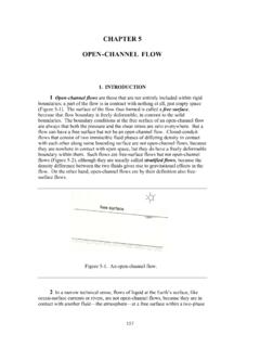
CHAPTER 5 OPEN-CHANNEL FLOW
ocw.mit.eduFigure 5-6. A) An open-channel flow for which the water-surface slope is less than the slope of the channel bottom. B) An open-channel flow for which the water-surface slope is greater than the slope of the channel bottom. 14 The key to the answer lies in flow resistance, which was addressed at length in Chapter 4.

Street Design Manual - San Diego
www.sandiego.gov4. Minimum grade is 0.6 percent unless drainage conditions cause a steeper minimum grade to be required in accordance with City of San Diego Drainage Design Manual. D. Medians 1. All center medians shall be raised, bounded by 6-inch B-2 concrete curbs and surfaced with stamped concrete, brick pavers, or other decorative paving as called for in ...

Lesson 10- Culvert and Ditch Sizing
www.wsdot.wa.govDrainage Ditch Cheat Sheet • Minimum ditch depth = water depth to convey the 10-year design event with a 0.5 foot minimum freeboard between the bottom of roadway subgrade to the 10-year design water surface elevation • Maximum flow velocity of 5 feet per second and longitudinal ditch slope for grass lined ditches

DRAINAGE DESIGN MANUAL - Dallas
dallascityhall.comROADWAY DRAINAGE DESIGN 21 ... 3 7 5 1 Subcritical Flow and Steep Slope 51 3 7 5 2 Supercritical Flow and Steep Slope 52 3 7 5 3 Hydraulic …

FOUNDATION/BUILDING SETBACKS TO SLOPES
dpw.lacounty.govfrom the slope to provide protection from slope drainage, erosion and shallow failures. Except as provided in Section 1808.7.5 and Figure 1808.7.1, the …