Transcription of Historical Overview of the Fort McMurray Area and Oil ...
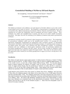
1 alberta Geological SurveyAlberta Energy and Utilities BoardHistorical Overview of theFort McMurray Area andOil Sands industry inNortheast alberta (With expanded bibliographies onoil sands, surficial geology, hydro-geology, minerals and bedrock innortheast alberta )Earth Sciences Report 2000-05 Historical Overview of the Fort McMurray Areaand Oil Sands industry in Northeast alberta (With expanded bibliographies on oil sands, surficial geology,hydrogeology, minerals and bedrock in northeast alberta )Frances J. HeinAlberta Geological SurveyResources BranchAlberta Energy and Utilities BoardA Geological Survey of Canada field party hauling a scow up the Athabasca River, alberta , in ENERGY AND UTILITIES BOARDE arth Sciences Report 2000-05: Historical Overview of the Fort McMurray Areaand Oil Sands industry in Northeast alberta (with expanded bibliographies on oil sands, surficial geology, hydrogeology,minerals and bedrock in northeast alberta )ISSNMay 2000 Published byAlberta Energy and Utilities BoardAlberta Geological Survey4th Floor Twin Atria Building4999 - 98th AvenueEdmonton, AlbertaT6B 2X3 Telephone: (780) 422-3767 (Information Sales)Fax: (780) 422-1918 Web site: Earth Sciences Report 2000-05.
2 May 2000 / Contents Historical Overview of the Fort McMurray Area ..22 Historical Overview of the Oil Sands industry in Northeast alberta ..53 The Future ..84 Acknowledgements ..105 References ..116 Additional Bibliography .. Historical photograph of McConnell, circa 1880 .. Historical photograph of Sidney Ells, circa 1930 .. Historical photograph of Geological Survey of Canada Field Map of Historical thermal projects in alberta to December Current alberta oil sands and heavy oil projects to June 30, 1998 ..9 Appendix 1 Historical references and survey work available at the alberta Energy andUtilities Board[Information Sales, alberta Geological Survey Office, Edmonton]..16_____EUB Earth Sciences Report 2000-05: May 2000 ivOverviewThis report contains an Overview of the exploration and Historical development of the FortMcMurray area, with emphasis on development of the oil sands industry in alberta .
3 Thiscompilation was initiated as part of ongoing work by the alberta Energy and Utilities Board(EUB), alberta Geological Survey, on the geology of the Athabasca oil sands deposit. In doingthis compilation a number of Historical references and survey work were found in Edmonton atthe alberta Energy and Utilities Board, alberta Geological Survey Office. Other references tothis work is scattered throughout the public domain, and has never been compiled as acomprehensive reference list related to the oil sands or to the geology of northeastern following document was produced to make this information known to the general general inquiries regarding this report to Fran Hein [Telephone: (403) 297-6929; or to the EUB, alberta Geological Survey Office in Earth Sciences Report 2000-05: May 2000 11.]
4 Historical Overview of the Fort McMurray AreaOriginally the Athabasca area was inhabited by a number of First Nations and Metis people,including the Cree, Chipewyan, Prairie Dene, and Anzac Metis. Descendants of Chipewyanpeople, who call themselves Dene, inhabit the Cold Lake area. The Dene and Chipewyan peoplerefer to themselves as cousins. According to early government records, the first European to seeoil sands was Henry Kelsey, Manager of York Factory on Hudson s Bay, who received in 1719 asample of oil saturated, bituminous sand , that was delivered to York Fort by a Cree guide, namedWa-Pa-Su. In 1776 Peter Pond, a fur trader and one of the founding members of the NorthwestTrading Company (later amalgamated with the Hudson s Bay Company), became the firstEuropean to enter the Athabasca region upon crossing the confluence of the Clearwater andAthabasca the indigenous peoples knew of the bitumen from the oil sands occurring alongthe Athabasca River, Peter Pond was credited, along with two cases of suspected murder induels, for first writing about the occurrence of the oil sands in 1778.
5 In 1792 Alexander Mac Mackenzie traversed the Methys Portage, crossing the confluence of the Clearwater andAthabasca rivers, and described the oil sands along the outcrops of the Clearwater-Athabascariver system. This was followed by other explorations in 1799 by David Thompson and in 1819by Sir John Franklin who travelled and surveyed the Athabasca River between Lake Athabascaand the confluence of the Athabasca and Clearwater rivers. Sir John Richardson did the firstgeological assessment of the oil sands in 1848 along his journey to the Arctic to search for themissing Franklin expedition. Sir John Richardson correlated the oil sands with the Devonianshales of the Marcellus Formation of New York and also did acid tests on the oil andmicroscopic examination of the sand , identifying the principal component as quartz.
6 In 1875 oilsprings (seeps) were found on the Peace River by John Macoun of the Geological Survey 1870 a fur trading post, located at the confluence of the Clearwater and Athabascarivers, was founded by John Moberly and named Fort McMurray after William McMurray whowas chief factor of the Athabasca region for the Hudson s Bay Company. The Hudson s BayCompany closed Fort McMurray in 1898 due to a dwindling fur trade, but reopened the fortagain in 1912 as a large-freight storage warehouse. Until 1921 there was only river access to FortMcMurray, and the fort served as the gateway to the Arctic. Goods were shipped from FortMcMurray on the Athabasca River to Lake Athabasca, then on the Mackenzie River to theArctic.
7 River transportation continued as the only access to the North until 1965 when theMackenzie Highway and the Great Slave Railway were opened. Until this time the shipyards atFort McMurray were used for building scows, barges and paddle wheelers. As the age of rivertransportation was closing and railways were being built, the industry of Fort McMurray startedshifting to more local resources, including fishing, logging, lumbering, salt, and the newlyemerging development of the vast oil sands 1906 Count Alfred von Hammerstein, originally from the Prussian army, drilled for oilin the Devonian limestone along the banks of the Athabasca River. He was hoping to discover free oil that he thought was a reservoir of pure petroleum underneath the oil sands failed to discover oil, but did find salt at the confluence of the Horse and Athabasca rivers.
8 In1925 a salt mine was opened on the Horse River by the alberta Salt Company, which closed in1927 due to problems with transportation and shipping of salt. In 1936 Industrial Minerals another salt plant at the town site of Waterways that had rail service to Lac La Biche. At_____EUB Earth Sciences Report 2000-05: May 2000 2 Waterways the salt plant used a hot water pumping process to extract the salt. Hot water waspumped down a shaft to dissolve the salt and the resulting salt-water brine was pumped up withina nearby parallel shaft. The salt brine was then evaporated, the salt retrieved and shipped as tablesalt until the 1940s. The Waterways salt plant closed in 1950 with the opening of a new salt plantin Elk Point, McMurray served as a military site during World War II and the Cold War.
9 TheCanol Project by the United States military was designed to secure safe delivery and supply ofoil for North America across the Arctic. The pipeline was started and built at Norman Wells. Alltroops, supplies and materials for the Norman Wells pipeline were first shipped to Waterways byrail, then from Fort McMurray by barge and boat to Norman Wells. In 1944 oil was shippedalong the pipeline from Norman Wells at a cost of $106 per barrel. During the Cold War aRCAF radar station was established on Stony Mountain south of Fort McMurray as part of themid-Canada DEW (Distant Early Warning) Line. The Stony Mountain site was dismantled in1964.
10 In 1989 the railway to Waterways was closed by Canadian National Railway, ending railservice to the Historical Overview of the Oil Sands industry in Northeast AlbertaAn Historical Overview of the discovery and development of the Athabasca Oil Sands is given inCarrigy and Kramers (1973), with updates presented in Strom (1986), Houlihan and Evans(1988), Wightman et al. (1992), Mink and Houlihan (1995), Polikar et al. (1998), and Sadler andHoulihan (1998). The first published geological descriptions of the Athabasca oil sands weregiven by Bell (1884) and McConnell (1893). The McMurray Formation was named by McLearn(1917), with assessments done by the Canadian Government surveys from 1926 to 1949 (Ells,1926; Government of Canada, 1949; Hume, 1947, 1949).