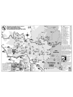
Transcription of Park Boundary Trailhead Access - Guide To Shenandoah
1 national park Service park Boundary Trailhead Access U. S. Department of the Interior Shenandoah national park Districts Side Trail Access Road Use Comments North East HICKERSON HOLLOW from Rt. 600 Foot, Poor Access ; very limited parking along roadside. Horse NORTH AT/TOM FLOYD Rt. 601 Foot Fair Access ; parking for 2 cars along roadside. COMPTON GAP Rt. 610 Foot, Good Access from Chester Gap; parking for 5 cars. Horse JORDAN RIVER Rt. 629 Foot, Fair Access ; parking for 4 cars along roadside; trail Access not Horse plainly visible. First mile across private land. MT. MARSHALL Rt. 625 Foot, Good Access ; parking lot for 5 to 8 cars. First mile across Horse private land. HARRIS HOLLOW Harris Hollow Rd Foot, Poor Access ; parking limited to 1 car along roadside.
2 Horse KEYSER RUN Rt. 614 Foot, Good Access ; parking for about 10 cars at Little Devil Stairs Horse parking area; do not block road LITTLE DEVILS STAIRS Rt. 614 Foot Same as Keyser Run PINEY BRANCH Rt. 600 Foot, Poor Access ; parking in the area is very limited along roadsides;. Horse do not block gate or road. First mile across private land. THORNTON RIVER Rt. 612 Foot, Poor Access ; no parking in the area along the road shoulder;. Horse heavily signed no parking.. PASS MOUNTAIN US Rt. 211 Foot Good Access from highway; parking for about 4 cars across highway. West DICKEY RIDGE US Rt. 340 Foot Good Access ; parking for about 6 cars at north entrance of Skyline Drive LANDS RUN Rt. 622 Foot, Good Access for 1-2 cars along roadside.
3 Horse JENKINS GAP Rt. 634 Foot, Poor Access ; very limited parking along roadside. First mile Horse across private land. BROWNTOWN Rt. 631 Foot, Poor Access ; very limited parking along roadside; Access is not Horse plainly visible. First 1 mile across private land. MATHEWS ARM Catron Rd N/A Access is closed. Trail is abandoned from Tuscarora Overall Run Trail junction to Boundary as of 2005. THOMPSON HOLLOW Thompson Hollow Foot Access is currently closed by private landowner as of 8/2010. Rd TUSCARORA US Rt. 340 Foot Poor Access ; no nearby public parking available. First mile across private land. HEISKELL HOLLOW from Rt. 697 Foot, Good Access : parking for 2 cars on road sholder. Do not block Horse road.
4 JEREMYS RUN from Rt. 611 Foot Access from Rt. #611 through private land to Boundary ; limited road shoulder parking along Rt. #611 bridge. ROCKY BRANCH Rt. 666 Foot, Fair Access ; can be difficult to locate; parking is limited to 1 or 2. Horse cars at base of private driveway. Central East BUCK HOLLOW US Rt. 211 Foot Good Access ; parking for 4-5 cars in pullout. HAZEL COUNTRY Rt. 600 Foot, Poor Access ; very limited parking for 1-2 cars along roadside (Hazel River, White Rocks, Horse outside of gate; Access through private land, mile to Trailhead . Sams Ridge). BROAD HOLLOW Rt. 681 Foot Good Access ; limited parking for 2 cars along roadside. Last Update: 09/01/2010 Page 1 of 3. national park Service park Boundary Trailhead Access U.
5 S. Department of the Interior Shenandoah national park Districts Side Trail Access Road Use Comments Central East PINE HILL GAP Rt. 681 Foot Poor public Access ; no public parking currently available. Hike Rt. #681 mile along park Boundary to Trailhead . NICHOLSON HOLLOW Rt. 600-Nethers Foot Fair Access through mile of private land. Parking at Old Rag temporary lot for 200 cars at mile north on Rt. #600. WEAKLEY HOLLOW/RIDGE TRAIL Rt. 600-Nethers Foot, Good Access ; parking lot limited to about 15 cars plus Old Rag Horse temporary lot for 200 cars mile north on Rt. #600. BERRY HOLLOW Rt. 600-Syria Foot, Good Access ; parking for about 12 cars Horse WHITEOAK CANYON/CEDAR RUN Rt. 600-Syria Foot Good Access through private land miles; privately owned parking lot for 20-25 cars.
6 ROSE RIVER Rt. 670 Foot, Good Access ; limited parking for about 6 cars at county Horse improved parking area at end of road. RAPIDAN AREA Rt. 649 Foot, Good Access through park and Rapidan Wildlife Management (Rapidan Camp and Environs) Horse Area (RWMA); parking along roadside outside park gate. STAUNTON RIVER/GRAVES MILL Rt. 662 Foot, Good Access ; parking for about 12 cars at end of road just Horse inside park Boundary . Room for 1 or 2 horse trailers but horse users are advised to park at end of Rt. #649 at junction of Blakey Ridge Fire Road ( park on road edge parallel to park Boundary ). CONWAY RIVER Rt. 615 Foot, Good Access through Rapidan Wildlife Management Area Horse (RWMA) ; parking along roadside at end of paved road at RWMA entrance.
7 4WD recommended. SLAUGHTER TRAIL Rt. 667 Foot, Poor Access ; no parking available. Horse POCOSIN HOLLOW Rt. 667 Foot Fair Access through private land miles; limited parking along Rt. #667 for 2-4 cars. POCOSIN FIRE ROAD Rt. 637 Foot, Fair Access through private land; road in poor shape before Horse Boundary . Limited parking along road at gate for 1 car. Hike to park mile. ENTRY RUN Rt. 643 Foot Good Access . Limited Trailhead parking for several cars. Section of trail outside of park is on PATC land. SOUTH RIVER Rt. 642 Foot, Fair Access . Limited parking for several cars outside private gate Horse on Wildlife Management Area land. First mile across private land. 4WD required. West SKYLAND FIRE ROAD Rt.
8 672 Foot, Poor Access ; no parking available in area. Horse REDGATE FIRE ROAD Rt. 611 Foot, Good Access ; limited parking along roadside for 4 cars. Horse TANNERS RIDGE FIRE ROAD Rt. 682 Foot, Good Access ; parking for 4-5 cars at State-maintained parking Horse area. WEST BRANCH NAKED CREEK Rt. 607 N/A Obliterated, removed from trail system. EAST BRANCH NAKED CREEK Rt. 759 Foot Poor Access through private land; no parking. Route not signed. POWELL MOUNTAIN Rt. 759 Foot Good Access ; limited parking along road for 1 car. MEADOW SCHOOL Rt. 759 Foot Good Access ; parking for 5 cars at end of state maintained road. DRY RUN Rt. 625 Foot, Poor Access ; Access permitted but no parking available.
9 Gated Horse by park neighbor mile below park Boundary . Last Update: 09/01/2010 Page 2 of 3. national park Service park Boundary Trailhead Access U. S. Department of the Interior Shenandoah national park Districts Side Trail Access Road Use Comments South East SMITH ROACH GAP RD from Rt. 626 Foot, Fair Access ; parking for 2 cars near park gate. Horse SIMMONS GAP ROAD Rt. 628 Foot, Good Access ; parking for 2 cars near park gate. Horse BROWNS COVE Rt. 629 Foot, Poor Access ; limited parking along road, miles from park Horse Boundary . NORTH & SOUTH FORK MOORMANS Rt. 614 Foot Good Access ; parking for 10+ cars above Charlottesville RIVER ROADS Reservoir; parking for 3 - 4 cars on NFMR road on park land.
10 BUCKS ELBOW ROAD/JARMAN GAP Rt. 611 Foot, Fair Access ; parking for 1 car at park gate on Boundary . Horse West GAP RUN from Beldor Hollow Foot No Access Rt. 628. BELDOR ROAD/SIMMONS GAP Rt. 628 Foot, Good Access ; parking for 2 cars near park gate Horse ONE MILE RUN Rt. 649 Foot Poor Access ; very limited parking along road for no more than 4. vehicles. Overnight parking prohibited. BIG RUN PORTAL from US Rt. 340 Foot, No Access ; no parking, all private land is posted. Horse LEWIS PEAK from Rt. 708 Foot No Access ; all private land is posted. MADISON RUN Rt. 663 Foot, Good Access ; parking for 5 cars along road near junction of Rt. Horse #663 and #708. PAINE RUN Rt. 661 Foot, Fair Access ; parking for 3 cars at private turn-around at end of Horse Rt.