Transcription of Northeast Georgia Mountains
1 WARNING:The North Georgia Mountains and Chattahoochee National Forest abound with beautiful waterfalls, but the enticing beauty of these falls has killed or seriously injured many people. DO NOT try to climb the rocks around waterfalls. They are covered with lichens and mosses that are slippery and can make you lose your grip. Observation decks have been built at many of the most popular waterfalls - use them. They offer the best vantage point for viewing or pic-ture taking. Many waterfalls are posted with warning signs. Please heed them for your safety. Layout & Design: Kristal McKenzieAlpine Helen-White County Chamber Photography by Jack Georgia Mountains Travel (404) 231-1820 mountain Lakes Vacation (800) 610-0020 Dahlonega-Lumpkin County (706) 864-3711 White County Chamber (706) 865-5356RE/MAX mountain (800) 784-3355 Blue Ridge mountain EMC ~ Habersham EMC ~ Jackson EMC ~ Waterfalls are the Gemstones of the East.
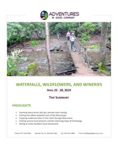
2 Each one is faceted differently. Some have beauty that is big and bold, while others have delicate and subtle characteristics. Common natural occurrences, such as rock, wood and water attain their highest form when they come together as a waterfall. People who can t agree on anything else seem to always agree on the beauty of a waterfall. Only a few waterfalls are visible from the road or parking lots, but most waterfalls are eas-ily reached, requiring varying lengths of walks or hikes. No matter how little or how much you do, hiking is good therapy for the pressures of mod-ern life. So, get out there, stretch those legs, and breathe some fresh air. Enjoy these natural wonders that lighten the heart and stir the soul!Covered are they covered? Some say they were covered to make crossing by horse safer, others say it was to provide a dry refuge during a storm.
3 Actually, neither is the reason. The real reason has nothing to do with horses or keeping wagons dry, but rather involves protecting the bridge itself. Wood exposed to the elements decays faster than that which is protected, a roof would protect the bridge's important structural members in the span. Periodic replacement of the roof would be far simpler (and cheaper) than repairing the timbers below. Gristmills were in most rural communities in the early 1900 s. Residents would take their grain to be ground into meal or fl our. At one time, Georgia has close to 1200 of the watered-powered wonders. Although they are no longer common, there are a few gristmills still operating that grind fresh corn and other grains which are then sold to the public. To confi rm hours and days of operation, call Creek FallsPanther Creek FallsMinnehaha FallsUpper Desoto FallsMinnehaha FallsMud Creek FallsHolcomb Creek FallsAmicalola FallsAll photography by Jack AnthonyWaterfall poster available!
4 GeorgiaMountainsWaterfalls, Grist Mills& Covered BridgesBLAIRSVILLE-CLEVELAND-DAHLONEGA AREAB arker s Creek MillThis mill was built in 1944 at the site of an older mill that served the community since the first white settlers came into the area in the late 1820 s. It is powered by a 12 foot overshot wheel set on babbet bearings. It was converted from a wooden spoked, steel rimed wheel to the current metal spokes in the 1960 s and has been renovated three times in its life, the most recent in the late 1980 s. The mill itself is a vertical mill with two 16 flint/granite stones and was built by the Meadow s Milling Company in North Wilkesboro, North Carolina. The miller, Woody Malot opens the mill the first Saturday of each month from 1-4 706-746-5718. Directions: Located near Rabun Gap off US Highway 441 on Betty s Creek Road.
5 Go about .5-mile past the Hambidge Center. Road curves will be just down the road on the left. Becky Branch Falls (Tallulah )Easily accessible 20-foot cascade located just five minutes from downtown. Directions: From Clayton, drive east on Warwoman Road for miles and park on left side of road by branch. Walk up the right side of branch on the trail for about 200 yards to a bridge at base of s Creek Falls (Tallulah )Approximately 60 feet high and makes a sheer drop over a granite mound into the Chattooga River. Directions: From Clayton, drive six miles east on Warwoman Road. Turn right onto Dick s Creek Road or Sand Ford Road. Go .5-mile and take left across the creek. Go miles. Cross second ford and park at Bartram Trail sign. Follow trail north to Dick s Creek. Follow creek to viewing area at top of Creek Falls (Tallulah )The Holcomb Creek Trail ( miles in length) begins at the intersec-tion of Hale Ridge Road ( Road 7) and Overflow Road ( Road 86), then follows a short loop to its end on Hale Ridge Road.
6 Passes Holcomb Creek Falls (which drops and flows over shoals for approxi-mately 150 feet) & Ammons Creek Falls where there is an observation deck. Directions: Take Warwoman Road east from Clayton for 10 miles. Turn left on Road 7 (Hale Ridge Road) and drive 9 miles. park to the east of intersection with Overflow Creek Road ( 86).Martin Creek FallsThis is a two-tier waterfall (35 feet high) with aquatic plants cover-ing the weeping rock wall on the left. This 20-minute walk (.5 mile in length) follows the Bartram Trail along the west side of the creek. Directions: From Clayton, go east on Warwoman Road for three miles. Turn left onto Road 152 and drive past the Game Check-ing Station. Drive .5 mile. park in small cleared camping area on the left at a sharp left bend in the road.
7 Walk west from the camping area. Cross Martin Creek, then travel uphill for about .4 mile to the top of the falls. CARNESVILLE AREAM innehaha Falls (Tallulah )Minnehaha Trail (.4 mile in length) follows fall Branch until it dead ends at Minnehaha Falls. Waterfall is approximately 100 feet high. Directions: Take 23/441 north from Tallulah Falls for three miles to the Rabun Beach Recreation Area sign. Turn left onto Old 441. Go miles and take left on Lake Rabun Road. Go one mile past Recreation Area. Take left on Low Gap Road (@ Flat Creek Commu-nity sign). Follow Bear Gap road, which forks to the left. Go miles to sign marking the trail on the right side of the Creek FallsAlso known as Little Estatoah , these falls have a vertical drop of 100 feet and flows into Estatoah Falls in Dillard.
8 Directions: Take US Highway 441 north to Dillard. Turn right on GA Highway 246 and follow signs to Sky Valley. At Sky Valley s entrance gate, turn left. Turn right on Tahoe Road and follow to the Turnpike MillLocated in an old grocery store and gas station. The mill produces fresh stone ground grits, cornmeal, flour, mixes. Open Wednesday-Saturday all year. Directions: Located south of Blairsville at 3485 Gainesville Highway. Panther Creek Falls (Chattooga )Panther Creek Falls Trail ( miles in length) follows Panther Creek through stands of hemlock and white pine along steep, rocky bluffs of the creek. The trail passes a series of cascades, as well as, Panther Creek Falls and terminates where Davidson Creek joins Panther Creek. The trail is noted for its beautiful variety of wildflowers and ferns while the stream offers excellent opportunities for trout fisher-men.
9 Hikers with heavy packs should be cautious of rocky overhangs. Directions: From Clarkesville, take 23/441 north for 10 miles to the Panther Creek Recreation Area. The western end of the trail begins across the highway from the recreation area. The eastern end of the trail can be reached by driving west on Yonah Dam FallsTrail parallels the west side of Joe Branch. Hike .6 of a mile to Panther Falls. Hike another .3 mile to Angel Falls. Directions: From Clayton, take U. S. 441/23 south for 7 miles. Turn right on unnum-bered county road for .1 mile, then turn left on GA Hwy 15 for two miles. Turn right on County Road 10 for five miles. Enter Rabun Beach Campground #2 entrance, go .2 mile to parking area on right. Trailhead is 80 feet to the Mill Covered BridgeIt spans the south forth of the Broad River and Is also known as Broad River Bridge or Carlton Bridge.
10 Washington W King built it in 1885 in the Town Lattice design. It is feet in length with three spans and is 236 feet long. There is parking and a picnic area as well as a Historic Marker. Watson Mill opened in 1798 and for a hundred years operated continuously as a grist, flour, or corn mill and originally served as the focal point for community life. Directions: Take GA 22 south of Comer for two miles, follow signs to Watson Mill Bridge State s Mill BridgeIt crosses Settledown Creek and is also known as Heardsville or Pool s Mill Bridge. It was built in 1901 by Bud Gentry in a Town Lat-tice design with a length of feet and width of feet. There CLAYTON AREAis a parking and picnic area as well as a Historic Marker. Directions: Take GA 20 seven miles west of Cumming to Ducktown, then three miles north to Heardsville, bridge is one mile north on Poole s Mill FallsAmicalola is a Cherokee word meaning tumbling waters and located within amicalola Falls State park .