Transcription of COMPREHENSIVE ZONING ORDINANCE
1 THE ST. MARY'S COUNTY COMPREHENSIVE ZONING ORDINANCE ADOPTED AUGUST 31, 2010 EFFECTIVE SEPTEMBER 14, 2010 (AMENDED AUGUST 2, 2011) (AMENDED SEPTEMBER 6, 2011) (AMENDED JULY 31, 2012) (AMENDED OCTOBER 2, 2012) (AMENDED DECEMBER 18, 2012) (AMENDED FEBRUARY 5, 2013) (AMENDED DECEMBER 31, 2013) (AMENDED FEBRUARY 20, 2014) (AMENDED JULY 7, 2014) (AMENDED NOVEMBER 18, 2014) (AMENDED DECEMBER 28, 2016) PREFACE By the enactment of County Commissioners ORDINANCE No. Z-10-02, this COMPREHENSIVE ZONING ORDINANCE and its accompanying Official ZONING Map were adopted, and were subsequently recorded in the Land Records of the St. Mary's County Circuit Court. Copies of the COMPREHENSIVE ZONING ORDINANCE and representations of the of the Official ZONING Map are available for viewing or for sale from the County Commissioners by way of the St.
2 Mary's County Department of Land Use and Growth Management, 23150 Leonard Hall Drive, Leonardtown, Maryland 20650. [THIS PAGE BLANK] St. Mary s County COMPREHENSIVE ZONING ORDINANCE Article 1. GENERAL PROVISIONS Page 10 - 1 ARTICLE 1. GENERAL PROVISIONS 1 CHAPTER 10 TITLE, PURPOSE AND ORGANIZATION 2 Sections: 3 Title. 4 Authority. 5 Purpose. 6 Organization of the ZONING ORDINANCE . 7 Official ZONING Map. 8 Applicability. 9 Minimum Standards. 10 Title. 11 This document shall be known as the St. Mary s County COMPREHENSIVE ZONING ORDINANCE and may also 12 be referred to as the ZONING ORDINANCE , or this ORDINANCE . 13 Authority. 14 Pursuant to Article 66B of the Annotated Code of Maryland, and other statutory provisions cited in other 15 Articles of this ORDINANCE , the Board of County Commissioners of St.
3 Mary s County (hereinafter, County 16 Commissioners ) has adopted this ZONING ORDINANCE . 17 Purpose. 18 The purposes of this ZONING ORDINANCE are to protect and promote the public health, safety and general 19 welfare; to implement the St. Mary s County COMPREHENSIVE Plan; and to accomplish the County s pursuit 20 of the vision in the Plan: 21 Preserve and enhance the quality of life by recognizing and protecting the unique character of St. 22 Mary s County as a rural Chesapeake Bay peninsula. Foster economic growth and create an 23 atmosphere of excellence by focusing and managing growth to create vibrant, attractive 24 communities; by protecting the rural character and economy of the countryside; by nurturing the 25 shoreline and adjacent waters; and by preserving and capitalizing on the other natural resources and 26 historical quality of the County.
4 27 Organization of the ZONING ORDINANCE . 28 This ORDINANCE consists of nine (9) articles. Without superseding the specific regulations set forth in each 29 article, the general structure and content of the articles are as follows: 30 1. Article 1: General Provisions. The overall organization and applicability of the regulations are 31 included in this article. General rules are provided for interpretation of ZONING boundaries, uses of 32 vacant land, public nuisance, conflicts with other laws and regulations, relation to deed restrictions 33 and prior regulations, construction of language, and severability. 34 2. Article 2: Administration. This article outlines detailed procedures for the administration of this 35 ORDINANCE , including responsibilities of decision-making bodies, common procedures that apply to 36 all development applications, notice and public hearing procedures, and requirements for (a) 37 administrative decisions; (b) appeals of administrative decisions; (c) variances; (d) conditional 38 uses; (e) site plan review, (f) transfer of development rights ( TDRs ); (g) vested rights and 39 authority to continue nonconforming projects.
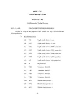
5 And (h) amendments to the ORDINANCE text and 40 ZONING Map, including amendments for planned unit developments ( PUDs ), (i) Development 41 Rights and Responsibilities Agreements ( DRARAs ). 42 3. Article 3: ZONING Districts. This article establishes Base Districts (ruraland residential, 43 commercial and mixed use, industrial and office, and commercial marine) and Special Districts 44 (overlay districts and floating zones) and states their purposes. It also establishes specific ZONING 45 Districts and their specific purposes, and specifies basic development standards for the ZONING 46 Districts. 47 48 St. Mary s County COMPREHENSIVE ZONING ORDINANCE Article 1. GENERAL PROVISIONS Page 10 - 2 4.
6 Article 4: Special Districts and Overlay Districts. This article includes specific purpose 1 statements for the Critical Area, historic landmarks and districts, and air installation compatible 2 use zones overlay districts and for the planned unit development floating zone. The article also 3 establishes development standards and use regulations for the overlay districts and floating zones. 4 5. Article 5: Use Regulations. This article establishes use classifications, accessory uses, temporary 5 uses, and use regulations and standards for each ZONING district . The article also establishes 6 provisions for nonconforming uses, structures and signs and right-to-farm provisions of this 7 ORDINANCE .
7 8 6. Article 6: Development Standards and Approvals. This article establishes standards for site 9 design, site plan review, and development design and layout including access, landscaping and 10 buffering, off-street parking and loading, and signs. 11 7. Article 7: Site Development and Resource Protection Standards. This article includes provisions 12 for adequate public facilities and standards and criteria for resource identification and protection. 13 It also establishes Critical Area standards for managing forested and agricultural lands, forest 14 conservation standards, and floodplain regulations of this ORDINANCE . 15 8. Article 8: Enforcement. This article provides for the prosecution of violations of this ORDINANCE .
8 16 9. Article 9: Definitions and rules of Measurement. This article includes a COMPREHENSIVE list of 17 terms and their meanings as used in this ORDINANCE . It also provides rules of measure. 18 Official ZONING Map. 19 The location and boundaries of the ZONING districts established by this ORDINANCE are indicated on the 20 Official ZONING Map, which is incorporated herein by reference. The Official ZONING Map, together with a 21 record of all amendments, are located and may be viewed at the Department of Land Use and Growth 22 Management. The Official ZONING Map shall constitute the official record of the ZONING districts in the 23 unincorporated lands of St. Mary s County. A copy of the Official ZONING Map currently in effect shall 24 also be kept on file in the office of the St.
9 Mary s County Clerk of the Circuit Court. 25 Applicability. 26 The provisions of this ORDINANCE shall apply to the development and use of all land within the 27 unincorporated areas of St. Mary s County unless expressly and specifically exempted or provided 28 otherwise in this ORDINANCE . No development may be undertaken without prior authorization, or exemption 29 from regulation, by this ORDINANCE . All regulated development shall comply with the standards, criteria, 30 and procedures of this ORDINANCE and any other applicable statute, law or regulation. 31 Minimum Standards. 32 Unless otherwise provided herein, the provisions of this ORDINANCE are minimum standards necessary to 33 accomplish the purposes of this ORDINANCE , and nothing herein is intended, nor shall it be construed to, 34 prevent any development or land use in St.
10 Mary s County from exceeding the minimums. 35 St. Mary s County COMPREHENSIVE ZONING ORDINANCE Article 1. GENERAL PROVISIONS Page 11 - 1 CHAPTER 11 RULES 1 Sections: 2 Purpose. 3 General Rules. 4 Rules for Interpretation of the Boundaries on the Official ZONING Map. 5 Rules for Construction of Language. 6 Severability. 7 Purpose. 8 The purpose of this chapter is to establish general rules for the application of this ZONING ORDINANCE . The meaning 9 and construction of words and phrases defined in this chapter apply throughout this ORDINANCE . Definitions of 10 general terms and rules for measurement are presented in Article 9, Definitions and Rules of Measurement. 11 General Rules.