Transcription of NORTH AND SOUTH AMERICA
1 AP/1 BConsult NOTAMS for latest byNATIONAL GEOSPATIAL-INTELLIGENCE AGENCYST. LOUIS, MISSOURINGA Aeronautical Navigation Office is an ISO 9001:2015 certified organization. Copyright 2022 by the United States GovernmentNo copyright claimed under Title 17 INFORMATION PUBLICATIONAREA PLANNINGMILITARY TRAINING ROUTESNORTH AND SOUTH AMERICAEFFECTIVE 0001L24 MAR 2022TO 0001L19 MAY 2022*7641014109670* *22083*NSN 7641014109670 EFF. DATE 22083 NGA REF. NO. PLANXAP1 BBOOKSPECIAL NOTICESSPECIAL NOTICES: Special Notices pertaining to AP/1B will be carried in this section for two issues. Unless specific written justification for continuance of the Special Notice is received by NGA STL prior to the cut-off for the third issue, the item will be incorporated with other data, if appropriate, or ACCESS TO AERONAUTICAL PRODUCTS AND DATAThe Aeronautical Content Exploitation System (ACES) is an enhanced web application on the NIPRNet and World Wide Web (internet) that provides access to the full suite of NGA's aeronautical products and data, including DoD FLIP, E-IPL terminal plates, DAFIF , AAFIF, and the DoD Aeronautical Mobile Application (AMA) and data downloads, as well as NavPlan charts, imagery, and FAA and Canadian FLIP products.
2 See GENERAL INFORMATION, INTERNET on page 1 of this publication for URL links to 't have internet access? DoD, FAA, and Canadian FLIPs are also available on the FLIP DVD (NSN 7644015335389); DAFIF is available on the DAFIF DVD (NSN 7644014717446); the DoD AMA is available on the AMA DVD (NSN 7644016004225); and AAFIF is available on the AAFIF DVD (NSN 7644015386515). 2 DECEMBER FEBRUARY 2022 FLIP HARDCOPY SUPPLY CHAIN IMPACTSThe Government Printing Office has notified the Defense Logistics Agency (DLA) of potential supply chain issues which may impact hardcopy FLIP production. FLIP custodians, please review and reduce your subscription order quantities to limit waste, and consider electronic means of FLIP access via the FLIP DVD, DoD Aeronautical Mobile Application ("Aero App"), or NGA's Aeronautical Content Exploitation System (ACES) at -or- ACES at To modify FLIP subscriptions, contact the DLA with your DODAAC at Com 804-279-6500, Toll Free 800-826-0342, or DSN DECEMBER 2021 RELOCATION OF SPECIAL PROCEDURES FOR IN-FLIGHT CONTINGENCIES IN OCEANIC AIRSPACE and WEATHER DEVIATION PROCEDURESTo ensure standardization of location and currency of information, in the coming publication cycles, Special Procedures for In-Flight Contingencies in Oceanic Airspace and Weather Deviation Procedures are being relocated to Section C - Theater Flight Data/Procedures of the FLIP IFR Supplement and OCONUS Enroute Supplements.
3 Guidance will be retained in its previous location for two publication INSTRUMENT PROCEDURE LIBRARY (E-IPL)E-IPL graphics are a collection of NGA produced Terminal Charts of current Foreign Procedures that are not included in FLIP. It is a paperless program designed to present Host Nation plates in the DoD FLIP "Volpe" Format. The procedures are not currently included in DAFIF (the release statement will be updated when this product has been incorporated). E-IPL charts are available on the DoD Aeronautical Mobile Application ("Aero App"), Aeronautical Content Exploitation System (ACES), and Aeronautical Source Packaging Service (ASPS). Operational use of the E-IPL is governed by individual Service policy and guidance; review all applicable Service documents. 2 DECEMBER TO ACES Content Exploitation System (ACES) ( ) is now the flagship NIPRNet website for accessing all unclassified, FOUO, and LIMDIS aeronautical products, information, and data previously available on now-retired legacy ACES and Consolidated Aeronautical Resource Download Site (CARDS).
4 ACES provides a more convenient user experience, along with new features such as in-browser viewable FLIP and E-IPL DVDs. ACES ( ) continues to provide internet (WWW) access to DAFIF , the FLIP and E-IPL DVDs, and Terminal procedures. 2 DECEMBER INFORMATION1. GENERAL - Area Planning, Military Training Routes, NORTH and SOUTH AMERICA (AP/1B) is a DoD Flight Information Publication (FLIP) produced and distributed by the National Geospatial-Intelligence Agency every 8 weeks in accordance with the ICAO Aeronautical Information Regulation and Control (AIRAC) system. It is designed to be used in conjunction with the corresponding DoD or FAA Enroute, Area, and Sectional charts; appropriate (Enroute) Supplement and Terminal books; and the Flight Information Handbook (FIH). This publication is intended for military use only and the information and procedures contained herein may not be applicable to other provides textual and graphic descriptions and operating instructions for IFR Military Training Routes (IR), VFR Military Training Routes (VR), and Slow Speed Low Altitude Training Routes (SR), as well as Aerial Refueling Tracks/Anchors and VFR Helicopter Refueling - AP/1B is the official source of IR, VR, and SR information for military users.
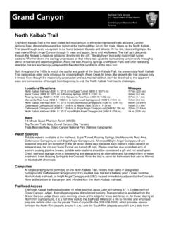
5 Complete information relative to policy and procedures for IRs and VRs is published in FAA Order JO series (Special Operations), to which the DoD complies, and is therefore directive for all military flight operations.(1)Avoidance Locations. All IR, VR, and SR segments on which flight below 1500 feet AGL is permitted shall be aligned such that the route width is clear of nuclear power plants, listed in Chapter 6. Additionally, aircrew should be familiar with the requirements of the FAA Aeronautical Information Manual (AIM) and applicable Service instructions ( , AFI 11-202v3, CNAF , AR 95-1, etc.) regarding overflight of sensitive areas such as national parks, wildlife refuges, and wilderness areas. route information in the AP/1B may not account for these areas, and area depictions on VFR Sectionals may not be current or accurate.(2)Special Use Airspace. route users shall obtain permission from the using or controlling agency before entering a MOA or restricted area.
6 Filing a flight plan that penetrates or terminates in special use airspace does not constitute entry is amended by Notice to Airmen (NOTAM) issued via the Defense Aeronautical Information Portal (DAIP).2. REVISIONS, CORRECTIONS, CHANGES, and ADDITIONS TO FLIP PRODUCTS - Contact the appropriate military or civilian operating agency listed in FLIP General Planning, Chapter 11. New or revised information will be indicated by a vertical line down the left margin of the page, extending the full length of the change (not applicable to the Front Cover or graphics).3. REQUISITIONS, DISTRIBUTION, SCHEDULES and QUALITY REPORTS - See FLIP General Planning, Chapter INTERNET - DAFIF ; IFR Enroute and Area charts; Enroute Supplements and Enroute Change Notices (ECN); FLIP Planning documents and Planning Change Notices (PCN); Terminal procedures and Terminal Change Notices (TCN); the Aeronautical Mobile Application ("Aero App") and associated data downloads; and other aeronautical products and data are available on NGA's Aeronautical Content Exploitation System (ACES) at and ACES at Host Nation FLIP and Aeronautical Information Publications (AIPs) are available on the Aeronautical Source Packaging Service (ASPS) at CUSTOMER HELP - For questions concerning NGA aeronautical products or services, contact the NGA Aeronautical Help Desk M-F (except holidays); 0700-1700 CST (UTC-6/-5 DT).
7 At 1-877-817-9134, (314) 676-0684/5439, or DSN 312-846-0684/5439, or e-mail to Outside of scheduled Help Desk hours, contact the NGA Operations Center at 1-877-345-1192 or (571) OF CONTENTSSPECIAL NOTICES .. INSIDE FRONT COVERGENERAL INFORMATION .. IIITABLE OF CONTENTS .. IVCHAPTER 1: GENERAL GUIDANCE .. 1-1 CHAPTER 2: IFR MILITARY TRAINING ROUTES (IR) .. 2-1 CHAPTER 3: VFR MILITARY TRAINING ROUTES (VR).. 3-1 CHAPTER 4: SLOWSPEED LOW ALTITUDE TRAINING ROUTES (SR) .. 4-1 CHAPTER 5: REFUELING TRACKS/ANCHORS/VFR HELICOPTER REFUELINGTRACKS/ANCHORS .. 5-1 CHAPTER 6: AVOIDANCE LOCATIONS .. 6-11-1 Chapter 1 GENERAL FAA Order JO series (Special Operations) provides specific guidance on Military Training Routes and is applicable to all DoD personnel including the Reserve Forces and National Guard. DoD aircrews should be familiar with this Order; contact a Special Operations Point of Contact listed at to request access to the document.
8 IR/VR MTRs are cooperatively developed by DoD and FAA to provide for military training and RDT&E requirements that cannot be met under the terms of FAR (Aircraft Speed). Accordingly, the FAA has issued a speed authorization to DoD to permit aircraft to exceed 250 knots IAS (below 10,000 feet MSL) within the lateral and vertical confines of published IR/VR MTRs. Each Service component (USAF, USN, USMC, USA, and USCG) issues written guidance, procedures, regulations, or instructions ( , Navy s OPNAV series), which cover MTR flying. Aircrew are expected to comply with FARs, JO , and applicable Service guidance when flying IR/VR MTRs and SRs. FAA Regional Air Traffic Division Managers may authorize deviations from the provisions of JO These deviations meet an appropriate level of safety and are explained in the route Description, Special Operating Procedures, or route Development. IR/VR Routes shall be developed using the procedures and criteria specified in JO IR/VR MTRs that include one or more segments above 1500 feet AGL shall be identified by three-digit characters ( , IR-XXX, VR-XXX, etc.)
9 IR/VR MTRs with no segments above 1500 feet AGL shall be identified by four-digit characters ( , IR-XXXX, VR-XXXX, etc.). Developers/ route Originators shall ensure all IR/VR MTRs are displayed on VFR Sectionals, VFR Terminal Area Charts, and Area Planning AP/1B Military Training route Charts. IR routes 1500 feet AGL and above should be charted on Enroute Low and Area Charts. route Originators shall monitor IR, VR, and SR data published in AP/1B and immediately inform the appropriate authorities when a disparity exists. route Developers should specify route entry windows in the Special Operating Procedures/Remarks section ( , plus or minus five minutes) to ensure aircraft enter on time, and provide maximum route deconfliction for other military and civilian Scheduling and Coordination. and SR routes shall not be flown unless properly scheduled through the designated originating/scheduling activity listed for that MTR.
10 Normally, a minimum of 2 hours notice is required to ensure civilian and other military users are notified of MTR activation. When scheduling an IR/VR MTR, Flight Service Stations (FSS) within 100 NM (in some cases more than 100 NM) of the scheduled MTR are notified to provide information to civilian pilots affording the opportunity to avoid the scheduled IR/VR MTR. Military pilots can benefit from this information by contacting the servicing FSS to view routes that have been activated. On a daily basis and to the maximum extent possible, the MTR Scheduler will confirm (via the tie-in FSS) the planned utilization of the route . route Schedulers will confirm that FAA Order (Flight Services) is complied with. route Schedulers will provide an hourly schedule for each MTR ( route number, aircraft type and number, proposed entry/exit time, and altitude) and pass changes to the tie-in FSS if a route closes or aircraft cancellations occur.