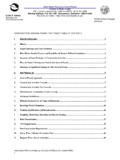
Transcription of Attachment K California Regional Water Quality Control ...
1 Attachment K California Regional Water Quality Control Board Lahontan Region category 6 Application Form and Monitoring and Reporting Program For Water Board staff use only; WDID #_____ Date of Receipt:_____ Lead Water Board Staff:_____ Conditional Waiver for Timber Harvest and Vegetation Management Activities All requested information is required - Please type or print clearly in ink 1. Activity Name: CAL FIRE Plan Number: (If regulated by CAL FIRE, enter the number of the plan or exemption/emergency notice assigned to the activity if available. If a CAL FIRE number is not available, but the activities will proceed under an exemption or emergency, please state CAL FIRE Exemption or CAL FIRE Emergency in this box.)
2 County: 2. Landowner s Contact information : (If there is more than one landowner, list their contact information in an addendum to this form.) Name of individual, company, or agency: Company or agency contact: Address: City: State: Zip Code: Phone: E-mail address (optional): 3. RPF, Federal Forestry Professional, or Natural Resource Professional Contact information : Name: RPF License Number: Address: City: State: Zip Code: Phone/Fax: E-mail address: 4. Name and Phone Number of Contact Person(s): (List the primary person(s) supervising/implementing on-site operations.) Name: Phone/Fax/E-Mail: Board Order No. R6T-2014-0030 Adopted April 10, 2014 Timber Waiver category 6 Application Form and Monitoring and Reporting Program Page 2 of 9 ( Attachment K) Name: Phone/Fax/E-Mail: If information requested in this form is included in existing documents or plans those documents may be used to substitute for information specifically requested in this form.
3 These documents must be submitted to the Water Board and the requested information must be specifically referenced (by page number) within this application. 5. Summary of Activity information : Total Activity Area Size (in acres): Silviculture prescription(s) or activity purpose: Project Location (narrative description, , township/range/section; Universal Transverse Mercator (UTM) geographic coordinates; nearby landmarks, highways, etc.): Indicate type of yarding system(s), equipment, and operations proposed for use (if any): Ground Based: Cable: Special: Tractor, including Cable, ground Hand crew end/long lining lead Masticator/Chipper Rubber tired Cable, high lead Helicopter skidder, Forwarder Cable, skyline Other:_____ Feller buncher _____ _____ Clearcut Acres Roads & Landings: Soils & Slopes: # of clearcut acres: __ Roads Constructed EHR Low SEZ/WBBZ Ops Roads Reconstructed EHR Mod Herbicide Use Roads in SEZ/WBBZ EHR High Winter Ops New Road Length: EHR Extreme Mechanical Site Prep lineal feet: _____ Unstable Areas Broadcast Burn Landings Constructed Slopes >65% Pile Burn Landings Reconstructed Slopes >50% w/ Site Prep Ground Ops 6.
4 Waterbody Classification: What types of waterbodies exist within the activity area? ( information on waterbody classification is provided in Attachment B.) Check all that apply: Class I Class II Class III Class IV Unclassified None within activity area Nearest Class I watercourse name: _____ Calwater Watershed Name(s), if known: _____ Board Order No. R6T-2014-0030 Adopted April 10, 2014 Timber Waiver category 6 Application Form and Monitoring and Reporting Program Page 3 of 9 ( Attachment K) 7.
5 Environmental Conditions: Provide a narrative description of the existing watershed resources and conditions including vegetation communities, forest stand density, geologic setting, wetland and riparian areas if present, and surface Water and groundwater. (attach additional pages if necessary) 8. Prescribed fire: Yes Yes Upland Yes Upland Yes No No WBBZ No WBBZ No N/A SEZ SEZ N/A Do Project activities include prescribed fire? If No, proceed to Item 9, otherwise continue. Do Project activities include broadcast burning? If Yes, where will broadcast burning occur? Check all that apply. Do Project activities include pile burning? If Yes, where will pile burning occur? Check all that apply. If the Project includes pile burning in an SEZ or WBBZ does it adhere to the requirements in Attachment Q? Yes No N/A If the Project includes pile burning in an SEZ does the Project meet the requirements for an automatic Basin Plan Prohibition Exemption as described in Attachment N?
6 (only applies to Lake Tahoe Hydrologic Unit) Board Order No. R6T-2014-0030 Adopted April 10, 2014 Timber Waiver category 6 Application Form and Monitoring and Reporting Program Page 4 of 9 ( Attachment K) Please provide a description of fire operations in SEZ and WBBZ areas including: i. Methods of treatment: ii. Approximate acreage of SEZ/WBBZ treatment area within the Project boundary: iii. Approximate percent of SEZ/WBBZ treatment area to be covered in piles (circle one): 0-10% 10-20% 20-30% iv.
7 Anticipated Option to be employed per Attachment Q, Item d. (circle one): Option 1 Option 2 v. If using Option 2 ( Attachment Q, Item d), provide methods or criteria (qualitative or quantitative) for determining vegetative recovery of burn scars as compared to pre-treatment conditions. vi. Identify treatment areas ( Units) where greater than 40% of material in piles is expected to exceed 9 diameter at the time the piles are built vii. Anticipated schedule for burn pile placement and burning viii. Water Quality related design features or mitigation measures to protect SEZ/WBBZ other than those required in Attachment Q (attach additional pages if necessary) Board Order No. R6T-2014-0030 Adopted April 10, 2014 Timber Waiver category 6 Application Form and Monitoring and Reporting Program Page 5 of 9 ( Attachment K) Please provide a description of fire operations in upland areas (areas outside of SEZs/WBBZs) including:i.
8 Methods of treatment ii. Approximate acreage subject to prescribed fire treatment iii. Anticipated schedule for burn pile placement and burning iv. Water Quality related design features or mitigation measures (attach additional pages if necessary) 9. Specific Activity information : Yes* No Do existing roads and landings proposed for use exhibit signs of erosion or instability, including rills, gullies, or tension cracking? *If you answered yes to the above question, please answer the following: Yes No Could this erosion or instability result in sediment delivery to a waterbody? If yes, describe mitigation measures that will be implemented to stop the delivery of sediment to waterbodies, or drainage structures that drain to waterbodies: (attach additional pages if necessary) 10. Provide activity information below as required in conditions 2 through 5 on pages 27 and 28 of the Timber Waiver: Board Order No. R6T-2014-0030 Adopted April 10, 2014 Timber Waiver category 6 Application Form and Monitoring and Reporting Program Page 6 of 9 ( Attachment K) (attach additional pages if necessary) Are operations within the winter period (as defined in Attachment A) 11.
9 Yes No proposed? If yes, what management practices have been incorporated to prevent soil disturbance and sediment delivery to waterbodies? (attach additional pages if necessary) Do you anticipate the need to apply pesticides (as defined in Attachment A) 12. to the activity area? Yes No If yes, please notify the Water Board staff in an addendum to this form, or in a or separate notice, at least 30 days prior to the proposed application. See Unknown Condition 21 of the Timber Waiver on page 26. 13. Map of Activity Area: To complete your application, include a USGS minute topographic (or equivalent or greater scale) map that clearly indicates all of the information listed below. Map(s) that have been created as part of a CEQA or other planning document, may substitute for creating an individual map for this application provided they meet the above scale requirements and include the information . If any of the required elements are not provided please include an explanation in the box below.
10 A. The activity area boundary. b. The relative location of the activities to a nearby city, town, or landmark. c. Location of private and public roads to be used within the activity area. Include the location of private and public roads that will be used to access the activity areas from a paved county, state, municipal, or federal road. Label the name or number of each road and indicate if such roads are under the ownership or Control of the land owner or manager. (The appurtenant roads may be shown on a separate map which may be planimetric with a smaller scale.) d. Location of road failures on existing roads proposed for reconstruction. e. Location of new temporary and permanent roads to be constructed. f. Location of proposed operations, including prescribed fire, within Waterbody Buffer Zones (WBBZs) and Stream Environment Zones (SEZs). g. Location of proposed landing construction or reconstruction where greater than acre of excavation, grading, or surface clearing will occur or identify areas of possible landing construction.
