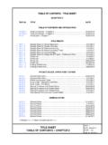
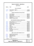
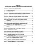
Transcription of Chapter 12 – Bridge, Structure and Riverine …
1 VDOT Drainage Manual 12-i Chapter 12 bridge , Structure and Riverine Hydraulics Chapter 12 bridge , Structure and Riverine Hydraulics TABLE OF CONTENTS Chapter 12 - bridge , Structure AND Riverine HYDRAULICS .. 12-1 Introduction .. 12-1 Definition 12-1 12-1 Riverine Hydraulics .. 12-1 Design Policy/Criteria .. 12-2 FEMA Floodplain Compliance .. 12-2 FHWA Compliance .. 12-2 AASHTO General Criteria .. 12-2 Department Criteria .. 12-3 Stream Crossing Design Storm .. 12-3 1 Freeboard Event .. 12-3 Backwater/Increases Over Existing Conditions .. 12-3 Flow Distribution .. 12-3 Scour .. 12-4 Multibarrel Culverts .. 12-4 Culvert Countersinking.
2 12-4 Lateral Encroachments .. 12-4 Stream Restoration .. 12-4 Impounding Structures (Dams) .. 12-4 Design Concepts .. 12-5 hydraulic Computation Methodologies .. 12-5 bridge Scour or Aggradation .. 12-5 Riprap 12-5 Engineering Assessment of No Adverse Impact .. 12-6 Riverine H&HA .. 12-7 Background .. 12-7 Necessary Resources .. 12-7 Hydrologic Analysis .. 12-8 hydraulic Analysis .. 12-8 Existing Effective Model .. 12-8 Existing Conditions Model (Adjusted) .. 12-9 Calibration .. 12-9 Proposed Conditions Model .. 12-9 Documentation .. 12-9 Detailed Hydrologic & hydraulic Analysis LD-293 .. 12-9 Engineering Assessment of No Adverse Impact.
3 12-10 System of 12-10 Level of Precision for Documentation .. 12-10 H&HA 12-11 Tidal H&HA .. 12-12 Background .. 12-12 VDOT Drainage Manual 12-ii Chapter 12 bridge , Structure and Riverine Hydraulics Necessary Resources .. 12-12 Coastal bridge and Culvert Design Techniques .. 12-13 Computer Modeling .. 12-14 Hydrologic Analysis .. 12-15 bridge Location .. 12-15 Channel Cross Section .. 12-15 Drainage Area Characteristics .. 12-16 Storm Tides .. 12-16 Flow Velocity .. 12-17 hydraulic Analysis .. 12-17 Documentation .. 12-18 H&HA 12-18 Riprap for Protection of bridge Abutments and Piers .. 12-19 Removal of Existing bridge and Approach Embankments.
4 12-20 Temporary Construction Causeway Design .. 12-22 Background .. 12-22 Causeway Design .. 12-22 Design Objectives .. 12-22 Plans .. 12-22 General Notes .. 12-23 Design Procedure .. 12-24 References .. 12-25 List of Figures Figure 12-1. Removal of Approach Embankment .. 12-21 Figure 12-2. Quantifying Removal of Approach Embankment .. 12-21 Figure 12-3. Temporary Construction Causeway Design .. 12-23 List of Appendices Appendix 12A-1 LD-293 Major Crossing H&HA Appendix 12B-1 LD-23 Structure and bridge Data Sheet Appendix 12C-1 Tidal bridge Scour Data and Worksheet Appendix 12C-2 Table of Storm Tide Description of Virginia Coast Appendix 12C-3 Virginia Coastal Maps Showing Predicted Water Surface Elevations Appendix 12D-1 Engineering Assessment of No Adverse Impact VDOT Drainage Manual 12-1 of 25 Chapter 12 bridge , Structure and Riverine Hydraulics Chapter 12 - bridge , Structure and Riverine Hydraulics Introduction Definition Bridges are defined as.
5 Structures that transport traffic over waterways or other obstructions Part of a stream crossing system that includes the approach roadway over the floodplain, relief openings, and the bridge Structure Structures with a combined centerline span of 20 or more. However, structures designed hydraulically as bridges, as described above, are treated as bridges in this Chapter , regardless of length Major Culvert crossings with a total 100-year discharge > 500 cfs are to be evaluated and documented as if they were bridges, unless otherwise exempted by VDOT Hydraulics Staff. Three sided structures (bottomless culverts, precast concrete arches, cast in place concrete frames, corrugated metal plate arches and similar structures) shall be treated as bridges.
6 Analysis/Design Proper hydraulic analysis and design is as vital as the structural design. Streamcrossing systems should be designed for: Minimum cost subject to criteria Desired level of hydraulic performance up to an acceptable risk level Mitigation of impacts on stream environment Accomplishment of social, economic, and environmental goals The requirements of existing Federal Emergency Management Agency (FEMA) or other officially delineated or regulatory floodplains Riverine Hydraulics In addition to stream crossings other VDOT projects have the potential to adversely impact flood elevations by modifying the flood plain or the stream channel.
7 The project types are listed below, these should also be evaluated using the methods and criteria found in this Chapter .* Stream Restoration Projects Lateral Encroachments into the Flood Plain * Rev. 7/16 Design Policy/Criteria Chapter 12 bridge , Structure and Riverine Hydraulics 12-2 of 25 VDOT Drainage Manual Design Policy/Criteria FEMA Floodplain Compliance The final design should not significantly alter the flow distribution in the floodplain Where design considerations permit, the "crest-vertical curve profile" should be considered as the preferred highway crossing profile when allowing for embankment overtopping at a lower discharge For FEMA Zones determined by Approximate Methods it is allowable to increase the flood elevations up to provided that coordination with the community shows that the cumulative impact requirements have been addressed.
8 For FEMA Zones determined by Detailed Methods it is not allowable to increase the 100-year flood elevation. FHWA Compliance Degradation or aggradation of the river should be estimated and contraction and local scour determined. The appropriate positioning of the foundation, below the total scour depth if practicable, should be included as part of the final design AASHTO General Criteria Design criteria are the tangible means for placing accepted policies into action and become the basis for the selection of the final design configuration of the stream-crossing system. Criteria are subject to change when conditions so dictate as approved by the Department.
9 Following are certain American Association of State Highway Transportation Officials (AASHTO) general criteria adopted by the Department related to the hydraulic analyses for bridges as stated in their highway drainage guidelines: Backwater will not significantly increase flood damage to property upstream of the crossing Velocities through the Structure (s) will not damage either the highway facility or increase damages to adjacent property Maintain the existing flow distribution to the extent practicable Pier spacing and orientation and abutment designed to minimize flow disruption and potential scour Foundation design and/or scour countermeasures to avoid failure by scour Minimal disruption of ecosystems and values unique to the floodplain and stream Design Policy/Criteria VDOT Drainage Manual 12-3 of 25 Chapter 12 bridge , Structure and Riverine Hydraulics Department Criteria These criteria augment the general criteria.
10 They provide specific, quantifiable values that relate to local site conditions. Evaluation of various alternatives according to these criteria can be accomplished by using a water surface profile program such as those identified in Chapter 16. Stream Crossing Design Storm Inundation of the travelway and clearance below the low shoulder dictates the level of traffic services provided by the facility. New construction and projects that increase the level of service of the roadway shall have an 18 freeboard from the low shoulder of the crossing to the design storm as determined by the functional classifications of roadways presented in Chapter 6, Hydrology.