Transcription of Chapter 15: Remote Sensing - GIS-Lab
1 2002 CRC Press LLC Chapter 15 Remote Sensing Remote Sensing Remote Sensing is the science of gathering information from a location that isdistant from the data source. Image analysis is the science of interpreting specificcriteria from a remotely sensed image. An individual may visually, or with theassistance of computer enhancement, extract information from an image, whetherit is furnished in the form of an aerial photograph, a multispectral satellite scene, aradar image, a base of LIDAR data, or a thermal Sensing is a dynamic technical field of endeavor. Between 1995 and2000 the number of users employed in these combined branches of knowledge rosefrom to million, and their commercial application values rose from $3 billionto $12 billion during the same time purpose of this Chapter is to acquaint the reader with the technology in orderto pique his/her interest in pursuing further knowledge, because these proceduresmay provide sources of pertinent information for the managers and/or techniciansinvolved in mapping or GIS projects.
2 With this in mind, a number of web sitereferences are sprinkled throughout this Chapter to start the reader on a voyage ofdiscovery. Most of these web sites are starting points to further should be noted that the Remote Sensing systems cited in this book do notcover the entire group of Remote geospatial data collection systems that is out therewaiting to help the project manager in his/her search for applicable digital informa-tion. Also, no partiality is intended for those systems and providers that are Chapter will not dwell on the mechanics of sensors. Rather, it is intendedto establish a passing acquaintance with the characteristics of electromagneticenergy, hopefully helpful to the reader in deciding what types of captured informationwill best fit a particular project needs.
3 2002 CRC Press LLC SEARCHING THE INTERNET The Internet can be an educational source of pertinent Remote Sensing informa-tion for the project manager to expand his/her technical knowledge. Tutorials There are Remote Sensing tutorials to be found on the Internet, and it may be tothe reader s advantage to access a few of these web sites: The web site discusses and illustratesspatial analysis, spectral analysis, advanced processing, applications, three-dimen-sional perspectives, LANDSAT and IRS-1C data fusion, change detection, andvarious data to web site for an enlightening tutorial onstereoscopy, radar fundamentals, and stereointerpretation that can be off-loaded fornoncommercial instructional purposes.
4 Applications Dynamics Remote Sensing , along with its entwined sibling sciences (photogrammetry, GPS,GIS), has enjoyed a dynamic upsurge during the past five years. If the reader is interestedin technologies related to agriculture, disaster management, environmental monitoring,forestry, mining, transportation, or utilities distribution, he/she would do well to accessthe web site for anextremely instructive session. For each of these technologies this Internet referenceprovides multipage studies of emerging applications. The Internet web is an enlightening source of information covering the availabil-ity of high technology commercial airborne hyperspectral/multispectral imaging sys-tems, advanced Remote Sensing applications, and airborne data acquisition servicesapplicable to governmental and industrial scientific fields of endeavor: AgricultureDefenseEnvironmentalForestryG eographic Information SystemsMappingOceanographicsResearchTerr estrial For those readers who have a specific interest in forestry applications of remotesensing, log on to an instructional glimpse at laser mapping.
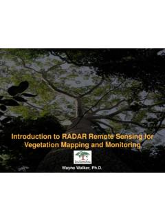
5 2002 CRC Press LLC An instructive Internet reference discussing the principles of Remote Sensing , withillustrations and images, is found at Remote Sensing SYSTEMS Many contemporary mapping technologists collect information with a variety ofinstrumentation, collectively known as Remote sensors. Even though these systemscollect digital spatial data in mechanically different ways, all of the captured infor-mation is related to the electromagnetic spectrum. Although aerial photos are limitedto the m range, there are other sensors that duplicate this range and stillothers that can extend their range well into the microwave reader may want to access the following key words on the Internet to get amore comprehensive grasp of this subject.
6 Advanced Very High Resolution RadiometerAgricultural Research Service Laser ProfileAgricultural Research Service Radiance TransectAgricultural Research Service Thermal TransectAirborne Data Acquisition and RegistrationAirborne Synthetic Aperture RadarAirborne Terrestrial Applications ScannerAirborne Visible/Infrared Imaging SpectrometerDigital Video ImageryEuropean Remote Sensing Satellite-1 Japanese Earth Resources Satellite-1 LANDSAT Multisprectral ScannerLANDSAT Thematic MapperMODIS/ASTER Airborne SimulatorSysteme Pour l Observation de la TerreThematic Mapper Simulator/12-Channel Daedelus Multispectral ScannerThermal Infrared Multispectral Scanner These sites can open a lot of doors into the subject of Remote Sensing methodologyand applications. Thematic Data Collection A Remote sensor is an instrument that gathers thematic information from adistance.
7 Over the years, image analysts have employed various segments of theelectromagnetic spectrum to enhance their data gathering capabilities. Commercialuse of aerial photography using panchromatic film began about the time of the CivilWar, but its extended utilization has come about since the World War I era. WorldWar II saw the beginning of near infrared film and the expanded use of color 1970s began the use of airborne and satellite platforms carrying electromagneticscanners to collect data from earth. Through the 1980s and 1990s these variousspatial vehicles transported scanners utilizing such electromagnetic components as 2002 CRC Press LLC visible light, near infrared, mid-range infrared, thermal, radar, and LIDAR to collectspecialized information.
8 Scanners Most scanners operate by catching either radiant rays or return signals andcapture information in digital form along scan lines (tracks) forming a continuousorbital path as illustrated in Figure data are furnished to the buyer as a copy of a segment (scene) of thisscanned path information, either in the form of an image or as digital data as shownin Figure photogrammetric planimetric and/or topographic mapping is limitedto the primary colors of visible light as shown in Table , but technicians invol vedin GIS and specialty projects may also want to consider other regions of the elec-tromagnetic spectrum for complementary data sources. Types of Sensors Although there are a number of Remote Sensing systems capable of collectinginformation, there are two general categories: Passive sensors collect natural radiant energy reflected or emitted from a targetedobject.
9 Active sensors transmit a signal and then receive the reflected response. There are many different types of data sensors in use, depending upon the purposeof the collected information. Some of the more popular Remote sensors currently Figure A portion of a single scan a c kSensorEarth 2002 CRC Press LLC employed in data capture are listed herein, but it is not intended that all availablesystems be included. Those shown represent a sampling of the different segmentsof the electromagnetic spectrum that are used in analyzing ground characteristics. Aerial Camera An aerial camera is a passive sensor that collects a direct, continuous tone pictorialimage in the visible light ( m) range. Through the use of proper film, thecamera can also create a photographic near infrared image composed of visible green( m), visible red ( m), and near infrared ( m) light.
10 Video Camera A video camera can be installed in an aircraft. This passive sensor records acontinuous swath of raster data covering a moving scene of the terrain, and the videotapecan be played on a graphic screen much like a video movie. Digital video systemstoday are often used to collect, manipulate, and analyze data in the black and white,natural color, and color infrared ranges of the spectrum. Since the video image is araster file, it can be segmented and imported into a CADD/CAM/CAD environment. Figure A scene from a scanner s orbital path. Table Spectral Bands of Primary ColorsBandSpectral Range ( m) a c kSceneEarth 2002 CRC Press LLC Scanners Scanners are passive sensors that capture the reflected or emitted energy intensityfrom observed objects into digital picture elements called pixels.