Transcription of Chapter 7 – Atmospheric Circulations
1 Chapter 7 - Title Chapter 7 . Atmospheric Circulations (pp. 165-195). Contents scales of motion and turbulence local winds the General circulation of the atmosphere ocean currents wind Examples Fig. : Scales of Atmospheric motion. Microscale mesoscale synoptic scale. Scales of Motion Microscale chimney Short lived eddies', chaotic motion Timescale: minutes Mesoscale local winds, thunderstorms Timescale mins/hr/days Synoptic scale weather maps Timescale: days to weeks Planetary scale Entire earth Scales of Motion Table : Scales of Atmospheric motion Turbulence Eddies: internal friction generated as laminar (smooth, steady) flow becomes irregular and turbulent Most weather disturbances involve turbulence 3 kinds: Mechanical turbulence you, buildings, etc.
2 Thermal turbulence due to warm air rising and cold air sinking caused by surface heating Clear Air Turbulence (CAT) - due to wind shear, change in wind speed and/or direction Mechanical Turbulence Mechanical turbulence due to flow over or around objects (mountains, buildings, etc.). Mechanical Turbulence: Wave Clouds Flow over a mountain, generating: Wave clouds Rotors, bad for planes and gliders! Fig. : Mechanical turbulence - Air flowing past a mountain range creates eddies hazardous to flying. Thermal Turbulence Thermal turbulence - essentially rising thermals of air generated by surface heating Thermal turbulence is maximum during max surface heating - mid afternoon Questions 1.
3 A pilot enters the weather service office and wants to know what time of the day she can expect to encounter the least turbulent winds at 760 m above central Kansas. If you were the weather forecaster, what would you tell her? 2. Why is the difference in surface wind speed between morning and afternoon typically greater on a clear, sunny day than on a cloudy, overcast day? Turbulence Aloft ( wind Shear). Formation of clear air turbulence (CAT), responsible for air pockets'. wind shear occurs at all altitudes and it can be horizontal or vertical At high altitudes, shear is encountered at the jet stream with the wind increasing from less than 50 mph to 150 mph over a few miles.
4 Local Winds Many mesoscale phenomena are the result of a thermal circulation : Thermal circulation - a circulation generated by pressure gradients produced by differential heating Thermal Circulations tend to be shallow - do not extend up through the depth of the troposphere Sea and Land Breezes Thermal circulation Monsoon Mountain + Valley Katabatic Winds Downslope winds Chinook Santa Ana Desert Winds All mesoscale phenomena Thermal Circulations No horizontal P or T variation Cool the N and warm the S. Complete the circulation Fig. : Thermal circulation produced by heating and cooling of the ground.
5 Thermal Circulations : Sea and Land Breezes Consider the land/sea interface in the morning Assume that the ocean and land surfaces have the same temperature Also assume that synoptic-scale phenomena are absent As solar heating increases during the morning, which surface heats quicker and why? Thermal Circulations : Sea and Land Breezes Uneven heating of land and water Diurnal wind coming from sea ( sea breeze') during daytime and from land ( land breeze') at night Why is the land breeze weaker than the sea breeze? Fig. : Development of a sea breeze and a land breeze The Sea-breeze Front The boundary between the cool, stable sea-breeze flow and the hot, unstable winds over land Passage is noted by: change of wind speed/direction rapid temperature decrease moisture increase change in air quality Max temperature occurs much earlier than inland cities Clouds often form along the front Sea-breeze Convergence in Fl produces large summertime rainfall Fig.
6 : Surface heating and lifting air along a sea breeze form thunderstorms almost daily during summer in S. Florida. Convergence of a sea breeze from Atlantic and Gulf sides. Lack of convergence in 98' caused fires. Questions 1. Explain why cities near large bodies of cold water in summer experience well-developed sea breezes, but only poorly-developed land breezes. 2. The prevailing winds in southern Florida are northeasterly. Knowing this, would you expect the strongest sea breezes to be along the east or west coast of southern Florida? What about the strongest land breezes. Monsoon Like sea/land breeze but seasonal Winter: Land cool - Dry Summer: Land warm - Wet season season (425 of rain/yr at *).
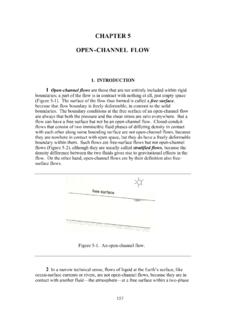
7 +uplift by Himalayas Fig. : Changing annual wind patterns associated with winter and summer Asian monsoon (linked to El Ni o) Many people depend on it for drinking water/irrigation. Downslope Winds Mountain breezes belong to a group of winds more generally as Katabatic winds. These are winds driven by cold air flowing down a slope Mountain Breezes Day: sunlight warms valley walls valley breeze Night: valley walls cool mountain breeze Fig. : Valley breeze: uphill during day Mountain breeze: downhill at night Question If campfire smoke is blowing uphill along the east- facing side of the hill and downhill along the west- facing side of the same hill, are the fires cooking breakfast or dinner?
8 From the drift of the smoke, how were you able to tell? Katabatic wind Katabatic or fall' winds (cold air). Down slope wind (stronger than a mountain breeze). Usually a plateau surrounded by mountains with opening sloping downhill the bora (Adriatic coast), mistral (Rhone valley), coho (Columbia Gorge wind ), Santa Ana (CA). Optimal conditions: Snow covered plateau cools Generates large PGF. Causes frost damage to vineyards Winds can exceed 100 knots Question Where on Earth would we find the strongest Katabatic winds? Why? Chinook Chinook: warm, dry wind flowing from east side of Rockies.
9 Indian word meaning snow eater'. Similar phenomena exist elsewhere in the world and have their own names (Alps =foehn). Temperature may rise as much as 36 F (20 C) in 1 hr, plus sharp drop in RH. Two kinds of chinook: with and without rain Pros and Cons Pros: relief from winter cold (main source is compressional heating), uncovers prairie grass, railroads Cons: fire hazard, crop failure (parched soil), high speed wind may do damage, human behavior? Chinook With Rain Air flows up a mountain. Air expands and cools as it moves into lower pressure . Cooled air reaches saturation and water vapor condenses, releasing into air on uphill side Fig.
10 : Conditions that may enhance a chinook Chinook With Rain Cooling on upwind side is reversed as air is compressed downwind - compressional heating Net effect on the air after passing over the mountain: Air is fairly dry since moisture lost on upwind side Air is warm (sometimes a great deal warmer). because of released + compressional heating Chinook Without Rain Sometimes air to W of mountain only flows over if it is above the mountain top Air below stays on W. side As upper level air flows over mountain it is compressed and warms Fig. : A chinook wall cloud over the rockies Question Why don't chinook winds form on the east side of the Appalachians?