Transcription of CONSTRUCTION SURVEYING MANUAL FOR CONTRACTORS …
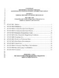
1 OREGON DEPARTMENT OF TRANSPORTATION Delivery and Operations Division engineering and Technical Services Branch engineering Automation Section Joseph R. Thomas, PLS engineering Automation Manager Chief of Surveys (503) 986-3316 CONSTRUCTION SURVEYING MANUAL FOR CONTRACTORS January 15, 2021 This companion MANUAL to Standard Specification 00305 provides detailed information on performing CONSTRUCTION survey work for highways, bridges, signs, signals, illumination and associated work. Revision History --------- For previous version revision history, please see past versions which are available from the ODOT engineering Automation Section. --------- Seventh Release - January 15, 2021 - Removed previous version Revision History.
2 Chapter - Revised timing of Pre-Survey Conference to match Pre- CONSTRUCTION Conference. Chapter - Clarified Culvert/Pipe Data Sheet requirements. Chapter - Added data format requirement for Grade Verification points. Chapter - Added final Vertical Clearance measurement instructions. This document is formatted for double sided printing Page i TABLE OF CONTENTS CHAPTER 1 - GENERAL INFORMATION .. 1 Scope ..1 Mandatory Pre-Survey Conference ..2 Review by the Engineer ..3 Agency Contractor Responsibilities ..3 Survey Methods ..6 Automated Machine Guidance ..6 Survey Work Records ..7 Communication With the Surveyor ..7 CHAPTER 2 - ELECTRONIC DATA.
3 8 General ..8 File Formats For Digital Data Exchange ..8 Other Documents - ..8 CHAPTER 3 - MATERIALS, EQUIPMENT, AND LABOR .. 9 Materials ..9 Survey Equipment ..9 Personnel ..9 CHAPTER 4 - CONSTRUCTION STAKING .. 11 CONSTRUCTION Staking Tolerances ..11 Slope Stakes and References ..11 Clearing Limits ..12 Grade Stakes ..12 Walls ..12 Pipes and Box Culverts ..12 Manholes and Inlets ..12 Stockpile Sites ..13 Cross Section Method ..13 Page ii Digital Terrain Model (DTM) Method ..13 engineering CHAPTER 5 - HORIZONTAL AND VERTICAL CONTROL AND LAYOUT .. 14 Horizontal Control ..14 General Specifications ..14 Terrestrial Networks ..15 GNSS Traverses.
4 17 Vertical Control ..18 Field Procedures ..18 Acceptance Standards ..19 Data Requirements ..19 Bridges ..20 Bridge Survey Control Stations ..20 Layout Marks and Reference Points ..21 Bridge Deck Grades ..22 Pavements ..23 Signs, Signals, Illumination and Fabricated CHAPTER 6 - TEMPORARY PROTECTION, PRESERVATION, AND MONUMENTATION .. 25 Temporary Protection and Direction of Traffic ..25 Preservation of Survey Project Monumentation ..25 CHAPTER 7 - THE PRE- CONSTRUCTION SURVEY .. 26 Scope ..26 Timing ..26 Tasks ..26 Gather Data ..26 Check Control ..26 Check the DTM ..26 Search For and Tie New Monuments ..27 Utility Relocation ..27 Document Results.
5 27 CHAPTER 8 - LINE AND GRADE VERIFICATION .. 28 General ..28 Page iii Submittal Format ..28 Collection of Grade Verification Points ..28 Outside Subgrade Area ..28 Within Subgrade Area ..28 CONSTRUCTION Tolerances ..29 Areas with Specified Tolerance values ..29 Areas without Specified Tolerance values ..29 Evaluation ..29 CHAPTER 9 VERTICAL CLEARANCE .. 31 General ..31 Temporary Reduction ..31 Permanent Reduction ..31 Final Vertical Clearance Measurements ..31 ODOT CONSTRUCTION SURVEYING MANUAL for CONTRACTORS engineering Automation Page 1 of 31 January 15, 2021 CHAPTER 1 - GENERAL INFORMATION Scope - This work consists of all SURVEYING activities necessary to control the many phases of work required to construct a Project to the lines and grades as shown, specified, or established.
6 Make all supporting computations and field notes required for control of the work and as necessary to establish the exact position, orientation, and elevation of the work from control stations, including furnishing and setting CONSTRUCTION stakes and marks, reference marks, and additional control stations. Plans, specifications and other data necessary to lay out the work will be available for inspection at the Engineers office. Definitions: 3D Engineered Model - The Agency prepared electronic file(s) that identify northing, easting, and elevation to represent the Work to be performed. The 3D Engineered Model may include the surface model(s) or other designed Work elements and is an electronic representation of the line, grade, and cross section applicable to the project.
7 3D CONSTRUCTION Model - Supplemental unstamped 3D Model, not furnished by the Agency, that the Contractor is required to submit to the Engineer. Automated Machine Guidance (AMG) - AMG is the computerized guidance of CONSTRUCTION equipment to follow the line and grade of the engineered design. Guidance is either by direct control of the machinery or through visual and/or audible signals to the operator. Operation is based on digital input from positioning systems, and typically produces an increased level of precision, speed, and accuracy. Confidence Points - Random points measured in the field within the boundary of a digital terrain model (DTM), the purposes of which are to verify the accuracy of the DTM and to provide evidence just prior to CONSTRUCTION that the DTM is a reasonable representation of the original ground for computation of volumes and pay quantities.
8 For constructed Grade Verification see Chapter 8 Line and Grade Verification. Confidence point locations follow these guidelines: Randomly selected without regard for the location of DTM points or triangles Evenly distributed over the entire DTM area to be validated Proportionately distributed between confidence point types as applicable At a density sufficient to validate the surface, generally ten per instrument location as used in collecting DTM data or if not applicable, as in LIDAR data, 2% of DTM points CONSTRUCTION SURVEYING MANUAL for CONTRACTORS ODOT Page 2 of 31 engineering Automation January 15, 2021 Control Network - An array of control stations either established by the Contractor or provided by the Agency.
9 Control Station - Any item identified in the Project records as having a position and elevation on the Project datum and intended to be used to control the many phases of the CONSTRUCTION work. Digital Terrain Model (DTM) - An electronic computer model of the shape of the ground. Grade Verification Points - Points measured in the field used to verify that a constructed grade has been built according to the line and grade of the design. Reference Stakes - Stakes set away from but with information relating back to the intended location and grade. Slope Catch - The location where a design slope intersects the existing ground and where excavation or embankment work should begin to provide the intended earthwork.
10 Slope Staking - The process of using measurements and calculations in the field to determine the slope catch. Slope staking shall normally include setting stakes to mark the slope catch and setting a reference stake for every catch stake. Stakes - Stakes, nails, marks, string lines, or other devices or mechanisms set or established for the purpose of indicating or controlling the location, orientation, or grade of any feature intended for CONSTRUCTION , or for the purpose of limiting or influencing the CONSTRUCTION work. Staking - The act of placing stakes. Subgrade Area - The area of Subgrade from Subgrade shoulder to Subgrade shoulder. Survey Marker - Any survey monument, control station, or stake.
