Transcription of Contents
1 Spatial Services, a unit of the Department of Customer ServiceSIX Maps FAQ s Information Sheet 2020 ContentsQ1. What is SIX Maps? ..2Q2. How can I access SIX Maps? ..2Q3. What other platforms are available? ..2Q4. I can t load and view SIX Maps. Which internet browser do I need to use? ..3Q5. What are the terms and conditions of use? ..3Q6. Why are there sometimes differences in the position of cadastral data and imagery when overlayed? ..3Q7. Why do fence lines sometimes not appear to be along the boundary of the property in aerial photos?
2 3Q8. How do I find the imagery date on SIX Maps? ..4Q9. How do I find historical imagery over Sydney on SIX Maps? ..4Q10. How do I find other historical, aerial and satellite imagery? ..5Q11. How current is the cadastral and topographic data displayed in SIX Maps? ..5Q12. How do I switch between the NSW map and imagery view on SIX Maps? ..5Q13. Is the imagery on SIX Maps the most current imagery available? ..6Q14. How often is the imagery on SIX Maps updated? When is the next update likely to occur? ..6Q15. Where can I find the SIX Maps user guide?
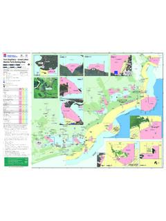
3 6Q16. Why is the address search failing in SIX Maps? ..6Q17. How is an error message displayed in SIX Maps? ..7Q18. Why does the Print/PDF tool return a blank screen upon clicking the Generate PDF button? ..7Q19. Why is the SIX Maps Viewer not loading properly? ..7Q20. How do I display a GPS track in SIX Maps? ..8Q21. What can I use the CSV Dropper tool for? ..8Q22. What datum does SIX Maps work on? gda94 , GDA2020 or WGS84? ..8Q23. Who should I contact if I need support for SIX Maps? ..81Q1. What is SIX Maps?SIX Maps (Spatial Information Exchange) is the entry point to view Spatial Services interactive images and mapping of NSW, incorporating a range of spatial and property Maps is free to view, and users can display whole of NSW imagery and base map data which includes NSW address and property administrative boundaries; Lot, Deposited Plan (DP), Strata Plan (SP) and Local Government Areas (LGA).
4 Q2. How can I access SIX Maps?Direct access: Services website: , then select the SIX Maps launch Search: Enter SIX Maps into your search engine of choiceQ3. What other platforms are available?The Spatial Collaboration Portal (SCP) provides a secure platform to facilitate the delivery of NSW spatial datasets. The portal allows local, state and federal agencies to deliver spatial data, asset management and visualisation services and enables users to search and discover datasets. Spatial Services will progressively deliver all services through the portal, including SIX Maps.
5 Please access the SCP via this link: Collaboration Portal features: APIs are available for our feature datasets within the SCP. The NSW land values, and property sales map is a free and easy way to view land values and property sales information. The Spatial Map Viewer provides an interactive map for analysing, editing, visualising, measuring and selecting data layers and map sections. portal/apps/ The Historical Imagery Viewer enables you to browse, view and download our historical imagery frames, at 600dpi. Images over Sydney can also be viewed as a mosaic, while individual frames are available to view and download over the whole of the state.
6 Html?id=f7c215b873864d44bccddda8075238cb The NSW Map Viewer allows users to customise and create their own maps, while accessing the open data available in the SCP or data shared through collaborating agencies. The SCP includes how to guides that offer an interactive way to learn how to navigate the many functions of the SCP. Each guide includes story maps showing steps and intuitive displays. #/home/pages/how-to-guidesSpatial Services, a unit of the Department of Customer Service2Q4. I can t load and view SIX Maps.
7 Which internet browser do I need to use?Spatial Services recommends the following browser versions to optimise your use of SIX Maps: Google Chrome Mozilla Firefox Microsoft Edge Apple SafariQ5. What are the terms and conditions of use?Spatial Services holds the government assets, including the Web Services, for the Crown in right of NSW. Spatial Services acts as the custodian, owner, creator and provider of web services held in its care on behalf of the NSW Government. SIX Maps terms and conditions can be accessed via selecting the Welcome & Help tab located under the Help tool panel.
8 Alternatively, terms and conditions can also be accessed directly at: Terms and conditions must be accepted in order to access the SIX Maps environment and any questions regarding these terms and conditions should be directed by email to prior to selecting I Accept. Q6. Why are there sometimes differences in the position of cadastral data and imagery when overlayed?It is important to note that cadastral data displayed within SIX Maps has no legal status and is intended for viewing purposes only. Only the registered deposited or strata plan of survey is recognised as the legal definition of the boundaries.
9 Apparent differences between the cadastral or topographic data and imagery can be due to the scales and inherent inaccuracies in the sourced hard copy data used in the original capture program. When the cadastral and topography datasets are overlayed with current and orthorectified imagery, the apparent differences between scale and accuracies often show misalignments between cadastral and imagery boundaries. For example, the cadastral boundary data was originally captured more than two decades ago from hard copy mapping with map scales varying from 1:2000 up to 1:100,000.
10 Q7. Why do fence lines sometimes not appear to be along the boundary of the property in aerial photos? Aerial photos on SIX Maps have no legal status and only act as a representation of the relative position of cadastral and topographic features. Users should always refer to the relevant registered deposited or strata plan for legal representation of boundary information. Inconsistencies between fence lines shown in aerial photos and property boundaries can occur when fence lines do not follow the officially surveyed boundary as displayed on a registered deposited or strata plan.