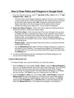
Transcription of Converting KML (Google Earth) files to Shapefiles
1 Converting KML ( google earth ) files to Shapefiles This instruction sheet will direct you to ArcGIS Desktop tools that can be used to convert to and from Shapefiles (SHP) and google earth files (KML). It should be noted that there are many different tools that will perform the same tasks, these are simply the easiest ones to use. 1. To convert a google earth (KML) file to a shapefile you will first need to download a script from the ESRI website. The script is free, however you may need to create a user account. This account will also be free. Once downloaded and installed, the script will appear as a toolbox in ArcToolbox. 2. From the ESRI homepage, choose the Support tab at the top of the page. 3. Next choose the Downloads tab at the top of the page 4. Follow the link to ArcScripts 5. In the search box type KML to SHP 6. Choose Convert google earth Path (KML) to SHP by Daniel Cossette, Sept.
2 29, 2008. 7. Download the file to your computer and unzip it. It will contain a pdf file called Installation Guide that will help you install and use the script. From the Installation Guide : The purpose of the Convert KML to SHP tool is to convert google earth kml files to Shapefiles . The output shapefile will contain feature names, descriptions, and google earth folder as attributes. The coordinate system of the output shapefile is in geographic coordinates (WGS84). The kml file may contain any number of points, lines, and polygons. The script will create a shapefile for the feature type of interest. If the kml file contains more than one type of feature, you will need to run the script once for each feature type that is to be converted to a shapefile. When digitizing in google earth , it is recommended that you store all features intended for a given shapefile in a single folder.
3 You can do this by using the following procedure: 1. Create a folder in the google Table of Contents by A. right-clicking on My Places, B. click Add, and C. click Folder. 2. Add features to the folder by clicking on the folder so that it is highlighted. Then proceed to create polygons, lines, or points. 3. When finished creating features, save the entire folder as a kml file by A. right clicking on the folder, B. select "Save As", and C. change type to kml. Individual features may also be saved as kml files . Before you can run the script in ArcGIS, you will need to load the script s toolbox into ArcToolbox. Loading the KML_to_SHP toolbox into ArcToolbox: The download from the ESRI ArcScripts site contains the file this file is the toolbox which you will need to load into ArcToolbox. The is the script file which must always be kept in the same location as the .tbx file so that the toolbox can find the script.
4 To load the toolbox into ArcToolbox: 1. Start ArcMap and open ArcToolbox 2. In ArcToolbox, right-click on ArcToolbox 3. Click on Add Toolbox, navigate to the , and click Open 4. Click the plus symbol to the left of the Convert KML to SHP toolbox to expand it. The toolbox will contain the Convert KML to SHP script 5. Double-click on the script to run it. Converting Shapefiles to google earth (KML) -To convert Shapefiles to google earth files you will have to use a different tool. It can be found in the same manner as above. -Search for: Shape2 KML - export Shapefiles and raster layers to KML by Matei Domnita, Aug 3, 2008 -Once you have downloaded and unzipped the file there will be a folder called Shape2 KML readme. Open this folder and read the pdf file called Shape2 KML Creator. This will explain how to install and use the tool. It also contains screen shots and other instructions From the Shape2 KML Creator pdf: 1.
5 Installing the command. To install the command and add it to a toolbar you must do this: -open the ArcMap Application -Click Tools> Customize - go to the Commands Tab -Click "Add from file" -browse to the Location of the Shape2 KML library -click on the file and click "Open" , or double click the TLB file -the shape2 KML command should apear in the command list. -ArcGIS should automatically highlight the command, or you can use the search feature to find it. -Just type shape in the search field above the list -drag and drop the command to any toolbar -the command apears on the toolbar 2. Starting the program -To start the program, click the button on the toolbar. A tip will appear to tell you what the button does. -after clicking the button, the main form will appear. Selected Layer is the layer for which you are currently setting the properties. The layers list presents the list of layers that can be exported.
6 You can either select all layers by clicking the "Select All" button or select just the layers you need. The name of the layer shown in tha layers list is the same as the name ahown in ArcMap. The KML file location is the location where the KMl file will be saved. You can change this location by pasting a new locaton in the box or you can browse to the location by clicking the " " button The Altitude, name and description selection is different for each selected layer. Change the selected layer in tha combo in the left of the form to activate these options. You can select the following altitude modes (if available): -clamp to ground, to place the feature directly on the ground -absolute, to place the feature at an absolute level. This can be taken from a value field in the Attribute table or inserted manually. -relative, to place the feature relative to ground level. The same as above, you can get the value from a field or insert it manually.
7 The Style selection allows you to set properties for the way features will be shown in google earth . Currentl;y, there is only one style for the entire KML, so the features will look the same even if they are from different layers. The style selection permits choosing the color for lines or icons, the fill for the polygons and the icon you wish to use for the points from a list of preset icons.