Transcription of CYCLONE WARNING IN INDIA
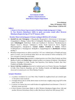
1 INDIA Meteorological Department Ministry of Earth Sciences Ministry of Earth Sciences Government of INDIA CYCLONE WARNING IN INDIA . STANDARD OPERATION PROCEDURE. INSAT 3D-18/0300 UTC. INDIA METEOROLOGICAL DEPARTMENT. MINISTRY OF EARTH SCIENCES. GOVERNMENT OF INDIA . MARCH, 2021. PREFACE. A tropical CYCLONE (TC) is a multihazard weather phenomenon, as it leads to heavy rainfall, gale wind and storm surge during the landfall. It also effects severely the marine activities during its life over the Sea. Though fewer tropical cyclones (about 7 % of global frequency) occur over the north Indian Ocean (NIO), it causes heavy loss of life and property over the region. Various components of early WARNING system for TCs include (i) hazard analysis, (ii) monitoring (iii) modeling, (iv) forecasting, (v) impact & risk assessment, (vi) WARNING generation, presentation & dissemination, (vii) co-ordination with disaster management agencies, (viii) public education & reaching out and (ix) post- event review.
2 Over the years, the INDIA Meteorological Department (IMD) has built up a credible CYCLONE WARNING System for the country which utilises augmented observational network, satellites, radars, array of various global & regional numerical weather prediction (NWP) models and modern information and communication technology for analysis, forecasting and WARNING generation & dissemination. In the event of an approaching TC, IMD issues impact based warnings to all concerned including the government, the local population, media and stakeholders through a variety of communication channels. As a result, during recent years the loss of life due to TCs has been reduced significantly to less than 100 in any CYCLONE . However, the huge loss of property due to TCs is still a challenge to be addressed. All the aspects of the early WARNING system of TCs have been standardized in the document Standard Operational Procedure (SOP) for CYCLONE WARNING in INDIA . to improve the efficiency of CYCLONE WARNING system.
3 As there have been significant improvements in all the components of CYCLONE WARNING system during recent years including observations, modeling and communication, the CYCLONE WARNING Division of IMD has updated this document incorporating all the latest developments in the field. This SOP document will be useful to forecasters, early WARNING service providers and disaster management agencies in effectively mitigating disaster due to TCs. Mrutyunjay Mohapatra March 2021 Director General of Meteorology Acknowledgements I am thankful to all the Officers and Staff members of CYCLONE WARNING Division for their coordinated efforts that went into the formulation of the Manual entitled CYCLONE WARNING in INDIA -Standard Operation Procedure . I hereby place on record my deep appreciation for the valuable contributions made by Mrs. Sunitha Devi, Scientist-F & Head CYCLONE WARNING Division and Mrs. Monica Sharma, Scientist-D, CYCLONE WARNING Division towards preparation, compilation, edition, review and publication of this manual.
4 I express my sincere thanks and appreciation to Mr. Mukesh Kumar, SA, Mr. Santosh Singh, SA Mr. Gaurav Kumar Srivastav, SA, Mr. Aditya Chaudhary, SA, Ms. Shilpa Singh, SA and Mr. V. Vijay Kumar, Meteorologist B for their technical support in publication of this document. Mrutyunjay Mohapatra March 2021 Director General of Meteorology CONTENTS. I. Introduction 1-56. II. CYCLONE WARNING Organisation 57-63. III. Needs for monitoring and prediction 64-70. IV. Observational aspects of CYCLONE WARNING system 71-100. V. Monitoring and Prediction technique 101-143. VI. Bulletins and warnings 144-195. VII. CYCLONE WARNING Dissemination 196-197. VIII. Pre- CYCLONE Exercise 198-202. IX. Post CYCLONE Action 203-216. X. Management of CYCLONE and Common Man 217-219. XI. Conclusions and future scope 220. List of Acronyms ACWC Area CYCLONE WARNING Centre ADT Advanced Dvorak Technique AIR All INDIA Radio AMSS Automatic Message Switching System AMSU Advanced Microwave Sounder Unit ARB Arabian Sea ARG's Automatic Rain Gauge Stations AWS Automatic Weather Station BoB Bay of Bengal BoM Bureau of Meteorology No.
5 Current Intensity Number CAPE Convective Available Potential Energy CCD Charge Coupled Device CDMC CYCLONE Distress Mitigation Committee CDO Central Dense Overcast CDR CYCLONE Detection RADAR. CDs Cyclonic Disturbances CIMSS Cooperative Institute for Meteorological Satellite Studies CINE Convective Inhibition Energy CIPS Cooperative Institute for Precipitation Systems CLIPER Model Climatology and Persistence Model CMV Cloud Motion Vectors COU Cone of Uncertainty CPC Climate Prediction Centre CRC CYCLONE Review Committee CTT Cloud Top Temperature CWC CYCLONE WARNING Centre CWD CYCLONE WARNING Division CWRC CYCLONE WARNING Research Centre DMDD Digital Meteorological Data Dissemination DMSP Defence Met. Satellite Programme of DPE Direct Position Error DRMS District-wise Rainfall Monitoring Scheme DWR Doppler Weather RADAR. ECMWF European Centre for Medium-Range Weather Forecasts EEC Radars Enterprise Electronics Corporation Radars EIR Enhanced Infrared EPS Ensemble Prediction System FNMOC Fleet Numerical Meteorology and Oceanography Centre GEFS Global Ensemble Forecast System GFS Global Forecast System GMDSS Global Maritime Distress Safety System GPP Genesis Potential Parameter GTS Global Telecommunication System HFRT High Frequency Radio Transmission HSDT High Speed Data Terminals HWRF Hurricane Weather Research and Forecasting IADP Intensive Agricultural Development Programme IAF Indian Air Force ICAO International Civil Aviation Organisation IITD Indian Institute of Technology Delhi IMD INDIA Meteorological Department IMDPS Indian Meteorological Data Processing System INCOIS Indian national Centre for Ocean Information Services INOSHAC Indian Ocean & South Hemispheric Centre INSAT Indian national Satellite System IOP Intense Observation Period IR Infrared Red IST
6 INDIA Standard Time ITCZ Inter-Tropical Convergence Zone IVRS Interactive Voice Response System JMA Japan Meteorological Agency JTWC Joint Typhoon WARNING Center LES Local Earth Station LLCCs Low level circulation centres Max (Z) Maximum reflectivity MFI Meteo France International MHA Ministry of Home Affairs MJO Madden-Julian oscillation MM5 Fifth-Generation Penn State/NCAR Mesoscale Model MME Multi Model Ensemble MSLP Mean Sea Level Pressure MSW Maximum Sustained Wind MW Microwave NASA GHCC national aeronautics and Space Administration- Global Hydrology and Climate Center. NBDP Narrow Band Direct Printing NCMRWF national Centre for Medium Range Weather Forecast NDBP national Data Buoy Programme NDM national Disaster Management NDMA national Disaster Management Authority NDRF national Disaster Response Force NIDM national Institute of Disaster Management NIO North Indian Ocean NIOT national Institute of Ocean Technology NOAA national Oceanic and Atmospheric Administration NRL Naval Research Laboratory NSDC national Satellite Data Centre NWFC national Weather Forecasting Centre NWP Numerical Weather Prediction OLR Outgoing Longwave Radiation PBO Pilot Balloon Observatories PMSS Probable Maximum Storm Surge PPI(Z)
7 Plan Position Indicator PRBS Pseudo-Random Burst Technique QPE Quantitative Precipitation Estimation RMC Regional Meteorological Centre RMR Radius of Maximum Reflectivity RMW Radius of Maximum Wind RS/RW Radio sonde/ Radio wind RSMC Regional Specialized Meteorological Centre RSS Remote Sensing Systems RTH Regional Telecommunication Hub SAARC South Asian Association for Regional Cooperation SCIP Statistical-Dynamical Model for CYCLONE Intensity Prediction SDMC SAARC Disaster Management Centre SLP Sea Level Pressure SRI Surface Rainfall Intensity SST Sea Surface Temperature STDS Satellite Tropical Disturbance Summary TB Brightness Temperature TC Tropical Cyclones TCAC Tropical CYCLONE Advisory Centre THORPEX The Observing System Research and Predictability Experiment TIGGE THORPEX Interactive Grand Global Ensemble TMI TRMM Microwave Imager TPC Tropical Prediction Centre TPW Total Precipitable Water TRMM Tropical Rainfall Measuring Mission UKMO UK Meteorological Office UTC Coordinated Universal Time UWT Uniform Wind Technique VHRR Very High Resolution Radiometer VIS Visible VOF Voluntary Observing Fleet VVP(Z) Volume Velocity Processing WMO World Meteorological Organisation WRF Weather Research and Forecasting Model WV Water Vapour WVWs Water Vapour Winds CYCLONE WARNING in INDIA : Standard Operation Procedure Chapter I.
8 Introduction A "Cyclonic Storm' or a " CYCLONE " is an intense vortex or a whirl in the atmosphere with very strong winds circulating around it in anti-clockwise direction in the Northern Hemisphere and in clockwise direction in the Southern Hemisphere. The word " CYCLONE " is derived from the Greek word 'Cyclos" meaning the coil of a snake. To Henri Piddington, the tropical storms in the Bay of Bengal and in the Arabian Sea appeared like the coiled serpents of the Sea and he named these storms as "Cyclones". Tropical cyclones are also referred to as 'Hurricanes' over Atlantic Ocean, 'Typhoons' over Pacific Ocean, 'Willy-Willies' over Australian Seas and simply as 'Cyclones' over north Indian Ocean (NIO). Classification of cyclonic disturbances Cyclones are intense low pressure areas - from the center of which pressure increases outwards. The amount of the pressure drop in the center and the rate at which it increases outwards gives the intensity of the cyclones and the strength of winds.
9 The criteria followed by the INDIA Meteorological Department (IMD) to classify the low pressure systems in the Bay of Bengal and in the Arabian Sea as adopted by the World Meteorological Organisation ( ) are given in Table Table Criteria for classification of cyclonic disturbances over the North Indian Ocean Type of disturbance Associated maximum sustained wind 1. Low Pressure Area Not exceeding 17 knots (<31 kmph ). (MSW). 2. Depression 17 to 27 knots (31-49 kmph). 3. Deep Depression 28 to 33 Knots (50-61 kmph ). 4. Cyclonic Storm 34 to 47 Knots (62-88 kmph ). 5. Severe Cyclonic Storm 48 to 63 Knots (89-117 kmph ). 6. Very Severe Cyclonic Storm 64 to 90 Knots (118-167 kmph ). 7. Extremely Severe Cyclonic Storm 91 to119 Knots (168-221 kmph ). 8. Super Cyclonic Storm 120 Knots and above ( 222 kmph ). Structure of Tropical CYCLONE Tropical Cyclones (TCs) are warm core low pressure systems having a large vortex in the atmosphere, which is maintained by the release of latent heat by convective clouds that form over warm oceans.
10 In the northern hemisphere, the winds in a CYCLONE blow anticlockwise in the lower troposphere and clockwise in the upper troposphere. However, in 1|Page CYCLONE WARNING in INDIA : Standard Operation Procedure the southern hemisphere, the winds of the CYCLONE blow in the opposite direction clockwise in the lower levels and anticlockwise in the upper levels. A full-grown CYCLONE is a violent whirl in the atmosphere with 150 to 1000 km diameter and 10 to 15 km height. Gale winds of 150 to 250 kmph or more spiral around the center of the low pressure system with 30 to 100 hPa below the normal sea level pressure. In a fully developed cyclonic storm, there are four major components of horizontal structure viz. Eye, Wall cloud region, Rain/Spiral bands and Outer storm area. A schematic diagram is given in Schematic diagram of a CYCLONE Eye A typical imagery of CYCLONE showing eye is given in The most spectacular part of a matured cyclonic storm is its 'eye', which forms at the centre of the storm inside a Central Dense Overcast (CDO) region.