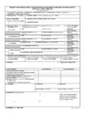
Transcription of DD FORM 2993, AUG 2015 - Executive Services …
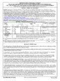
1 ENVIRONMENTAL BASELINE SURVEY (EBS) CHECKLIST For use of this form, see ATP 4-11B; the proponent agency is :Classification:Note: Do not leave any blanks empty. If they do not apply to the current site, enter not applicable (NA) or nothing significant to report (NSTR) to show the section has been investigated. The section numbers in the checklist correspond to the section numbers in the report format. *Items that are completed in the Environmental Baseline Study Report. These items are shown in the EBS Checklist to ensure that item numbers are matched between the checklist and the ADMINISTRATIVE DATAa. LOCATION NAME(Official name and legal address of the location being assessed.)
2 Name of country, city, township, or area of operation for the site location.)b. LOCATION ALIASES (Other names the base is currently or was previously known as.)c. START DATE AND TIMEd. END DATEe. ORGANIZATION CONDUCTING SURVEY(Name of the unit or activity conducting the assessment.)f. SURVEYOR S NAME, RANK, GRADE, AND TITLEg. SURVEYOR S TELEPHONEh. SURVEYOR S E-MAILi. GEOGRAPHIC LOCATIONNote: If this information is classified, enter it in Section 14 of this checklist. The 8-digit military grid coordinates are mandatory for the site using the center of the camp for reference. Coordinates may also be taken from the outside corners of the site to provide site boundaries.
3 A global positioning system may be used in addition to the grid coordinates. The 8-digit military grid coordinates will always include the 3-character zone designator and the 2-character grid square (Enter notes associated with the geographic location; for example, the datum associated with the location, map type, map number, global positioning system used, and so forth.)2. Executive SUMMARY *(Completed after information gathered is analyzed and recommendations developed. This is a synopsis of significant findings, conclusions, and recommendations based on the data analysis with the ultimate recommendation being to use or not use the site.)
4 3. INTRODUCTIONa. LIMITATIONS OF ASSESSMENT (Enter the physical obstructions, limiting conditions (such as weather), mission restrictions, and the lack of equipment and supplies encountered during the assessment.)Coordinate 4 Coordinate 2 Coordinate 3 Coordinate 1 Page 1 of 20 PagesDD FORM 2993, FEB 2015 Click this button to add a continuation page if more space is needed for any Designer GENERAL DATA GAPS(Enter data that was either not obtainable at the time of the survey or that will be received in the future; for example, awaiting analytical data, personnel not available to be interviewed, and locations of key facilities may be unknown or may move before occupation.)
5 4. SITE CHARACTERISTICS (Attach site maps and photographs to the survey. Take at least one photograph per section or area of concern. Photographs can be used to document conditions before and after occupation. Create a photograph log that documents the date, time, location and a brief description of each photograph.)b. CAMP FIXED POPULATION Note: If this information is classified, enter it in Section 14 of this checklist. Enter the population of the location, if known. Separate by military and civilian ROTATION SCHEDULE Note: If this information is classified, enter it in Section 14 of this checklist.(What is the unit rotation schedule [months, years, and so forth]).
6 D. NUMBER OF UNITED STATES TROOPS IF NOT A UNITED STATES CAMP Note: If this information is classified, enter it in Section 14 of this PHYSICAL SETTING(Provide a description of the general geography, topography, geology, hydrology, vegetation, raw materials, natural resources, and urban and rural settings. Make note of any obvious damage caused by natural and manmade events such as earthquakes, flooding, tornadoes, hurricanes, tsunami, or mining.)f. CLIMATE AND WEATHER(Provide information regarding the climate and weather in the area; for example, temperature range, predominate wind direction, or normal rainfall. Identify if the area is prone to seasonal or periodic events such as hurricanes, tornadoes, tsunamis, or monsoons.)
7 Attach five recent previous years of meteorological data (if possible, in an electronic format), the source of the data, and a point of contact for the source.)a. UNITS AND DETACHMENTS, TEAMS, AND ELEMENTS PRESENT Note: If this information is classified, enter it in Section 14 of this checklist. Include as much detail as possible and include all 2 of 20 PagesDD FORM 2993, FEB 2015 Classification:Classification:g. SOIL(Note the types, permeability, drainage ditches, low lying areas [standing water], unusual or out-of-place mounds, disturbed areas, discolored soil, areas unusually devoid of vegetation, and so forth. Is the area prone to sink holes?
8 Provide 8-digit military grid coordinates of the areas identified. A global positioning system may be used in addition to the grid coordinates.)h. GROUNDWATER(Groundwater is any water source present beneath the surface of the ground. What is the depth of the groundwater and in what general direction does it flow?) i. SURFACE WATER(What surface water is present on the site; lakes, ponds, rivers, or streams? What is the direction of flow for surface water and drainage? Indicate the direction of surface drainage on graphics or a site map. Note any standing [nonflowing or sluggish] water.)j. WETLANDS, FLOOD ZONES, COASTAL ZONES(Is the site located in or near a wetland, flood zone, or coastal zone; for example, swamp, marsh, bog, or areas prone to flooding?
9 Include the location of the wetlands and flood zones on graphics or site maps as appropriate. Note any areas that are flooded, show evidence of past flooding or flash flooding, and any potential wadis, washes, or dry creek beds.)5. DETAILED SITE AND ADJACENT PROPERTY DESCRIPTION (Make a detailed sketch or map overlay of the site, noting the areas of significance including the date, the surveyor s name and unit, a north arrow, scale, and legend. Take photographs and include grid coordinates and a description of both the area and reason for taking the photograph.) Note: Everything examined in this section for the site must also be examined for all adjacent property and documented in Section 7 DESCRIPTION OF STRUCTURES(Describe the structures and their use: housing, maintenance, or office space.
10 Include heating and ventilation systems and potential for Radon. Note the condition of the materials that may contain asbestos, such as roof shingles, floor tiles, or pipe insulation. These may release hazardous fibers if damaged. Look for signs of chipping or peeling lead-based paint. Look for electrical hazards and structural damage. Determine current and prior usage of structures. Document water and sewer capability. Look for evidence of previous spills, hazardous materials, or waste storage. Note any chemical-type or strange odors. Look for evidence of pest infestation.)Tents (soft-sided structure) Semipermanent (hard buildings without permanent below surface foundations) Permanent (hard buildings with permanent below surface foundations)Page 3 of 20 PagesDD FORM 2993, FEB 2015 NOTESC lassification:Classification:b.