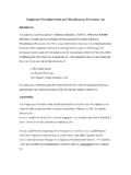
Transcription of Equation List for Sizing Wet Ponds
1 Equation List for Sizing Wet Ponds Calculating the Water Quality Volume (Water Quality TM Section ) The water quality protection volume is calculated by multiplying the 85th percentile annual rainfall event by the volumetric runoff coefficient (Rv) and the site area. Rv is defined as: Rv = + (I) ( ). where: I = percent of impervious cover (%). For North Central Texas, the average 85th percentile annual rainfall event is inches. Therefore, WQv is calculated using the following formula: WQv = Rv A ( ). 12. where: WQv = water quality protection volume (acre-feet). Rv = volumetric runoff coefficient A = total drainage area (acres). Calculating the Forebay Volume (Site Development Controls TM Section ) The forebay is sized to contain inches per impervious acre of contributing drainage Calculating the Permanent Pool Volume (Site Development Controls TM Section ) Wet Pond: Size permanent pool volume to WQv Extended Detention Wet Pond: Size permanent pool volume to WQv.
2 Size extended detention volume to WQv. Extended Detention Micropool Pond: Size permanent pool volume to 25 to 30% of WQv. Size extended detention volume to remainder of WQv. Calculating the Streambank Protection Volume (Hydrology TM Section ) The Soil Conservation Service1 (SCS) hydrologic method requires basic data similar to the Rational Method: drainage area, a runoff factor, time of concentration, and rainfall. The SCS approach, however, is more sophisticated in that it also considers the time distribution of the rainfall, the initial rainfall losses to interception and depression storage, and an infiltration rate that decreases during the course of a storm. For SPv estimation, using Figure , the unit peak discharge (qU) can be determined based on Ia/P and time of concentration (tC). Knowing qU and T (extended detention time, typically 24 hours), the qO/qI ratio (peak outflow discharge/peak inflow discharge) can be estimated from Figure Ia = 200/CN - 2.
3 Where: Ia = initial abstraction CN = curve number Equation List for Sizing Wet Ponds Ia/P. where: Ia = initial abstraction P = accumulated rainfall obtained from rainfall tables by county in the Hydrology TM Section (inches). Using the following Equation from TR-55 for a Type II rainfall distribution, VS/Vr can be calculated. VS/Vr = (qO/qI) + (qO/qI)2 (qO/qI)3 ( ). where: VS = required storage volume (acre-feet). Vr = runoff volume (acre-feet). qO = peak outflow discharge (cfs). qI = peak inflow discharge (cfs). The required storage volume can then be calculated by: VS = (VS/Vr)(Qd)(A) ( ). 12. where: VS and Vr are defined above Qd= the developed runoff for the design storm (inches). A = total drainage area (acres). Equation List for Sizing Wet Ponds Figure SCS Type II Unit Peak Discharge Graph Equation List for Sizing Wet Ponds Figure Detention Time vs. Discharge Ratios Calculating the Flood Control Volume (Hydrology TM Section ) For drainage areas of less than 200 acres, a modification of the Rational Method can be used for the estimation of storage volumes for detention calculations.
4 The Modified Rational Method uses the peak flow calculating capability of the Rational Method paired with assumptions about the inflow and outflow hydrographs to compute an approximation of storage volumes for simple detention calculations. The allowable release rate can be determined from: Qa = Ca i A ( ). where: Qa = allowable release rate (cfs). Ca = predevelopment Rational Method runoff coefficient i = rainfall intensity for the corresponding time of concentration (in/hr). A = area (acres). The critical duration of storm, the time value to determine rainfall intensity, at which the storage volume is maximized, is: 2 CAab ( ). Td = b Qa Equation List for Sizing Wet Ponds where: Td = critical storm duration (min). Qa = allowable release rate (cfs). C = developed condition Rational Method runoff coefficient A = area (acres). a, b = rainfall factors dependent on location and return period taken from Table The required storage volume, in cubic feet can be obtained from the equations below: Vpreliminary = 60 [CAa (2 CabAQa)1/2 + (Qa/2) (b-tc)] ( ).
5 Vmax = Vpreliminary * P180/Ptd ( ). where: Vpreliminary = preliminary required storage (ft3). Vmax = required storage (ft3). tc = time of concentration for the developed condition (min). P180 = 3-hour (180-minute) storm depth (in). Ptd = storm depth for the critical duration (in). all other variables are as defined above The equations above include the use of an adjustment factor to the calculated storage volume to account for under Sizing . The factor (P180/Ptd) is the ratio of the 3-hour storm depth for the return frequency divided by the rainfall depth for the critical duration calculated in Equation The Modified Rational Method also often under sizes storage facilities in flat and more sandy areas where the target discharge may be set too large, resulting in an oversized orifice. In these locations modifications to the C factor or time of concentration should be considered in the design of the orifice.
6 Equation List for Sizing Wet Ponds Table Rainfall Factors a and b for the Modified Rational Method (1-year through 100-year return periods). Return Interval County 1 2 5 10 25 50 100. a Collin b a Dallas b a Denton b a Ellis b a Erath b a Grayson b a 163 Hood b a Hunt b a Johnson b a Kaufman b a Navarro b a Palo Pinto b a Parker b a Rockwall b a Somervell b a Tarrant b a Wise b TM. iSWM Technical Manual Landscape Specific Landscaping Criteria for Structural Stormwater Controls Stormwater Ponds and Wetlands Stormwater Ponds and wetlands are engineered basins and wetland areas designed to control and treat stormwater runoff. Aquatic vegetation plays an important role in pollutant removal in both stormwater Ponds and wetlands. In addition, vegetation can enhance the appearance of a pond or wetland, stabilize side slopes, serve as wildlife habitat, and can temporarily conceal unsightly trash and debris.
7 Within a stormwater pond or wetland, there are various hydrologic zones as shown in Table that must be considered in plant selection. These hydrologic zones designate the degree of tolerance a plant must have to differing degrees of inundation by water. Hydrologic conditions in an area may fluctuate in unpredictable ways; thus the use of plants capable of tolerating wide varieties of hydrologic conditions greatly increases the successful establishment of a planting. Plants suited for specific hydrologic conditions may perish when those conditions change, exposing the soil, and therefore, increasing the chance for erosion. Each of the hydrologic zones is described in more detail below along with examples of appropriate plant species. Table Hydrologic Zones Zone # Zone Description Hydrologic Conditions Zone 1 Deep Water Pool 1-6 feet depth (permanent pool). Zone 2 Shallow Water Bench Normal pool elevation to 1 foot depth Zone 3 Shoreline Fringe Regularly inundated Zone 4 Riparian Fringe Periodically inundated Zone 5 Floodplain Terrace Infrequently inundated Zone 6 Upland Slopes Seldom or never inundated Zone 1: Deep Water Area (1- 6 Feet).
8 Ponds and wetlands both have deep pool areas that comprise Zone 1. These pools range from one to six feet in depth, and are best colonized by submergent plants, if at all. This pondscaping zone is not routinely planted for several reasons. First, the availability of plant materials that can survive and grow in this zone is limited, and it is also feared that plants could clog the stormwater facility outlet structure. In many cases, these plants will gradually become established through natural recolonization ( , transport of plant fragments from other Ponds via the feet and legs of waterfowl). If submerged plant material is commercially available and clogging concerns are addressed, this area can be planted. The function of the planting is to reduce resedimentation and improve oxidation while creating a greater aquatic habitat. Plant material must be able to withstand constant inundation of water of one foot or greater in depth.
9 Plants may be submerged partially or entirely. Plants should be able to enhance pollutant uptake. Landscape and Aesthetics Guidance LS-11. Revised 04/10. TM. iSWM Technical Manual Landscape Plants may provide food and cover for waterfowl, desirable insects, and other aquatic life. Some suggested emergent or submergent species include, but are not limited to: Water Lily, Deepwater Duck Potato, Spatterdock, Wild Celery and Redhead Grass. Zone 2: Shallow Water Bench (Normal Pool To 1 Foot). Zone 2 includes all areas that are inundated below the normal pool to a depth of one foot, and is the primary area where emergent plants will grow in stormwater wetlands. Zone 2 also coincides with the aquatic bench found in stormwater Ponds . This zone offers ideal conditions for the growth of many emergent wetland species. These areas may be located at the edge of the pond or on low mounds of earth located below the surface of the water within the pond.
10 When planted, Zone 2 can be an important habitat for many aquatic and nonaquatic animals, creating a diverse food chain. This food chain includes predators, allowing a natural regulation of mosquito populations, thereby reducing the need for insecticidal applications. Plant material must be able to withstand constant inundation of water to depths between six inches and one foot deep. Plants will be partially submerged. Plants should be able to enhance pollutant uptake. Plants may provide food and cover for waterfowl, desirable insects and other aquatic life. Common emergent wetland plant species used for stormwater wetlands and on the aquatic benches of stormwater Ponds include, but are not limited to: Arrowhead/Duck Potato, Soft Rush, various Sedges, Softstem Bulrush, Switchgrass, Pickerelweed, Pond Cypress and various Asters. Zone 3: Shoreline Fringe (Regularly Inundated).