Transcription of Global Positioning System (GPS) Surveying
1 Global Positioning System (GPS) SurveyingProblem: Surveying Land Areas for HighwayInfrastructures is Time- and Labor-intensiveThere are considerable costs associated with conventionalsurveying technology. Methods are time-consuming andoften require multiple trips to the same site to gather dataand to ensure the collected data is accurate. In addition,workers must be trained to operate conventional surveyingequipment also can delay data collection and highway surveys; crews are not always ableto work under certain weather conditions, such as snow,rain, or extreme Federal HighwayAdministration (FHWA) recognizesthe importance of increasing survey accuracy while reduc-ing labor costs and improving efficiency addressing thisproblem is one of the Agency s top.
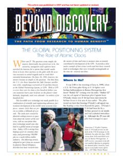
2 GPS Increases Survey Accuracy, ImprovesProductivity, and Reduces CostsOver the past 5 years, studies across the United Stateshave shown that GPS technology increases the productivity of conventional survey crews, reduces datacollection time, improves survey accuracy, and allowscrews to work under a broad range of weather , less expertise is required to operate a GPS Surveying unit than is needed to operate conventional Surveying is GPS?GPS is a space-based, radio-navigation System that provides worldwide, all-weather, three-dimensional position, velocity, navigation, and time data to both civilian and military users.
3 Potential uses for GPS within the highway community are diverse and range fromproviding traveler information to mapping (GPS technology can be integrated easily with GeographicInformation Systems).How does it work?GPS can provide a very accurate digital map of the highway infrastructure. The technology operates on theprinciple of triangulation if the difference from anobserver to three known points can be measured, theposition of the observer can be calculated. The systemincludes at least 24 satellites in orbit 19,320 kilometers(12,000 miles) above the earth and inclined at 55 . These satellites continuously broadcast their position, atiming signal, and other information.
4 By combining the measurements from four different satellites, users withreceivers can determine their 3-dimensional position, currently within 4 20 meters (13 66 feet).Putting it in Perspective It takes many days to survey small sections of road usingtraditional techniques. Complete road inventories may take Applications: Research Indicates ImprovedSurvey Accuracy and Reduced CostsThe Utah Department of Transportation found that oneperson operating GPS equipment is generally twice asfast as a conventional survey crew, and a GPS systemwith two units is potentially four times faster than crewsusing conventional Surveying technologies.
5 Other advantages of GPS technology include the ability to use the technology across long distances with minimalsetups. After a GPS System is placed, roving can be performed within a radius of 10 kilometers (6 miles) ofthe stationary base unit. Using conventional technologies,the base unit would have to be moved every 183 meters(600 feet). In one study, GPS equipment recorded 5,511topographic points in 30 person-hours, while a similarproject using conventional technologies covered only1,500 topographic points in 120 , Michigan, and North Carolina are the lead States of the American Association of State Highway andTransportation Officials Technology ImplementationGroup (TIG) initiative to champion GPS for surveyingapplications.
6 Plans include hands-on demonstration workshops and training programs for agencies that plan toapply GPS to Surveying efforts. The GPS TIG group alsois considering developing national standards and protocols for GPS to conventional Surveying technology, GPS: Is faster. Requires less labor. Requires less training. Is more ResourcesAdditional information on GPS Surveying technology isavailable at more information, contact:John McCracken,FHWA Office of ResearchDevelopment,and TechnologyPhone:(202) Brown,North Carolina Publication No: FHWA-RC-BAL-04-0015