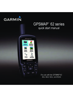
Transcription of GPSMAP 400/500 Series - Garmin International
1 GPSMAP 400/500 Series Weather and XM Satellite Radio supplement 2011 Garmin Ltd. or its subsidiariesAll rights reserved. Under the copyright laws, this manual may not be copied, in whole or in part, without the written consent of Garmin . Garmin reserves the right to change or improve its products and to make changes in the content of this manual without obligation to notify any person or organization of such changes or improvements. Go to for current updates and supplemental information concerning the use of this , the Gamin logo, GPSMAP , BlueChart , GDL , and g2 Vision are trademarks of Garmin Ltd. or its subsidiaries, registered in the USA and other countries. These trademarks may not be used without the express permission of Garmin .
2 DAFIF is a trademark of the National Geospatial-Intelligence Agency. XM and XM WX Satellite Weather are registered trademarks of XM Satellite Radio 400/500 Series Weather Supplement iIntroduction WARNINGSee the Important Safety and Product Information guide in the product box for product warnings and other important manual includes XM WX Satellite Weather , cellular Global System for Mobile communication (GSM) weather, and XM satellite radio information for the following products: GPSMAP 431 GPSMAP 431sGPSMAP 441 GPSMAP 441sGPSMAP 531 GPSMAP 531sGPSMAP 536 GPSMAP 536sGPSMAP 541 GPSMAP 541sGPSMAP 546 GPSMAP 546sCellular Equipment RequirementsTo use cellular weather, you must have a cellular GSM antenna such as the Garmin GDL 40.
3 To connect your chartplotter to a cellular antenna, refer to the installation instructions for the Equipment RequirementsTo use XM WX Satellite Weather, you must have a Garmin XM satellite weather receiver. To use XM Satellite Radio, you must have a Garmin XM satellite radio receiver. Go to for more information. To connect the XM antenna and receiver and for subscription instructions, refer to the instructions for your XM Garmin Product SupportContact Garmin Product Support if you have any questions about this product. In the USA, go to , or contact Garmin USA by phone at (913) or (800) In the UK, contact Garmin (Europe) Ltd. by phone at 0808 2380000. In Europe, go to and click Contact Support for in-country ModeSimulator mode provides simulated weather of Contentsii GPSMAP 400/500 Series Weather SupplementTable of ContentsIntroduction.
4 ICellular Equipment Requirements ..iXM Equipment Garmin Product Support ..iSimulator Mode ..iXM WX Satellite Weather and Cellular Weather ..1 Cellular Weather ..1XM WX Satellite Weather ..1 Weather Features ..1 Weather Data Broadcasts ..2 Status Messages ..2 Viewing Precipitation Information ..2 Switching Weather Charts ..3 Storm Cell and Lightning Information ..3 Hurricane Information ..4 Weather Warnings and Weather Bulletins ..4 Forecast Sea Conditions ..6 Viewing Fishing Information ..8 Visibility Information ..9 Viewing Buoy Reports ..10 Viewing Local Weather Information near a Buoy ..10 Creating a Waypoint on the Forecast Chart ..10 About the Weather Overlay ..11 Weather Alarms ..13 Selecting a Cellular or XM Antenna.
5 14 Selecting an External Cellular Antenna ..14 Viewing Weather Subscription Information ..14XM Satellite Radio ..15 Using XM Radio Bar ..16 Appendix ..17 Weather Data Warranty ..17 Software License Warnings and Weather Bulletin Color Shading ..19XM Satellite Radio Service Agreement ..20 Index ..21XM WX Satellite Weather and Cellular WeatherGPSMAP 400/500 Series Weather Supplement 1XM WX Satellite Weather and Cellular Weather WARNINGThe weather information provided through this product is subject to service interruptions and may contain errors, inaccuracies, or outdated information, and consequently should not be relied upon exclusively. Always use common sense while driving or navigating, and check alternate weather information sources prior to making safety-related decisions.
6 You acknowledge and agree that you shall be solely responsible for use of the weather information and all decisions taken with respect to driving or navigating in weather. Garmin will not be responsible for any consequences of using the weather WeatherCellular weather provides data through wireless service providers. An antenna, such as the Garmin GDL 40, communicates with nearby cellular towers to receive the weather data. The weather data for each feature comes from reputable weather data centers such as the National Oceanic and Atmospheric Administration (NOAA) National Weather Service, Environment Canada, and M t view cellular weather, you must initially select an annual subscription service online at You may purchase a day pass directly from the chartplotter.
7 A day pass provides 24 hours of continuous weather data. Refer to the antenna installation instructions or the instructions at to activate this WX Satellite WeatherA Garmin XM satellite weather receiver and antenna receives XM WX Satellite Weather data and shows it on various Garmin devices, including the Navigation chart on a chartplotter. The weather data for each feature comes from reputable weather data centers such as the National Weather Service and the Hydrometeorological Prediction Center. For more information, go to the XM WX Satellite Weather Web site at view XM WX Satellite Weather information, you must have a subscription to XM WX Satellite Weather, and you must have a Garmin XM satellite weather receiver connected to a FeaturesFeatureXM WX Satellite WeatherCellular WeatherType of Precipitation (page 2)XXSatellite Cloud Cover (page 3)XXEuropean, Canadian, and USA radar (page 3)XXLightning (page 3)XXSevere Storm Tracks (page 4)XCanada and USA Warnings (page 4)XXHurricane Track (page 4)XXSurface WX Analysis (page 5)XSea Surface Pressure Forecast (page 8)
8 XXXM WX Satellite Weather and Cellular Weather2 GPSMAP 400/500 Series Weather SupplementFeatureXM WX Satellite WeatherCellular WeatherCity Forecasts (page 6)XXSurface Wind Vectors (page 7)XXWave Direction and Wave Direction Forecast (page 7)XXWave Height and Wave Height Forecast (page 7)XXWave Period and Wave Period Forecast (page 7)XXForecasting Fish Locations (page 9)XVisibility (page 9) and Visibility Forecast (page 10)XNational Weather Station Marine Local Forecast (page 10)XXBuoy Data (page 10)XXSea Surface Temperature and Sea Surface Pressure (page 10) XXWeather Data BroadcastsSatellite weather data is broadcast at set intervals. For example, XM weather radar data is broadcast at five-minute intervals. Cellular weather data is broadcast at fifteen-minute intervals.
9 When the Garmin receiver is turned on, or when a different weather feature is selected, the receiver has to receive new data before it can be shown. You might experience a delay before weather data or a different feature appears on the chart. Note: Any weather feature can change in appearance if the source that provides the information you purchase cellular weather data or when the chartplotter automatically requests a cellular weather update, the current boat position is transmitted, and your chartplotter then receives weather data for your area centered around your current MessagesWhen viewing a weather chart, a status message, such as one of the following, may be displayed in the upper-left WX you must purchase a day pass or a subscription to view weather you must register your cellular antenna before you can purchase and view cellular weather data.
10 If you see this message after registering your antenna, shut down your system and then turn it back Precipitation InformationPrecipitation ranging from very light rain and snow, up to strong thunderstorms, is indicated in varying shades and colors. Precipitation is shown either independently or with other weather the Home screen, select Information > Weather > time stamp in the upper-left corner of the screen indicates the elapsed time since the weather data provider last updated the WX Satellite Weather and Cellular WeatherGPSMAP 400/500 Series Weather Supplement 3 Showing an Animated radar LoopYou can view precipitation information as an image of the latest update or as an animated loop of the latest the Home screen.