Transcription of Guide to Best Practices for Georeferencing - HerpNET
1 Guide to Best Practices for Georeferencing Guide to Best Practices for Georeferencing BioGeomancer Consortium August 2006 Published by: Global Biodiversity Information Facility, Copenhagen Copyright 2006 The Regents of the University of California. All rights reserved. The information in this book represents the professional opinion of the authors, and does not necessarily represent the views of the publisher or of the Regents of the University of California. While the authors and the publisher have attempted to make this book as accurate and as thorough as possible, the information contained herein is provided on an "As Is" basis, and without any warranties with respect to its accuracy or completeness.
2 The authors, the publisher and the Regents of the University of California shall have no liability to any person or entity for any loss or damage caused by using the information provided in this book. Guide to Best Practices for Georeferencing Includes Index ISBN: 87-92020-00-3 Recommended Citation: Chapman, and J. Wieczorek (eds). 2006. Guide to Best Practices for Georeferencing . Copenhagen: Global Biodiversity Information Facility. Edited by: Arthur D. Chapman and John Wieczorek Contributors: , , , , , , Contents 1 1. 1 2. PRINCIPLES OF BEST 1 3 BIOGEOMANCER 3 3 3 3 4 4 KEY DOCUMENTS AND 4 COLLECTING AND RECORDING DATA IN THE 7 1.
3 THE IMPORTANCE OF GOOD LOCALITY DATA 7 2. RECORDING 7 3. RECORDING 8 4. USING A 8 5. RECORDING 10 6. RECORDING 10 7. RECORDING 10 8. RECORDING 11 9. RECORDING YEAR OF 11 10. 11 11. RECORDING DATA FOR SMALL 12 12. NEW 12 BEGINNING THE Georeferencing 13 1. 2. THE RESOURCES 14 3. FIELDS TO INCLUDE IN YOUR 14 a. Determine what fields you 14 b. Locality 14 c. Georeferencing 15 d. Ecological 16 e. Applying 16 4. USER 17 5. USING STANDARDS AND 17 6. CHOOSING A 18 a. Sorting records for batch 18 b. Using previously georeferenced 19 c. Using 19 7. DATA ENTRY 20 Georeferencing LEGACY 21 1. CLASSIFYING THE LOCALITY 21 2. FINDING THE LATITUDE AND 22 3. USING 4. FINDING THE 22 5. calculating 23 Best Practices for Georeferencing a.
4 calculating uncertainties due to an unknown 23 Aug. 2006 i Best Practices for Georeferencing ii Aug. 2006 b. calculating uncertainty from 24 c. calculating uncertainties from extents of 25 d. calculating uncertainty from 26 e. calculating uncertainty from coordinate 27 f. calculating uncertainty by reading off a 28 g. calculating combined 30 h. Using the MaNIS Georeferencing 30 6. DETERMINING SPATIAL 31 MAINTAINING DATA 33 1. FEEDBACK TO 33 2. ACCEPTING FEEDBACK FROM 33 3. DATA CHECKING AND 33 a. Data 34 b. Data 34 c. Making 35 d. Truth in 35 4. REPONSIBILITIES OF THE 35 5. RESPONSIBILITIES OF THE 35 6. 36 7. PERFORMANCE 36 8.
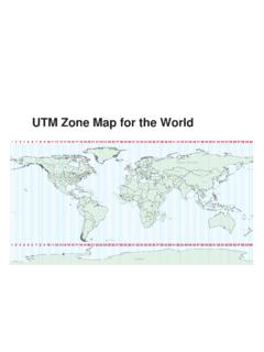
5 INDEX OF SPATIAL 36 9. 37 39 41 FURTHER 43 SOFTWARE AND ON-LINE 44 GAZETTEER LOOK-UP 44 APPENDIX: GUIDELINES FOR Georeferencing LOCALITY 45 FEATURE (NAMED PLACE).. 45 NEAR A 48 BETWEEN TWO 49 STREET 50 51 BETWEEN TWO 53 OFFSET 54 OFFSET 56 OFFSET AT A 60 OFFSET ALONG A 62 OFFSET IN ORTHOGONAL 64 OFFSET FROM TWO DISTINCT 67 LATITUDE AND LONGITUDE 68 UTM 70 TOWNSHIP, RANGE, 71 73 CANNOT BE 74 DEMONSTRABLY 75 CAPTIVE OR 76 77 Glossary Accuracy a measure of how well data represent true values. Cadastre a register that defines boundaries of public and/or private land. Cadastral map a map showing cadastre ( ) boundaries Coordinates a sequence of numbers designating the position of a point in n-dimensional space [ISO 19111].
6 Examples of two-dimensional coordinate systems are Latitude/Longitude and Universal Transverse Mercator (UTM). Coordinate reference system a reference system that relates a sequence of numbers or coordinates ( ) to the real world via a datum ( ). Coordinate system a system used to denote direct or relative positions by coordinates ( ). Data Quality described fitness for use (Juran 1964, 1994, Chrisman 1991, Chapman 2005a) of data. As a collector, you may have an intended use for the data you collect but data have the potential to be used in unforeseen ways; therefore, the value of your data is directly related to the fitness of those data for a variety of uses. As data become more accessible, many more uses become apparent (Chapman 2005c). Datum a parameter or set of parameters that serve as a reference or basis for the calculation of other parameters [ISO 19111].
7 A datum defines the position of the origin, the scale, and the orientation of the axes of a coordinate system. A datum may be a geodetic datum, a vertical datum or an engineering datum. In this document, the term datum generally refers to a geodetic datum ( ). Decimal degrees degrees expressed as a single real number ( , ) rather than as a composite of degrees, minutes, seconds, and direction ( , 7 54' " E). Note that minus ( ) signs are used to indicate southern and western hemispheres. Decimal latitude the latitude coordinate (in decimal degrees) at the center of a circle encompassing the whole of a specific locality. Convention holds that decimal latitudes north of the equator are positive numbers less than or equal to 90, while those south are negative numbers greater or equal to 90.
8 Example: degrees (which is roughly the same as 42 30' 36" S). Decimal longitude the longitude coordinate (in decimal degrees) at the center of a circle encompassing the whole of a specific locality. Decimal longitudes east of the Greenwich Meridian are considered positive and less than or equal to 180, while western longitudes are negative and greater than or equal to 180. Example: degrees (which is roughly the same as 122 29' 24" W). Digital Elevation Model (DEM) a digital representation of the elevation of locations on the land surface of the earth, usually represented in the form of a rectangular grid. Easting and Northing within a coordinate reference system ( , as provided by a GPS or a map grid reference system), Eastings are the vertical grid lines running from top to bottom (North to South) which divide a map from East to West and Northings are the horizontal lines running from left to right (East to West) dividing the map from North to South.
9 The squares formed by intersecting eastings and northings are called grid squares. On 1:100,000 scale maps each square represents an area of 100 hectares or one kilometer square. Elevation the elevation of a geographic location is its height above mean sea level or some other fixed reference point (cf. vertical datum). Elevation may be a negative number in those parts of the earth where the land surface is below mean sea level. Elevation may be Best Practices for Georeferencing Aug. 2006 iii recorded on maps in the form of contour lines linking points of uniform elevation, or as spot heights at trig points ( ) usually at the summits of mountains, and rarely at low points. Elevation is used when referring to points on the earth, whereas altitude is used for points above the surface of the earth, such as the altitude of an aircraft, and depth for positions below the surface (of a lake, sea, etc.)
10 Extent the geographic range, magnitude, or distance which a location may actually represent. With a town, the extent is the polygon that encompasses the area inside the town s boundaries. In this document, we usually refer to the linear extent the distance from the geographic center of the location to the furthest point in the representation of the location. False Precision occurs when data are recorded with a greater number of decimal places than implied by the original data. This often occurs following transformations from one unit or coordinate system to another, for example from feet to meters, or from degrees, minutes, and seconds to decimal degrees. In general, precision cannot be conserved across metric transformations; however, in practice it is often recorded as such.