Transcription of Guidelines For Determining State Water Bottoms
1 Guidelines For Determining State Water Bottoms Inherent Sovereignty April 30, 1812 Navigable in 1812 ? State Land Office Responsibility It is the responsibility of the State Land Office to determine which waterways were navigable in 1812 and should be classified as a State claimed Water bottom from a historically navigable perspective. Water bottom Determination Requests Recreational Interest Oil & Gas Industry Land Owners & Surveyors State and Federal Agencies In General These Guidelines are used by the State Land Office to establish a consistent method for review of Water Bottoms throughout the State of Louisiana. The criteria is subjective in nature, in that only the courts can make an official determination of navigability. Limits of State Ownership River or Stream mean (ordinary) low Water line Lake mean (ordinary) high Water line, present or historical Gulf of Mexico highest tide in the winter season Boundaries In Motion State loses ownership along a river or stream by accretion or reliction.
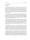
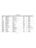
2 There is no right to accretion in a lake or to the Gulf of Mexico. Waterways that carry Water only during flood stage are not considered as State owned. What Documents Are Used? -Previous determinations included in the State Land Office files -Official Government Township Plats and field notes -USGS Quadrangle Maps & current aerial photography. - State oil & gas mineral lease history records -Records of previous litigation, if any Previous Determinations In State Land Office Files Official Government Township Plats Official Government Township Plats 1 chain or 100 links (66 feet) is generally considered minimum size. Must be illustrated on the Township Plat as being meandered or shown with a double line. Single line waterways are considered with confirmation from field notes that the width is in excess of 1 chain. Official Government Field Notes 1935 Edition USGS Quadrangle Map Current Aerial Photography State Oil & Gas Mineral Lease History Current State Mineral Leases Previous Litigation Exceptions If it can be proven that the Deputy Surveyor omitted a waterway by error.
3 If the Deputy Surveyor did not establish the section lines on the ground. Limitations Article 9, Section 3 of the Louisiana Constitution states as follows: The legislature shall neither alienate nor authorize the alienation of the bed of a navigable Water body, except for purposes of reclamation by the riparian owner to recover land lost through Accordingly this report is limited to the matters discussed here and is based upon the referenced documentation. Any matters of historic usage, navigability in law, public rights of use and access or other matters, which are beyond the purview of this office, are expressly excluded. Therefore, in the event additional evidence is made available, this office reserves the right to review said evidence and amend its claim as deemed appropriate. Senate Concurrent Resolution 2004 Urges and requests the governor to direct the State land office to complete inventory of the Water Bottoms in this State within the next four years, and to provide sufficient funding through appropriations or other means to accomplish this task.
4 Senate Concurrent Resolution 2005 Requests the State land office to implement a procedure for public notice of preliminary Water bottom ownership determinations by the State land office. Senate Concurrent Resolution 2006 Directs the State land office to provide information on the inventory of State Water Bottoms to the public, including access to any maps or interactive programs showing public lands or Water Bottoms . Review Each Township (1,500 Plus) Water bottom Classifications State Claimed Publicly Accessible Claimed By State & Adjacent Land Owner Judgment, Agreement or Compromise Against State Ownership Monthly Update