Example: stock market
Hiking The Mt. Whitney Trail - USDA
above Trail Camp through June. Nights are usually still below freezing. Winter-like storms are still possible. : The trail is . usually snow free and the weather can be fair and pleasant. At eleva-tions above Trail Camp, however, it is often cold and windy. Thun-derstorms and lightning are a sig-nificant hazard. If thunderstorms
Tags:
Information
Domain:
Source:
Link to this page:
Documents from same domain

Christmas Tree Cutting on the Sulphur Ranger District
www.fs.usda.govWinter Park F rase o n e w a y o n e w a y Frosty!"$!"$ North Pole t w o w a y èé t w o w a y èé U n i o n P a c i f i c R a il r o a d 3-Way Take a photo here with Smokey Bear No Southbound Traffic Past This Point (turnaround area only) (Weekends only; variable hours) NATIONAL FOREST BOUNDARY (Elk Meadows Trailhead) (Twin Bridges Trailhead ...
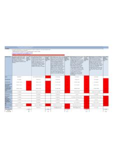
Average Annual Cost for Road Maintenance by Operational ...
www.fs.usda.govpatching, crack sealing, chip sealing and removal of unsuitable material. Shoulders are shaped to provide a smooth transition to traveled way and drain efficiently. Ditches and culverts function efficiently. Clean/Repair structures (cattleguard, gate) and signs. Paint pavement markings. Road
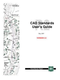
CAD Standards User’s Guide - USDA
www.fs.usda.govComputer Aided Design (CAD) construction and design drawings for the Forest Service. The purpose of this document is to establish standards, which will result in the preparation of consistent and compatible AutoCAD files. It is intended to guide users in the overall CAD system, operations, and to establish standards and procedures that will
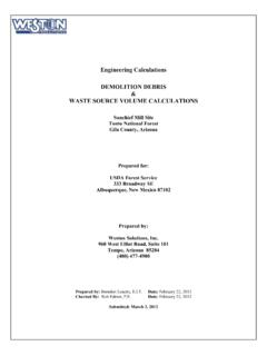
Engineering Calculations DEMOLITION DEBRIS WASTE …
www.fs.usda.govstructures. To estimate the volume of the spread footing foundation, use the surface area method. For volume estimating purposes, assume that the slab is 12 in thick. There are 15 visible courses of 8-in tall concrete masonry units (CMU) serving as the Upper Level foundation; for volume estimating purposes assume the CMU foundation
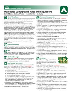
Developed Campground Rules and Regulations
www.fs.usda.govDay use visitors may be in developed recreation areas from 6 a.m. to 10 p.m. Only campers may remain in this area after 10 p.m. Check bulletin boards and observe posted hours. 36 CFR 261.58 (u). Fees Some campgrounds are designated U.S. Fee Area. You must pay a fee to use these facilities. Refer to the fee section of bulletin
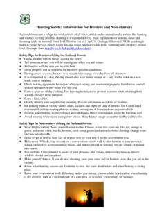
Hunting Safety: Information for Hunters and Non-Hunters
www.fs.usda.govSafety Tips for Non-hunters visiting the National Forests • Wear bright clothing. Make yourself more visible. Choose colors that stand out, like red, orange or green, and avoid white, blacks, browns, earth-toned greens and animal-colored clothing. Orange vests and hats are advisable. • Don’t forget to protect fido.
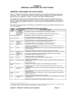
HERBICIDES, TRADE NAMES, AND TARGET SPECIES
www.fs.usda.govFor any pesticide classified as a potential carcinogen, the risk would depend on the extent to which a person might be exposed (how much time and to what quantity of the pesticide). The factors considered include short-term studies, long-term cancer studies, mutagenicity studies, and structure activity concerns.
Tree Owner's Manual - USDA
www.fs.usda.govU.S. Department of Agriculture 11 Campus Blvd., Suite 200 Newtown Square, PA 19073 NA-FR-04-07 November 2008 www.na.fs.fed.us . Tree Owner's Manual . for the Northeastern and Midwestern United States . Tree Owner's Manual. Authors: Jill R. Johnson, Forest Service Gary R. Johnson, University of Minnesota Maureen H. McDonough, Michigan State ...
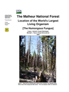
The Malheur National Forest - Home | US Forest Service
www.fs.usda.govForest Service Pacific Northwest Region The Malheur National Forest Location of the World’s Largest Living Organism [The Humongous Fungus] Craig L. Schmitt, Forest Pathologist Michael L. Tatum, Forest Silviculturist 2008 Figure 1. Dead and live-symptomatic trees in this Armillaria root disease center. Down trees in the foreground died earlier.
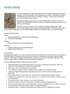
Snake Safety - US Forest Service
www.fs.usda.govStay calm Call Dispatch via radio or 911 Wash the bite area gently with soap and water if available Remove watches, rings, etc., which may constrict swelling
Related documents

SEDONA - USDA
www.fs.usda.gov4 R o a d x4 Road Visitor Center 1. 3 0 0 ir 0 3 Brewer Trail Old Post Trail am Crusty Trail Carroll Canyon Old Post Trail Carroll Canyon Sterling Pass Trail Vultee Arch Trail Brins Mesa Trail Chuckwagon Trail Wilson Mountain Trail Soldier Pass Trail Munds Mountain Trail Schnebly Hill Trail Cow Pies Trail Brins Mesa Trail Lizard Head Trail ...

REPORTS OF INTERNATIONAL ARBITRAL AWARDS RECUEIL …
legal.un.orgConsolidated Mining and Smelting Company at Trail, British Columbia, have been causing damage in the State of Washington, and Considering further that the International Joint Commission, established pursuant to the Boundary Waters Treaty of 1909, investigated problems arising from the operation of the smelter at Trail and rendered a report and

Walking tracks and information - Department of Environment ...
parks.des.qld.gov.auR o a d s C a v e C r e e k Glow-worm cave Private access No through road Private access No through road Natural Bridge circuit Natural Bridge Restricted Access Area 0 50m. Title: Springbrook walk track maps and information Author: Queensland Government Department of Environment and Science Subject: