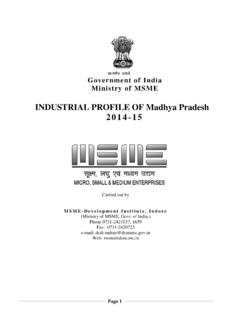
Transcription of INDUSTRIAL PROFILE OF MADHY PRADESH 2016-17
1 Page 1 lR;eso t;rs G o v e r n m e n t o f I n d i a M i n i s t r y o f M S M E INDUSTRIAL PROFILE OF MADHY PRADESH 2016-17 Carried out by M S M E-D e v e l o p m e n t I n s t i t u t e , I n d o r e (Ministry of MSME, Govt. of India,) Phone 0731-2421037, 1659 Fax: 0731-2420723 e-mail: Web- Page 2 Forward Madhya PRADESH the "heart of India" due to its geographical location in India, Madhya PRADESH is the second largest state in the country by area. With over 75 million inhabitants, it is the sixth largest state in India by population.
2 The area covered by the present-day Madhya PRADESH includes the area of the ancient Avanti mahajanapada, whose capital Ujjain (also known as Avanti) arose as a major city during the second wave of Indian urbanization in the sixth century BCE. Subsequently, the region was ruled by the major dynasties of India, including the Mauryans, the Mughals and the Marathas. By the early 18th century, the region was divided into several small kingdoms which were captured by the British and incorporated in to Central Provinces and Berar and the Central India Agency. After India's independence, Madhya PRADESH state was created with Nagpur as its capital: this state included the southern parts of the present-day Madhya PRADESH and Maharashtra.
3 In 1956, this state was reorganized and its parts were combined with the states of Madhya Bharat,Vindhya PRADESH and Bhopal to form the new Madhya PRADESH state with Bhopal as its capital. This state was the largest state of India by area until 2000. In 2000, the Chhattisgarh region was split to create a new state, and Rajasthan became the largest state of PRADESH is home to a large tribal population, which has been largely cut-off from the mainstream development . This makes MP one of the least developed states in India, with an HDI value of (2011), which is below the national average.
4 The state's per-capita gross state domestic product (nominal GDP) is the fourth lowest in the country (2010 11) MP is also the lowest-ranked state on the India State Hunger Index. (Pradeep Kumar) Director Page 3 Contents S. No. Topic Page No. 1 General Characteristics of the State 4 2 Location & Geographical Area 4-5 3 Topography 4 4 Economy & Infrastructure 6 5 Availability of Minerals 7-9 6 Forest 10 7 Agriculture resources & Production 11-12 8 Administrative set up 13 9 Health Institute in Madhya PRADESH 14 10 School in MP 15 11 INDUSTRIAL scenario in Madhya PRADESH 16-17 12 MSME scenario in Madhya PRADESH 18 13 INDUSTRIAL Areas in Madhya PRADESH managed by DTICs 19-20 14 Developed land available for allotment by AKVN 20-21 15 Cluster 22-27 16 Large scale Industries in Madhya PRADESH 27-36 17
5 Medium scale Industries in Madhya PRADESH 36-43 18 Opportunities in investment in different Sectors 44-50 19 Up Coming Project 51-56 20 Micro Small Enterprises Facilitation Council 57 21 Public procurement 57-65 Page 4 1. General Characteristics of the State Madhya PRADESH had the honor of being the largest state of the country until Chhattisgarh was carved out of it on 1st November 2000. Landlocked in the central part of the country, Madhya PRADESH is bordered by the states of Rajasthan to the northwest, Uttar PRADESH to the north, Chhattisgarh to the east, Maharashtra to the south, and Gujarat to the west.
6 The history of Madhya PRADESH goes back to the time of Ashoka, the great Maury an ruler. A major portion of Central India was part of the Gupta Empire (300-550 AD). In the first half of the seventh century the state was part of the domains of the famous emperor Harsha. The close of tenth century was a period of confusion. In the early eleventh century the Muslims entered central India, first Mahmud of Ghazni and then Mohammad Gori who incorporated certain parts with Sultanate of Delhi. It also formed part of the Mughal Empire with the rise of Maratha's. Till the death of Madhoji Scindia in 1794, Marathas ruled supreme in Central India, but after that independent and smaller states came into being.
7 The disintegrated smaller states paved way for British sovereignty. Some great women rulers of the region like Rani Ahilyabai Holkar of Indore, Gond queen Rani Kamla Devi and Rani Durgawati have carved a niche for themselves in history. When India became independent in 1947, the British Indian province of Central Provinces and Berar formed Madhya PRADESH . Boundary changes followed and finally the state of Chhattisgarh was carved out of Madhya PRADESH . 2. Location & Geographical Area. Nicknamed the "heart of India" due to its geographical location in India, Madhya PRADESH is the second largest state in the country by area.
8 With over 75 million inhabitants, it is the sixth largest state in India by population. The area covered by the present-day Madhya PRADESH includes the area of the ancient Avanti mahajanapada, whose capital Ujjain (also known as Avanti) arose as a major city during the second wave of Indian urbanization in the sixth century BCE. Subsequently, the region was ruled by the major dynasties of India, including the Mauryans, the Mughals and the Marathas. By the early 18th century, the region was divided into several small kingdoms which were captured by the British and incorporated in to Central Provinces and Berar and the Central India Agency.
9 After India's independence, Madhya PRADESH state was created with Nagpur as its capital: this state included the southern parts of the present-day Page 5 Madhya PRADESH and Maharashtra. In 1956, this state was reorganized and its parts were combined with the states of Madhya Bharat,Vindhya PRADESH and Bhopal to form the new Madhya PRADESH state with Bhopal as its capital. This state was the largest state of India by area until 2000. In 2000, the Chhattisgarh region was split to create a new state, and Rajasthan became the largest state of PRADESH is home to a large tribal population, which has been largely cut-off from the mainstream development .
10 This makes MP one of the least developed states in India, with an HDI value of (2011), which is below the national average. The state's per-capita gross state domestic product (nominal GDP) is the fourth lowest in the country (2010 11) MP is also the lowest-ranked state on the India State Hunger Index. 3. Topography: Madhya PRADESH has a mixed topography that consists of both hills and plains. The state has three predominant seasons: winter (November through February), summer (March through May), and the monsoon season (June through September).
