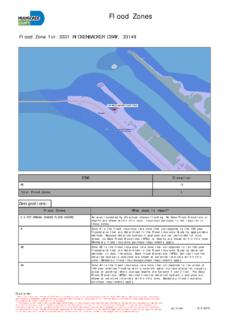
Transcription of Key Elements of Flood Disaster Management 2
1 23 Key Elementsof Flood Disaster Risk Management and Flood Plain DelineationA change to proactive Management ofnatural disasters requires an identification ofthe risk, the development of strategies toreduce that risk, and the creation of policiesand programmes to put these strategies intoeffect. Risk Management is a fundamentalactivity geared to the evaluation of schemesfor reducing but not necessarily eliminatingthe overall risk, as in may cases risk cannotbe entirely eliminated. Figure 8 provides aschematic of the steps associated with riskassessment and Management .
2 It includesassessing the potential for a hazard to occurand a vulnerability analysis to provide anunderstanding of the consequences shouldan event of a certain magnitude andfrequency occur. Based on this initial work,various mitigation measures can beevaluated to assess their ability for reducingrisk exposure. Based on a thorough riskassessment, Disaster Management plans andspecific mitigation measures can beidentified. Efforts would then be undertakento implement the selected flooding events, there is a need tocalculate the probability or likelihood that anextreme event will occur and to establish andestimate the social, economic andenvironmental implications should the eventoccur under existing conditions.
3 Maps of theflood-prone areas should be prepared anddetailed impacts outlined. A participatoryprocess should be invoked, leading to thedevelopment of an acceptable level of can be evaluated and implementedto meet this level. This overall process assiststhe community in better understanding thevarious actions that can increase or decreaserisk exposure, and can lead to greatercommunity participation in the developedsolutions to the flooding 8 Framework for Flood Risk Assessment and Risk ManagementSource: Adapted from WMO, 1999 Natural System ObservationsInventoryAccountingDataThema tic Event MapsEstablish FloodHazard PotentialStreamflow versusProbability of OccurrenceRisk AssessmentRisk = function (Hazard, Vulnerability, Value)Planning / Mitigation MeasuresReduce Risk Through Best PossibleManagement Practices> Land use Planning ( Flood Plain Mapping)> Structural Measures (Dams, Building Codes)> Flood Forecasting and Warning SystemsAssess VulnerabilityValue (Material, People)
4 InjuriesResiliencyProtection Goals / Risk AcceptanceUnacceptable RiskAcceptable RiskImplementationandPeriodic Review25 Guidelines for Reducing Flood LossesThere may be a necessity to define severalzones within the Flood -prone area, dependenton the velocity of the river and other physicalfactors. As an example, the Flood -prone areamay be broken down into floodway and floodplain components. Figure 9 shows aschematic of the designated floodway andflood plain for a hypothetical of the Flood -prone areaIn order to map and delineate an areaaffected by floodwaters, there is the need toselect a "design" event.
5 Various approachesfor estimating the design event exist, basedin essence on "acceptable" risk, although atthe time of their adoption, the concept ofacceptable risk was not explicitly approaches include using a historicalworst-case scenario that happened in thebasin or could plausibly have happened,which is referred to as storm approach is to theoreticallymaximize the meteorological factors thatcould happen in an area leading to the worstpossible storm producing the worst possibleflood. These are termed the ProbableMaximum Storm and Probable MaximumFlood, respectively.
6 The third approach is touse a probability-based analysis whereinsystematic records and historical informationon past flooding are used to develop arelation of probability of occurrence versusmagnitude. It is becoming popular to adoptthe concept of acceptable risk rather thanadopting preset levels of protectionassociated with a specific probability ofoccurrence ( , the 100-year Flood ). Acommunity and its government may wish tomove to more extreme design levels whenfaced with the reality of future loss-of-lifeand extreme economic hardships when thefuture event occurs.
7 The frequency based approach is thepredominate method used in most floodplain delineation studies when the potentialfor loss of life is considered negligible interms of historical floods . The peak flooddischarge and corresponding water level areestablished for various frequencies ofoccurrence or return periods of events suchas once in 25 years (1:25), 1:50, and 1 estimated damages areDesignation of floodplain and floodway componentsSource: Environment CanadaFigure 926established for each probability. Manyjurisdictions have set their design level tothe "100 year Flood ".
8 Statistically it is quitepossible to have more than one "100 yearflood" within a 100-year period, and a moreextreme event can also occur at any time. Areasonable length of streamflow record isrequired to ascertain with some accuracy theprobability of an event using a known historical Flood todefine the Flood -prone area, various effortsare required to delineate the Flood plain. Thisapproach can at times rely on surveyinformation collected during or immediatelyafter the historical Flood event. These datacan be used to verify hydraulic modelinformation to ensure accurate delineation ofthe Flood plain.
9 In cases using historicalfloods, care should be taken to adjuststreamflow and water levels to reflect thepresent levels and possibly projected levels ofdevelopment in the basin or other physicalchanges in the waterway. When a historicalstorm is transposed, hydrological models areused to transform rainfall to streamflow, andhydraulic models are, in turn, used todelineate the Flood shortcoming of using a known extremeflood event is the difficulty of assigning afrequency of return for evaluation of in data-short areas or when theevent can cause catastrophic results, it isprobably the preferred approach.
10 It is alsouseful in establishing acceptable levels approaches tend to assume that eventsin the future are predictable based on theexperience of the past. If changes in land useare occurring, this may not be true, and thechanges should be reflected in the , the impacts of climate change orvariability are not typically being incorporatedin the analysis. If possible, such factorsshould also be taken into account in thedelineation of Flood -prone areas. Floodway and Flood plainThe floodway is that portion of the Flood -prone area that is required to pass the designflood event without a significant rise inwater levels compared to undevelopedconditions.