Transcription of Long Island Sound Eastern Part - National Oceanic and ...
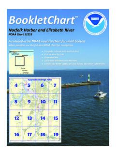
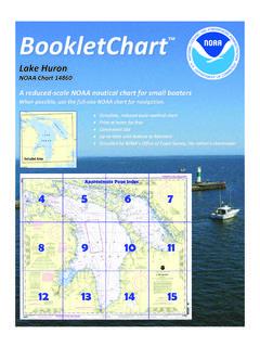
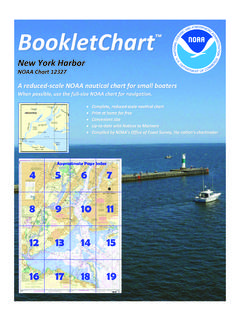
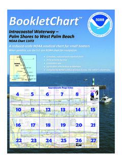
1 BookletChart . long Island Sound Eastern part NOAA Chart 12354. A reduced-scale NOAA nautical chart for small boaters When possible, use the full-size NOAA chart for navigation . Published by the About miles east-southeastward of Barlett Reef, the velocity of flood is knots and ebb knots. The flood current sets 285 and the ebb National Oceanic and Atmospheric Administration 062 . National Ocean Service long Island Sound , Caution. Submarine operating areas are in the Office of Coast Survey approaches to New London Harbor, Connecticut River, and off the northern shore of long Island . As submarines may be operating submerged in these areas, vessels should proceed with caution. 888-990-NOAA New London Harbor, Dangers. On the west side of the approach to New London Harbor, foul ground extends about 1 mile from shore in the What are Nautical Charts? vicinity of Goshen Point (chart 13211). The southerly and southeasterly limits of this area are marked by buoys.
2 The area has numerous rocky Nautical charts are a fundamental tool of marine navigation . They show patches and boulders, some showing above water, and should be avoided water depths, obstructions, buoys, other aids to navigation , and much by small craft. Rapid Rock, marked by a buoy on its southeast side, is more. The information is shown in a way that promotes safe and about miles southwestward of New London Ledge Light; it has a least efficient navigation . Chart carriage is mandatory on the commercial depth of 10 feet. An unmarked ledge covered 35 feet is about 100 yards ships that carry America's commerce. They are also used on every Navy south by eastward of Rapid Rock and is the outermost shoal to the and coast guard ship, fishing and passenger vessels, and are widely southward. Sarah Ledge, mile northeastward of Rapid Rock and carried by recreational boaters. marked by a buoy, has a least depth of 14 feet and is the easternmost What is a BookletChart ?
3 Shoal on the west side of the main channel approach. On the east side of the main channel foul ground extends about 1 mile This BookletChart is made to help recreational boaters locate offshore. New London Ledge, marked by New London Ledge Light, has a themselves on the water. It has been reduced in scale for convenience, least depth of 7 feet. Black Ledge, just to the northeastward of New but otherwise contains all the information of the full-scale nautical London Ledge, has a rocky islet, 2 feet high, on it. Depths are 5 to 18 feet chart. The bar scales have also been reduced, and are accurate when on the ledge. Buoys mark the shoal area. used to measure distances in this BookletChart. See the Note at the Broken ground fringes the shore southwestward of New London Harbor bottom of page 5 for the reduction in scale applied to this chart. Light. A rock with 3 feet over it is located about mile from shore in the Whenever possible, use the official, full scale NOAA nautical chart for bight just southward of the light and shoal soundings extend as far as navigation .
4 Nautical chart sales agents are listed on the Internet at mile from shore where an 8-foot sounding is located. Connecticut River, Dangers. Saybrook Outer Bar, which obstructs the mouth of the Connecticut River, is shifting, with depths of 2 to 12 feet This BookletChart does NOT fulfill chart carriage requirements for extending nearly 2 miles off the mouth; it is marked off its southeastern regulated commercial vessels under Titles 33 and 44 of the Code of end by a lighted bell buoy. Federal Regulations. In 1976, obstructions were reported in the channel at the railroad bascule bridge 3 miles above the mouth of the Connecticut River; a least depth of Notice to Mariners Correction Status 13 feet is reported in the channel in an area 40 to 50 feet from the east This BookletChart has been updated for chart corrections published in abutment of the bridge. Mariners requiring greater depths are advised to the coast guard Local Notice to Mariners, the National Geospatial avoid this area of the channel during passages.
5 Intelligence Agency Weekly Notice to Mariners, and, where applicable, Dangers. Townshend Ledge, miles southeastward of Southwest Ledge the Canadian coast guard Notice to Mariners. Additional chart Light, has a least depth of 18 feet and is marked by a lighted bell buoy. corrections have been made by NOAA in advance of their publication in Stony Islet, miles eastward of Southwest Ledge Light, is low, bare, and a Notice to Mariners. The last Notices to Mariners applied to this chart surrounded by ledges bare at low water to a distance of about 100 yards. are listed in the Note at the bottom of page 7. Coast Pilot excerpts are A partly bare ledge is about mile north-northwestward of Stony Islet. not being corrected. From this ledge and Stony Islet westward to the entrance of New Haven Harbor, an area of foul ground with many rocks bare at low water extends For latest Coast Pilot excerpt visit the Office of Coast Survey website at about mile offshore.
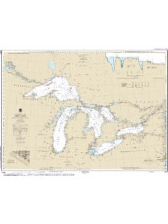
6 This area should be avoided. Shoals with 16 to 18 feet over them extend over mile southeastward 54 from the breakwaters on both sides of the dredged entrance channel. A. spoil area with reported depths of 15 feet is on the Eastern side of the (Selected Excerpts from Coast Pilot) entrance channel. An 18-foot spot is on the east side of the main channel, long Island Sound is a deep navigable at the first turn westward of Southwest Ledge Light. waterway lying between the shores of The bights on the west shore of New Haven Harbor from Pond Point Submarine operating areas are in the northward are shoal with bare rocks and foul ground in most of them. The approaches to New London Harbor, shore is rocky at Woodmont, about 2 miles northeastward of Pond Point. Connecticut River, and off the northern Black Rock, bare at low water and marked by a seasonal buoy, is mile shore of long Island . As submarines may be off the north end of Morris Cove.
7 Opposite, on the west side, is a break- operating submerged in these areas, vessels water, partly covered, extending from Sandy Point, marked by a light. should proceed with caution. In the Eastern portion of long Island Sound the current turns from to 1 hours earlier coast guard Rescue Coordination Center along the north shore than in the middle of the Sound . 24 hour Regional Contact for Emergencies Proceeding westward from The Race in the middle of the Sound , the velocity of current is knots off Cornfield Point, about 1 knot off New RCC Boston Commander 2. Haven, 1 knot off Eatons Neck, knot between Peningo Neck and 1st CG District (617) 223-8555. Matinecock Point, and knot eastward of Hart Island . Boston, MA. Lateral System As Seen Entering From Seaward on navigable waters except Western Rivers PORT SIDE PREFERRED CHANNEL PREFERRED CHANNEL STARBOARD SIDE. ODD NUMBERED aids NO NUMBERS MAY BE LETTERED NO NUMBERS MAY BE LETTERED EVEN NUMBERED aids .
8 PREFERRED CHANNEL TO PREFERRED CHANNEL. GREEN LIGHT ONLY STARBOARD TO PORT RED LIGHT ONLY. FLASHING (2) TOPMOST BAND GREEN TOPMOST BAND RED FLASHING (2). FLASHING FLASHING. OCCULTING GREEN LIGHT ONLY RED LIGHT ONLY OCCULTING. QUICK FLASHING QUICK FLASHING. ISO COMPOSITE GROUP FLASHING (2+1) COMPOSITE GROUP FLASHING (2+1) ISO. 8. 1 2. "2". Fl R 6s R "8". Fl R 4s "1" G "9" GR "A" RG "B". Fl G 6s Fl G 4s Fl (2+1) G 6s Fl (2+1) R 6s LIGHTED BUOY. LIGHT LIGHTED BUOY LIGHT. 5 U C. G. 6. 2. G G. GR. C "1" "5" RG RG. "U" GR R R. C "S" N "C" "G" N "6" "2. ". CAN DAYBEACON CAN NUN NUN DAYBEACON. For more information on aids to navigation , including those on Western Rivers, please consult the latest uscg Light List for your area. These volumes are available online at VHF Marine Radio channels for use on the waterways: Distress Call Procedures Channel 6 Inter-ship safety communications. Channel 9 Communications between boats and Make sure radio is on.
9 Ship-to-coast. Select Channel 16. Channel 13 navigation purposes at bridges, locks, and Press/Hold the transmit button. harbors. Clearly say: MAYDAY, MAYDAY, MAYDAY.. EMERGENCY INFORMATION Also give: Vessel Name and/or Description;. Channel 16 Emergency, distress and safety calls to coast guard and others, and to initiate calls to other Position and/or Location; Nature of vessels. Contact the other vessel, agree to another channel, and then switch. Emergency; Number of People on Board. Channel 22A Calls between the coast guard and the public. Severe weather Release transmit button. warnings, hazards to navigation and safety warnings are broadcast here. Wait for 10 seconds If no response Channels 68, 69, 71, 72 and 78A Recreational boat channels. Repeat MAYDAY call. Getting and Giving Help Signal other boaters using visual distress signals (flares, HAVE ALL PERSONS PUT ON LIFE JACKETS! orange flag, lights, arm signals); whistles; horns; and on your VHF radio.
10 You are required by law to help boaters in trouble. Respond to distress signals, but do not endanger yourself. NOAA Weather Radio All Hazards (NWR) is a nationwide network of radio stations broadcasting continuous weather information directly from the nearest National Weather Service office. NWR broadcasts official Weather Service warnings, watches, forecasts and other hazard information 24 hours a day, 7 days a week. Quick References Nautical chart related products and information - QR. Interactive chart catalog - Report a chart discrepancy - Chart and chart related inquiries and comments - Chart updates (LNM and NM corrections) - Coast Pilot online - Tides and Currents - Marine Forecasts - National Data Buoy Center - NowCoast web portal for coastal conditions - National Weather Service - National Hurrican Center - Pacific Tsunami Warning Center - Contact Us - For the latest news from Coast Survey, follow @NOAA charts This Booklet chart has been designed for duplex printing (printed on front and back of one sheet).