mpl 10 03 08 plot ver - WA - DNR
show atitude and longitude. Latitude is the location north or south of the equator, Longitude is the ocation east or west of the Prime Meridian (north-south running line through the Greenwich Observatory in England). I Tics (plus signs) in the map body show where longitude and latitude intersect. Washington's northeast corner is almost
Tags:
Information
Domain:
Source:
Link to this page:
Documents from same domain
MEMORANDUM - Washington
www.dnr.wa.govpresentations and discussions regarding the Policy recommendations for a permanent water- ... “Residential unit” means a home, apartment, residential condominium unit or mobile ... such as a restaurant, tavern, motel or hotel. (d) “Natural waters” only excludes water conveyance systems which are ar tificially constructed and actively ...

Current Bald Eagle Protection on Forest Land in Washington ...
www.dnr.wa.govas the need for a Bald Eagle Management Plan as part of a complete forest practices application (FPA). Landowners conducting forest practices activities still need to ensure that they meet Federal requirements for the protection of eagles.

2021 Permit to Remove Firewood from State Trust Lands
www.dnr.wa.govWinches, wheelbarrows, and chainsaws are the only permissible equipment allowed off the roads. 14. Roadways and ditches must be left clear of limbs, tops, and any other debris created as a result of wood cutting operations. 15. Permittee must not block roads or hinder traffic. Watch out for other vehicles.

Planting Forest Seedlings - WA - DNR
www.dnr.wa.govFunding from the USDA Forest Service supported printing of this brochure. Both the USDA Forest Service and Washington State Department of Natural Resources are equal opportunity employers and service providers. People who need this information in an alternative format may call 360-902-1706 or TRS 711.

What Are Landslides And How Do They Occur?
www.dnr.wa.govto explain why landslides are much more common during the rainy season, and especially common during or right after large storms. ... river incision or the removal of material at the base of a slope by humans) or that reduces the friction of a slope (such as the addition of water) can increase the likelihood of a landslide.

Hilary Franz - WA
www.dnr.wa.govSusanna Fenner DIRECTOR, LEGAL AFFAIRS & BUSINESS PRACTICE Yh d/ ^ & COMMUNITY ENGAGEMENT. Title: PowerPoint Presentation …

Tsunami Hazard Map of the Elliott Bay Area, Seattle ...
www.dnr.wa.govbay and then inundates the Harbor Island area. Because the nature of the tsunami depends on the initial deformation of the earthquake, which is poorly understood, the largest source of uncertainty is the input earthquake.

Cultural resources are an important part of our history ...
www.dnr.wa.govGravesite Railroad Trestle HISTORIC SITES Historic sites include areas and structures or other evidence of human activities that identify the origins, evolution and/or development of the nation, state or locality. They can also be places associated with an individual important in history or places where significant historical
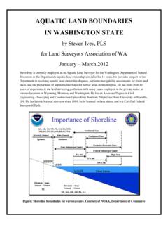
AQUATIC LAND BOUNDARIES IN WASHINGTON STATE
www.dnr.wa.govChapter 4: The Importance of Navigability for Title Purposes 6 Chapter 5: Federal Lands and Surveys by the General Land Office (GLO) 10 Chapter 6: Tides and Tidal Datum 16 Chapter 7: Tidelands 35 Chapter 8: Lateral (Sideline) Boundaries for Aquatic Lands 40 Chapter 9: Oyster Lands 44 Chapter 10: Harbor Areas, Waterways, and Streets 45 ...

C Caassccaaddiiaa SSuubbdduuccttiioonn ZZoonnee ...
www.dnr.wa.govJosh Bruce, Oregon Partnership for Disaster Resilience . Kathryn Forge, Public Safety Canada . Jere High, Oregon State Public Health Division . Andre LeDuc, University of Oregon . Charlie Macaulay, Global Risk Consultants . Ines Pearce, Pearce Global Partners . Althea Rizzo, Oregon Emergency Management .
Related documents
Covariance matrix - New York University Center for Data ...
cds.nyu.eduExample 1.9 (Canadian cities). We consider a dataset which contains the locations (latitude and longitude) of major cities in Canada(so d= 2 in this case). Figure1shows a scatterplot of the data. The sample covariance matrix is X = " 524:9 59:8 59:8 53:7 #: (28) The latitudes have much higher variance than the longitudes. Latitude and longitude ...

Grade 8 Social Studies - richland.k12.la.us
richland.k12.la.usabout the United States and Louisiana, including rates of increase/decrease for demographic variables (G-1C-M2) ... (latitude/longitude), and/or use of the compass rose. Map Resources ... parish seats, regions of Louisiana, major cities of Louisiana, major battle …

Global Urban Competitiveness Report - UN-Habitat
unhabitat.orgwest coast of the United States (100 degrees west longitude), Western Europe (20 degrees east longitude) and China, Japan and South Korea (110-140 degrees east longitude), and the latitude is concentrated between north 25 to north 55 degrees. Cities in Northern China and Eastern Europe generally According to the Global Urban

US Topo Map Symbols - EDRnet
edrnet.comA US Topo map is a digital topographic map that covers 7.5-minutes of longitude by 7.5-minutes of latitude and is produced at a scale of ... US Topo maps are freely distributable and are available for download on the Web from the USGS Store ... that connect principal cities and towns, and link these places with the primary highway system.
Geographical Influences on Climate - Teacher Guide
gpm.nasa.govlocation –elevation, lakes or oceans, wind direction compared to oceans or mountains, latitude, etc. After students have time to complete the front side of the capture sheet, they will compare their data to that of other cities in a relevant grouping. Each group of three cities focuses on one key aspect of geographical influences on climate –

Answer Key - Esri
downloads.esri.comThe US government takes a census count of the population every decade. Here, percent change is a measure (in percentages) of the difference in values between the population sizes of counties in 2010 compared with 2000. In the case, the difference between the numbers of people by county shows both increase (+) and decrease (-).