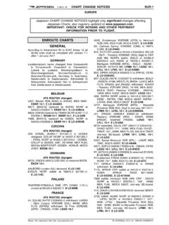
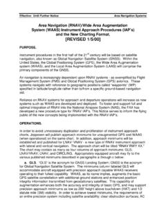
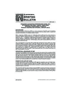
Transcription of NavData - jeppesen.com
1 NavData14 OCT 945 NavData name CONVENTIONSWAYPOINT IDENTIFIERSW aypoint names entered into thenavigation data base are limited to amaximum of five characters. Officialwaypoint names assigned by a country saviation information authority often haveother than five characters. Forcompatibility with the navigation database, waypoint identifiers are assigned toall waypoints in accordance with theground rules set forth as follows:A. VOR, VORDME, VORTAC, TACAN andNon-Directional Beacons (NDB). waypoints located at any of the abovetypes of facilities will take on the official1-, 2-, 3-, or 4-character identifier of thefacility in :Los Angeles VORTACLAXT yndall TACANPAMFt. Nelson NDBYEN ewark as Waypoint ConceptFor systems employing the "NDB asWaypoint" concept, waypoints located atNDB s will be identified by the use of thestation identifier followed by the alphacharacters "NB".
2 Examples:Ft. Nelson NDBYENBN ewark RNAV waypoints ,Intersections and Reporting many countries, these waypoints areassigned unique 5-character names,with the identifier the same as thename. For waypoints not so named, identifiers are developed using thefollowing rules sequentially until 5 orfewer character groups One-Word Namesa. Use the full name if five charactersor less are :ACRA, LOGAN, PIKE, DOTb. Eliminate double :KIMMEL becomes KIMELCOTTON becomes COTONRABBITT becomes RABITc. Keep first letter, first vowel and lastletter. Drop other vowels startingfrom right to :ADOLPH becomes ADLPHBAILEY becomes BAILYBURWELL becomes BURWLd. Drop consonants, starting from rightto :ANDREWS becomes ANDRSBRIDGEPORT becomes BRIDT2. Multiple Word NamesUse the first letter of the first word andabbreviate the last word using theabove rules for one-word names toreduce it to four :CLEAR LAKE becomes CLAKEROUGH AND READY becomesRREDY3.
3 Phonetic Letter When an ICAO phonetic alphacharacter is used as a waypointname (Alpha, Bravo, Charlie, etc.),use the rules established inparagraph above. When morethan one waypoint in a country hasthe same phonetic name , obtainuniqueness by applying rule :Waypoint November becomesNOVMRW aypoint Charlie becomesCHAREW aypoint Alpha remains ALPHAb. When a double phonetic, such asTango India, is used as thewaypoint name , use the rulesestablished in paragraph When a phonetic alpha characterfollowed by a numeric and/or otheralpha characters (A1, A1N, B2,etc.), is used as the waypoint name ,it will appear the same in the database as shown on aeronauticalcharts. JEPPESEN SANDERSON, INC., 1987, 1994. ALL RIGHTS OCT 94 NavData6 name CONVENTIONSWAYPOINT IDENTIFIERSD. Unnamed Waypoints1. Unnamed Turn Points, Intersectionsand Bearing/Distance waypoints (Forbearing/distance waypoints on terminalarea procedures, see paragraph )a.
4 If an unnamed turn point,intersection or bearing/distancewaypoint is colocated with a namedwaypoint or NAVAID station on adifferent route structure ( , lowlevel or approach), the name oridentifier of the colocated waypoint :Unnamed turn point on J2between Lake Charles (LCH) andNew Orleans (MSY) VORTACs iscoincidental with the Lafayette(LFT) low level VORTAC. LFT isused as the identifier code for theturn Identifier codes for unnamed turnpoints, intersections or bearing/distance way-points that are notcoincidental with named waypointsshould be constructed by taking theidentifier code of the referenceNAVAID for the turn point/intersection/(bearing/distancewayp oint) (expected to be thenearest NAVAID serving the airwaystructure in which it is located) andthe distance from this NAVAID to theturn point/intersection/(bearing/distance waypoint).
5 If the distance is99 nautical miles or less, theNAVAID identifier is placed first,followed by the distance. If thedistance is 100 nautical miles ormore, the last two digits only areused and placed ahead of theNAVAID :NAVAIDDISTANCECODEINW18 INW18 CSN10606 CSN2. FIR, UIR and Controlled AirspaceReporting PositionsIn cases where the governmentauthority does not provide unique5-letter or less waypoint names, and incases where the government suppliedname cannot be converted to a unique5-letter identifier using rules , ,and , the following rules are appliedin developing an identifier for FIR - use the three characters "FIR"plus a numeric from 02 to 99. Anidentifier so developed is uniquewithin the geographical area : FIR09b. UIR - use the three characters "UIR"plus a numeric from 02 to 99. anidentifier so developed is uniquewithin the geographical area : UIR39c.
6 FIR/UIR - Use "FIR" and a numericas indicated : FIR69d. Controlled Airspace - use the3-letter characters for the type ofcontrolled airspace plus a numericfrom 02 to 99. These are TerminalWaypoints and as such are uniquewithin the Terminal Area. Examplesof controlled airspace types are:TMA Terminal Control AreaCTA Control AreaCTR Control ZoneTIZ Traffic Information ZoneATZ Aerodrome Traffic ZoneExamples: CTR03 TIZ15 JEPPESEN SANDERSON, INC., 1987, 1994. ALL RIGHTS OCT 947 name CONVENTIONSWAYPOINT IDENTIFIERS3. Reporting Positions Defined byCoordinatesEntry/Exit positions to Oceanic ControlAreas are often defined by waypointswhich are "undesignated", madeavailable in source documentation asgeographical coordinates (Latitude/Longitude) expressed in full degrees. Incases where such positions are to beentered into the data base, the follow-ing rules are applied:a.
7 Positions in the northern hemisphereuse the letters "N" and "E", thesouthern hemisphere use the letters"S" and "W" and numerics forlatitude and longitude as follows:(1) Latitude, use values provided bysource. Latitude will alwaysprecede longitude.(2) Longitude, use only the last twovalues of the three digitlongitude value. Placement ofthe letter designator in the fivecharacter set indicates what thefirst digit is published as. Theletter designator will be the lastcharacter if the longitude is lessthan 100 degrees and will bethe third character if thelongitude is 100 degrees orgreater.(3) The letter "N" is used for northlatitude and west longitude. Theletter "E" is used for northlatitude and east longitude. Theletter "S" is used for southlatitude and east longitude. Theletter "W" is used for southlatitude and west Examples:N latitude/W longitudeN52 00/W075 00 = 5275NN50 00/W040 00 = 5040NN07 00/W008 00 = 0708NN75 00/W170 00 = 75N70N07 00/W120 00 = 07N20N latitude/E longitudeN50 00/E020 00 = 5020EN75 00/E050 00 = 7550EN06 00/E008 00 = 0608EN75 00/E150 00 = 75E50N06 00/E110 00 = 06E10S latitude/W longitudeS52 00/W075 00 = 5275WS50 00/W040 00 = 5040WS07 00/W008 00 = 0708WS75 00/W170 00 = 75W70S07 00/W120 00 = 07W20S latitude/E longitudeS50 00/E020 00 = 5020SS75 00/E050 00 = 7550SS06 00/E008 00 = 0608SS75 00/E150 00 = 75S50S06 00/E110 00 = Identifiers1.
8 Should application of these rules resultin more than one waypoint having thesame identifier, a new identifier isgenerated for each waypoint bydeveloping a four (or less) characteridentifier and adding a suffix number : SHAWNEE (COLO) SHAE1 SHAWNEE (CAL) SHAE22. If the suffix number reaches 10, startover with one and place the suffix inthe fourth- character position. Theoriginal fourth character is placed inthe fifth-character : SHAWNEE (OKLA) SHA1EF. Terminal following rules are applied indeveloping identifiers for waypoints usedsolely in terminal area procedures. Suchwaypoint identifiers will be unique only forthe airport specified. A way-point identifierused in a terminal area cannot berepeated in that terminal area but can beused in an enroute area encompassed bythe same geographical area way-point identifiers can berepeated in areas covered by differentgeographical codes.
9 These identifierdeveloping rules are only applied whenthe waypoints in question have not beenassigned official names/ identifiers by thegovernment authority. JEPPESEN SANDERSON, INC., 1987, 1994. ALL RIGHTS OCT 94 NavData8 name CONVENTIONSWAYPOINT IDENTIFIERS1. Airport-Related waypoints (SingleApproach Procedure for given runwaycoded)Single Approach Procedure for givenrunway coded and waypoints commonto more than one approach: Thefollowing two-character codes are to beadded to the runway identifier to createan airport-related waypoint identifierwhen no named waypoint has beenestablished by the government sourcefor the fix type:FF= Final Approach FixAF= Initial Approach FixIF= Intermediate Approach FixCF= Final Approach Course FixMA= Missed Aproach Point FixSD= Step-Down FixNote:if multiple step-down fixwaypoints need to be created,replace "D" with anothercharacter, retain the "S".
10 RC= Runway Centerline FixRW = Runway Fix* OM = Outer Marker Fix* MM = Middle Marker Fix* IM= Inner Marker Fix* BM= Backcourse Marker FixTD= Touchdown point inboardof runway threshold* See also rule GExamples: FF36MA09L2. Airport-Related waypoints (MultipleApproach Procedure for given runwaycoded.)Multiple approach Procedures for agiven runway coded for which commonwaypoints cannot be established:The following two-character codesare to be added to the runwayidentifier to create an airport-relatedwaypoint identifier when no namedwaypoint has been established bythe government source for the fixtype:Fx = Final Approach Fix, where "x"equals the Type of procedurein questionAx = Initial Approach Fix, where "x"equals the Type of procedurein questionIx = Intermediate Approach Fix,where "x" equals the Type ofprocedure in questionCx = Final Approach Course Fix,where "x" equals the Type ofprocedure in questionMx = Missed Approach Point Fix,where "x" equals the Type ofprocedure in questionSx = Step-Down Fix Note.