Transcription of Oran Park - Camden History
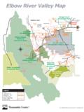
1 1 oran park Ian Willis (2010) oran park is a locality on the southwest rural-urban interface of the Sydney metropolitan area. It is an area that has been a zone of transition and contrasts, similar to other parts of the Sydney basin. For some it is a place of loss, while for others it is a place of hope and a fulfillment of their dreams. The western part of the locality of oran park is delineated by the Northern Road, in the south the boundary is Cobbitty Road, while in the east the extent is the watercourse of South Creek and in the north Lowes Creek. There area has always had a rural character and in 2001 the population of the oran park -Catherine Field area was 1,470, yet within 20 years oran park is predicted to grow to 25,000, while the Camden LGA will surge by 390 per cent to a population of over 250,000.
2 The area has never had closer settlement, and the nearest urban centres have been the hamlet of Catherine Fields to the north, the village of Cobbitty to the west and township Narellan to the south along with the new suburbs of the Harrington park development. The locality was part of Nepean Shire Council until 1948, at which time the shire council was split up between Penrith, Liverpool and Camden Councils. oran park was part of the shire s C Riding and was amalgamated with Camden Municipal Council. Originally oran park was part of the traditional land of the Dharawal people, who were then dispossessed, and then displaced by Europeans who established their grand colonial estates.
3 Until recently the area largely retained a rural character with open pastures and rolling hills, creating a picturesque landscape reminiscent of rural England. The rural character has never been seriously challenged, although there have been a golf course, a trotting track, a motor racing circuit while some had dreams of theme parks. The first developer sub-divisions in the 1960s were for small-scale hobby farming, which saw the appearance of stables, small-scale floriculture and horticulture. These urban-fringe dwellers have been recently joined by 2 developer corporations selling dreams to new suburbanites who live in streets named after motor racing celebrities.
4 Early estates The European domination of oran park commenced with the two principal land grants, one of 2,000 acres (809 hectares), Harrington park , granted to William Douglas Campbell in 1815, and another to George Molle in 1815, Netherbyres, of 1,600 acres ( hectares) which ran between South Creek and the Northern Road. Campbell was a member of the British merchant navy, who first visited New South Wales in 1797, and eventually returned in 1801 as master of the brig, Harrington. He had trading interests in the Pacific and was a knowledgeable navigator of the Pacific region. He settled on his property in 1817 and named it after his ship. He died in 1827. In 1829 the oran park portion of Campbell s grant (800-acres) was sub-divided from the Harrrington park estate and assigned to John Douglas Campbell, William s nephew.
5 He leased the 800-acre property oran to Sydney gentleman Henry Keck in 1839 for eight years, with an option to purchase the property for 1,600. The terms of the lease confirm that JD Campbell had commenced building a house at oran park before 1839. Historian Rosemary Broomham maintains that the price of the property indicates that the house was a substantial building .1 oran park , and other colonial estates like it, were part of the spatial pattern and economic structure of the Cumberland Plain established by a powerful colonial elite by 1840. They built themselves impressive homes, and in the Cowpastures their ilk included the John Macarthur s Camden park , George Macleay s Brownlow Hill, John Oxley s Kirkham and Elderslie, Alexander Riley s Rabey, Edward Lord s Orielton, William Hovell s Glenlee, Rowland Hassell s Denbigh and Garnham Blaxcell s Curtis park .
6 This set, who modeled themselves on the British elite, established a social and economic hegemony over the region that persisted into the 20th century. 3 Unfortunately for Keck, the depression of the 1840s resulted in his lease on oran being transferred to Henry William Johnson. Johnson completed the purchase of the property for by raising a mortgage with JD Campbell and later Thomas Barker. Broomham maintains that the high price he paid for the property disproves the apocryphal tale that he built the entire house in 1857 . Johnson lived at oran park until 1869 when he defaulted and Barker foreclosed on him. Barker (of Maryland and Orielton), one of the wealthiest men in the colony and a man of influence.
7 He was a member of the New South Wales Legislative Council from 1853-1856 and the Assembly from 1856-1857. oran park house was a typical country manor house with panoramic vistas over the landscape and to the important access point of the estate, reminiscent of the English park . It was set on a knoll creating an imposing composition set amongst landscaped grounds and an example of the Summit Model of homestead sited on a hilltop with the homestead complex. The house was a Georgian form with a symmetrical front and 12 paned windows and six-panelled doors, marble chimney pieces, plastered walls internally and plaster ceilings. It had two storeys, built of English bond brick.
8 It had a lead lined flat roof behind parapets, a two storey timber verandah on three sides and an attached three storey octagonal tower at the rear. The interior had detailed cedar joinery and paneling, particularly to the main entrance hall, and geometric staircase with a large arched stair window. There was a two-story servants wing at the rear. The outbuildings included a cottage, silo and stable. The front of the house had a carriage loop with plantings forming a circle in front of the house, with a driveway to its entrance from the intersection of Cobbitty Road and Cowpastures Barker sold oran park to Campbelltown grazier Edward Lomas Moore (of Badgally) in 1871, the son of an assigned convict.
9 Moore also owned the neighboring property Netherbyres and leased part of the combined property to farmer Thomas Cadell in 1882. EL Moore lived at oran park during the 1870s and 1880s and died in 1887 (at his new house at Badgally). After his death there were questions about the estate and oran park eventually passed to John and Frederick Moore in 1904. Frederick Moore was mayor of Campbelltown from 1901to 1909. In 1907 oran park was sold to Essington Moore, who in 1919 leased it and the neighboring Netherbyres, to Charles, James and Andrew McIntosh for seven years. In 1939, after Moore s death, Hubert Harry Robbins, described a Sydney gentleman, purchased oran park and the 4 neighboring properties of Netherbyres and Graham s Farm.
10 Historian Helen Proudfoot maintains that Robbins and ER Smith ran oran park as a golf club along with a racing and trotting courses. The house was apparently extended in the 1930s, the roof reconstructed, the side verandahs built in and a west wing and front portico Robbins died towards the end of the war and in 1946 his wife Joyce, consolidated the three properties into a single title of 2200 acres. She then promptly subdivided the property and sold off a 507-acre During the Second World War, when HH Robins owned the oran park property, 260 acres were used by the military for the Narellan Military Camp. The camp was located on the intersection of Cobbitty Road and the Northern Road, (Green s Corner) and occupied all four points of the intersection.