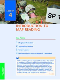
Transcription of OS Landranger (1:50 000 scale) Map symbols
1 OS Landranger (1:50 000 scale ). Map symbols ROADS AND PATHS Not necessarily rights of way LAND FEATURES. Junction number Electricity transmission line Service area 1 Elevated (pylons shown at standard spacing). S Motorway (dual carriageway). M1 Pipe line V. V. V. Motorway under construction (arrow indicates direction of flow). Unfenced Footbridge ruin Primary Route A 470 Dual carriageway Buildings Main road A 493 Public building (selected). Primary Route / Main road under construction Bus or coach station Secondary road B 4518 [ with tower Narrow road with passing places A 855 Bridge B 885 ] Place of worship with spire, minaret or dome Road generally more than 4m wide { without such additions Road generally less than 4m wide Chimney or tower Path / Other road, drive or track Glass structure Gradient: 20% (1 in 5) and steeper, 14% (1 in 7) to 20% (1 in 5).}
2 O Heliport Gates / Road Tunnel Triangulation pillar Ferry P Ferry V. Ferry (passenger) / Ferry (vehicle). t Mast E ( Wind pump / wind generator RAILWAYS W Windmill with or without sails Track multiple or single Bridges / Footbridge Graticule intersection at 5' intervals Track under construction Level crossing Cutting / embankment LC. Siding Viaduct a Quarry Tunnel Station, (a) principal Light rapid transit system, Light rapid transit system Spoil heap, refuse tip or dump narrow gauge or tramway station Coniferous wood WATER FEATURES Non-coniferous wood Cliff Mixed wood Marsh or salting Slopes Shingle Towpath Canal Lock Ford : Beacon Flat rock l Lighthouse Orchard / Park or ornamental ground Aqueduct Lighthouse (in use).)
3 L. Sand (disused). Lake Weir Normal tidal limit Bridge Dunes Low w a ter mark ` Forestry Commission access land Footbridge Mud Canal (dry) High water mark National Trust-always open HEIGHTS 1 metre = feet ROCK FEATURES. National Trust-limited access, observe local signs 50 Contours are at 10 metres vertical interval Heights are to the nearest 650 \ X National Trust for Scotland 144 Outcrop metre above mean sea level 0 Cliff Heights shown close to a triangulation pillar 60. Scree refer to the ground at the base of the pillar and not necessarily to the summit. OS Landranger (1:50 000 scale ). Map symbols PUBLIC RIGHTS OF WAY OTHER PUBLIC ACCESS TOURIST INFORMATION.
4 Footpath Other route with public access c Camp site Bridleway (not normally shown in urban areas). Alignments are based on n Caravan site Road used as a public path the best information available. These routes are not shown on g Garden Byway open to all traffic maps of Scotland. H Golf course or links The symbols show the defined route so far National Trail, European Long as the scale of mapping will allow. Rights of way are not shown on maps of Scotland. Distance Route, Long Distance i I Information centre, all year / seasonal Route, selected Recreational The representation on this map of any other Routes d Nature reserve p P& R.
5 Road, track or path is no evidence of the P& R. National/Regional Cycle Network Parking, Park and ride, all year / seasonal existence of a right of way Surfaced cycle route P Picnic site Firing and Test Ranges in Danger Area the area. Danger! 4 8. National/Regional Cycle Network Selected places of tourist interest Observe warning notices. number T T Telephone, public / motoring organisation BOUNDARIES ANTIQUITIES 8 Viewpoint Visitor centre National / Site of monument Walks / Trails y District Stone monument Youth hostel County, Unitary Authority, B Battlefield (with date). Metropolitan District Visible earthwork ABBREVIATIONS.
6 Or London Borough Roman National Park CG Coastguard P Post office Non-Roman CH Clubhouse PC Public convenience (in rural areas). MP Milepost PH Public house MS Milestone TH Town Hall, Guildhall or equivalent NB. Due to changes in specification there are differences on some sheets Ordnance Survey, the OS Symbol and OS Landranger are registered trademarks of Ordnance Survey, the national mapping agency of Great Britain. July 2002. Made, printed and published by Ordnance Survey, Southampton, United Kingdom. For educational use only. Crown copyright 2002.