Transcription of P ine trail P - Connecticut
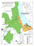
1 Lake PocotopaugFlanders RdSmith StMain StRte 196 Rte 66 Walnut AveEASt HAMPtonBull Hill RdRte 2 Exit 16 Salmon River State ForestDay Pond State ParkMARLBoRougHRiver RdRte 149 Bridge RdRiver RdCoLCHEStERHEBRonAmston LakeSalmon River State ForestRaymond Brook Marshold Hartford RdJones Stgrayville RdRte 85niles RdLebanon AveCrouch RdRte 85 Colchester RailroadAir line trailSouth Rdold Colchester RdMain StLebanon AveComstock3) RAPALLo ViADuCt Built in 1873 (as was its sister, the Lyman Viaduct, 1-1/2 miles east in Colchester), the Rapallo bears the name of a railroad director and was built for two train tracks. originally a 1,380 ft. long bridge 60 ft. high above Flat Brook, the increasing weight of freight trains necessitated filling underneath it in 1913. the spectacular views of the marsh to the north and other natural surroundings make this a rare ) CoMStoCk BRiDgE the Comstock Bridge was built in 1791 and rebuilt in 1860.
2 It is one of only three remaining covered bridges in Connecticut . the Comstock Bridge links East Hampton and Colchester and is approximately 1-1/4 miles south of the intersection of Colchester s Bull Hill Road and the air line trail . the bridge is open to pedestrian traffic and has a picnic area Hampton1) BELL toWn ViLLAgE CEntER & LAkE PoCotoPAugEast Hampton is called Bell town as it was the center of the bell making industry for the country. taking a detour off the trail at Cranberry Meadow onto Smith St. and traveling west leads to the Bell town Village Center, a mecca for antique shoppers. traveling north leads to the business center of East Hampton and Lake Pocotopaug. Caution is advised on busy ) CRAnBERRy Bogthis pond offers benches for resting; the sights of wildflowers and sounds of bullfrogs in the summer; and picturesque ice skating and hockey games in the winter.
3 Cranberry Meadow and Bog was once a natural cranberry producing bog. During the 1920 s and 30 s, the cranberries were harvested, transported to grocers, and bartered for ) LyMAn ViADuCttowering 137 feet high over Dickinson s Creek, this is one of the biggest thrills of the trail . Built in 1873 and named after David Lyman, the Air line s first president, the Lyman was once a 1,108 foot long bridge. the increasing weight of freight trains necessitated filling the bridge to the top with gravel in 1912-13 (a culvert allows Dickinson s Creek to flow through).45PP76P8 PPPPP6) SALMon RiVER StAtE FoREStthis 6,115 acre forest offers miles of hiking, provides several picnic areas, and borders Day Pond State Park. Salmon River is a key river in the s Atlantic Salmon restoration project, and provides water recreation activities such as fishing and spring kayaking, and has a handicap accessible fly fishing ) RiVER RoAD BRiDgEthis 22 foot long brownstone arch bridge was built in 1887 and carried trains 18 above the unpaved section of River Road, which follows the beautiful Salmon ) CoLCHEStER StAtion, toWn CEntER & HiStoRiC DiStRiCtAt Colchester Railroad s terminus lie the historic station and freight depot that once served passengers and the Hayward Rubber Complex (owned by nathaniel Hayward, inventor of vulcanized rubber).
4 Turning right (south) onto Lebanon Avenue leads to the town Center, lovely town green, and a wide sampling of historic architecture, recognized in the national Register of Historic king & trail HEad Bull Hill Road - Handicapped accessible River Road - Handicapped accessible and canaccommodate Horse Trailers. to reach the trail , take the path through the woods south of the parking area. or, take a detour along the unpaved portion of River Rd. following Salmon River to Bull Hill Road and access the trail a short distance by Stan Malcolm: 7/14air line trail - Southguide & Map for the towns of East Hampton, Colchester, Hebron and LebanonA Connecticut greenway, State Linear Park and Multipurpose trail for non-motorized usersthe Air line trailMuch appreciation is extended to the Public Works Departments of these four towns who enthusiastically improved the trail , to the countless volunteers who supported and assisted this project, to the National Recreational trail Program for the funding of materials, and to the State of Connecticut , Department of Energy and Environmental Protection for making available this Linear State Park and Greenway for the use of the MoRE inFoRMaTionCt DEEP Hampton Parks & Recreation (860) 267-6020 Colchester Parks & Recreation (860) 537-7297 Hebron Parks & Recreation (860)
5 228-5971 x129 Lebanon town Hall (860) 642-6100sNPaR king & trail HEad Cranberry Meadow on Smith Street - Handicapped accessible. A large Air line Railroad sign highlights the Street - Handicapped accessible. trail access from Memorial garden Village Parking PocotopaugFlanders RdSmith StMain StRte 196 Rte 66 Walnut AveEASt HAMPtonBull Hill RdRte 2 Exit 16 Salmon River State ForestDay Pond State ParkMARLBoRougHRiver RdRte 149 Bridge RdRiver RdCoLCHEStERHEBRonAmston LakeSalmon River State ForestRaymond Brook Marshold Hartford RdJones Stgrayville RdRte 85niles RdLebanon AveCrouch RdRte 85 Colchester RailroadAir line trailSouth Rdold Colchester RdMain StLebanon AveComstock3) RAPALLo ViADuCt Built in 1873 (as was its sister, the Lyman Viaduct, 1-1/2 miles east in Colchester), the Rapallo bears the name of a railroad director and was built for two train tracks.
6 Originally a 1,380 ft. long bridge 60 ft. high above Flat Brook, the increasing weight of freight trains necessitated filling underneath it in 1913. the spectacular views of the marsh to the north and other natural surroundings make this a rare ) CoMStoCk BRiDgE the Comstock Bridge was built in 1791 and rebuilt in 1860. it is one of only three remaining covered bridges in Connecticut . the Comstock Bridge links East Hampton and Colchester and is approximately 1-1/4 miles south of the intersection of Colchester s Bull Hill Road and the air line trail . the bridge is open to pedestrian traffic and has a picnic area Hampton1) BELL toWn ViLLAgE CEntER & LAkE PoCotoPAugEast Hampton is called Bell town as it was the center of the bell making industry for the country. taking a detour off the trail at Cranberry Meadow onto Smith St.
7 And traveling west leads to the Bell town Village Center, a mecca for antique shoppers. traveling north leads to the business center of East Hampton and Lake Pocotopaug. Caution is advised on busy ) CRAnBERRy Bogthis pond offers benches for resting; the sights of wildflowers and sounds of bullfrogs in the summer; and picturesque ice skating and hockey games in the winter. Cranberry Meadow and Bog was once a natural cranberry producing bog. During the 1920 s and 30 s, the cranberries were harvested, transported to grocers, and bartered for ) LyMAn ViADuCttowering 137 feet high over Dickinson s Creek, this is one of the biggest thrills of the trail . Built in 1873 and named after David Lyman, the Air line s first president, the Lyman was once a 1,108 foot long bridge. the increasing weight of freight trains necessitated filling the bridge to the top with gravel in 1912-13 (a culvert allows Dickinson s Creek to flow through).
8 45PP76P8 PPPPP6) SALMon RiVER StAtE FoREStthis 6,115 acre forest offers miles of hiking, provides several picnic areas, and borders Day Pond State Park. Salmon River is a key river in the s Atlantic Salmon restoration project, and provides water recreation activities such as fishing and spring kayaking, and has a handicap accessible fly fishing ) RiVER RoAD BRiDgEthis 22 foot long brownstone arch bridge was built in 1887 and carried trains 18 above the unpaved section of River Road, which follows the beautiful Salmon ) CoLCHEStER StAtion, toWn CEntER & HiStoRiC DiStRiCtAt Colchester Railroad s terminus lie the historic station and freight depot that once served passengers and the Hayward Rubber Complex (owned by nathaniel Hayward, inventor of vulcanized rubber). turning right (south) onto Lebanon Avenue leads to the town Center, lovely town green, and a wide sampling of historic architecture, recognized in the national Register of Historic king & trail HEad Bull Hill Road - Handicapped accessible River Road - Handicapped accessible and canaccommodate Horse Trailers.
9 To reach the trail , take the path through the woods south of the parking area. or, take a detour along the unpaved portion of River Rd. following Salmon River to Bull Hill Road and access the trail a short distance by Stan Malcolm: 7/14air line trail - Southguide & Map for the towns of East Hampton, Colchester, Hebron and LebanonA Connecticut greenway, State Linear Park and Multipurpose trail for non-motorized usersthe Air line trailMuch appreciation is extended to the Public Works Departments of these four towns who enthusiastically improved the trail , to the countless volunteers who supported and assisted this project, to the National Recreational trail Program for the funding of materials, and to the State of Connecticut , Department of Energy and Environmental Protection for making available this Linear State Park and Greenway for the use of the MoRE inFoRMaTionCt DEEP Hampton Parks & Recreation (860) 267-6020 Colchester Parks & Recreation (860) 537-7297 Hebron Parks & Recreation (860)
10 228-5971 x129 Lebanon town Hall (860) 642-6100sNPaR king & trail HEad Cranberry Meadow on Smith Street - Handicapped accessible. A large Air line Railroad sign highlights the Street - Handicapped accessible. trail access from Memorial garden Village Parking PocotopaugFlanders RdSmith StMain StRte 196 Rte 66 Walnut AveEASt HAMPtonBull Hill RdRte 2 Exit 16 Salmon River State ForestDay Pond State ParkMARLBoRougHRiver RdRte 149 Bridge RdRiver RdCoLCHEStERHEBRonAmston LakeSalmon River State ForestRaymond Brook Marshold Hartford RdJones Stgrayville RdRte 85niles RdLebanon AveCrouch RdRte 85 Colchester RailroadAir line trailSouth Rdold Colchester RdMain StLebanon AveComstock3) RAPALLo ViADuCt Built in 1873 (as was its sister, the Lyman Viaduct, 1-1/2 miles east in Colchester), the Rapallo bears the name of a railroad director and was built for two train tracks.