Transcription of Pancake Creek lies sheltered behind Bustard Head, …
1 Pancake Creek lies sheltered behind Bustard Head, on the Central Queensland coast, about halfway between Gladstone (north) and Bundaberg. It is attractive as a sea kayaking destination because there is no road access, but that isolation means the prospective paddler must consider several factors when planning a trip into the area. Depending on the access route chosen, the skills level required will vary, but the kayaker will always have to pay particular attention to the state of wind and tide. These notes are a limited introduction to navigation into the area, and some notes on the estuary and adjacent headland, including the walk from Pancake Creek up to the Upstreampaddle 23no public access to the old road to Middle Island, at the tidal divide. Looking west from Middle Creek Looking east from Middle Creek tidal divide to Middle Island Nearest town to Pancake Creek is Miriam Vale on the Bruce Highway, some 463 kilometres north of Brisbane.
2 About 47 kilometres from Miriam Vale on the Round Hill road to the Town of 1770, is the Eurimbula turnoff on the left. About 6 kilometres down this unsealed road is a branch to Middle Creek campground in the Eurimbula National Park. This 13 kilometres section is 4wd only, and can take over half an hour to the launch site at the campground close to the mouth of Middle Creek , it is an 18 kilometres paddle to the Pancake Creek campsites. A tidal divide is encountered half way where Middle Creek becomes Pancake Creek . It is recommended that kayakers travel up Middle on a rising tide, to arrive at the tidal divide close to the top of the tide, and then go north with the falling tide. The higher the tide, the greater the tidal flow. High tidal flow can cancel out any chance of progress against the direction of the tide. Other possible access to Pancake Creek is from 1770, leaving from a sandy beach on Round Hill Creek , next to the Round Hill Road. From there it is an 11 kilometre paddle in open water down to the mouth of Middle Creek .
3 If taking this approach, the paddler should time their arrival at the bar at the Creek mouth, on a rising tide. Deepest water lies up close against the north bank. This option can demand a high level of skill and experience, if adverse wind or tide conditions are is also possible to continue in open water down to Jenny Lind Creek entrance, or around Bustard Head, and Clews Point to Pancake Point. Jenny Lind bar can be most unfriendly in bad weather. There is a tiny Creek connection between Jenny Lind Creek , and Chinaman Creek in Pancake Creek , which is open at high tide, on tides above metres. Upstreampaddle 24 Looking WSW (towards Turkey Beach) from the dirt road over the king tide passage mudflat. The tide floods from both sides of the road, but the Turkey Beach side fills quicker. This was a m tide. The centre treeline is 250m distant this photo is on the same bearing as the photo on the left, taken from one kilometre east at the eastern edge of the mudflat.
4 The other approach or departure option is from the small fishing village of Turkey Beach, which is in Rodds Bay, the estuary north of Pancake Creek . Thirteen kilometres north of Miriam Vale, on the Bruce Highway, is a sealed road running another 24 kilometres east to the town. There seems to be a resident population of small wallabies that feed on the holiday cottage lawns in drier weather, so slow down when nearing is close to 30km to get to Pancake Creek from Turkey Beach, and the second half of that is in open water directly into the prevailing south-easterly winds. If a vehicle shuttle can be arranged, approach from the south at Middle Creek , or from Round Hill, with Pancake Creek to Turkey Beach via the coastline as the departure route, running with the winds all the way, is a better option. At king tides it is possible to cross from Rodds Bay to Pancake Creek as shown above. It can ve very difficult to locate a pathway through the mangrove tree belt that separates the Rodds Bay estuary, and the open tidal mudflat that connects at the eastern side, to a minor Creek off Pancake Creek .
5 King tide passage (location on map, article page, one) is passable on king tides over metres. At the very highest water kayaks are paddled over the mangrove tree tops, and across the shallowly flooded mudflat. Upstreampaddle 25 Upstreampaddle 26 Pancake Creek campsite Looking south from Pancake Creek campsite. Boatshed on the left. Note timber and cleared channel, mid photo. Aircraft Beach, looking south to Bustard Head Bustard Head Lightstation The better Pancake Creek campsites are found on the eastern shore close to the mouth. They have the advantage of a sandy beach, cleared grassy campsites that are flat, and have picnic tables. There are many other sites, including a Rodds Peninsular National Parks camp ground (no facilities) on the western bank, km upstream from the mouth. At all sites you will encounter march flies, mosquitoes, and sandflies, but clothing that covers the arms and legs should be sufficient for comfort in tide launching is arduous because of the wide sandflats.
6 Tidal run is fast, and the kayaker will not be able to make headway against it. The concrete foundation slab of the Bustard Head Lightstation boatshed is found immediately south (upstream) of the campsite with the National Parks sign (photo left below). The photo (below, right) right shows the small bay upstream from that campsite. The boatshed slab is just above the high tide mark, mid photo. The walk track from Pancake Creek up to Bustard Head Lightstation starts at the boatshed slab. The presence of wooden sleepers to stabilise the track will confirm that you have the right track. It is km to the Lighhouse. If the walker intends crossing to the ocean beach side (Aircraft Beach) it is strongly recommended that they follow the boatshed track, and take the track down to the beach after 1 kilometre. The map shows a shorter distance due east, but the way is choked with fallen timber, cactus, and dense vegetation. It is a pleasant walk to the Lightstation, with an optional return along the ocean beach, following the shore north to Clews Upstreampaddle 27four planes on the beach, January 11, 2009 The history of Bustard Head Lightstation can be found in the book "Lighthouse of Tragedy" reviewed in the Winter 2007 magazine.
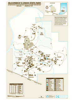
7 The book has background information on the grave sites in the cemetary. The map (this article, page four) makes the cemetary easy to find. There is a resident caretaker at the Lightstation, to control vandalism, and one of the cottages is available for rent. Visitors arrive by an amphibious vehicle on most days, and sometimes light aircraft fly in to the beach north of the Lightstation. You may not wander freely around the Lightstation, but you can see just about everything from the grass history is evident in the area; indigenous people's stone tools and implements may be seen in the sand behind Aircraft Beach, and a stone fishtrap is said to be at Mort Creek on Rodds Peninsula. (Please sent me a photo and /or GPS cordinates of the fishtrap if you see it)A small spring is to be found behind the beach, in Pancake Creek , third bay upstream from the mouth, near some palm trees. Boil water before using. Yachts that arrive at the mouth of Pancake Creek on a falling tide can make almost no headway upstream.
8 The water in Chinaman's Creek is a translucent emerald colour, and makes the trip into Jenny Lind by the back Creek , worthwhile. Jenny Lind is said to be home to large sharks. stone tools in the sand behind Aircraft Beach the cemetary small light, Clews Point Upstreampaddle 28
