Transcription of PART D: DEVELOPMENT PERMIT AREA GUIDELINES 20. …
1 138 D R A F T CITY OF COLWOOD OFFICIAL COMMUNITY PLAN20. riparian Areas & Marine PART D: DEVELOPMENT PERMIT area GUIDELINESS horelines Environmental DPAThe areas included on Figure 18 include environmentally sensitive areas in or around lakes, streams, ponds, wetlands, and the sea. riparian areas are those areas adjacent to aquatic systems that contribute to the proper functioning condition of the aquatic system and are distinctly marked on the map presented in Figure 18. The following design GUIDELINES are intended to complement a site adapte planning approach to minimize ecosystem disturbance and protect open space and wildlife riparian area Guidelinesa.
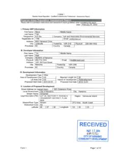
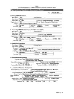
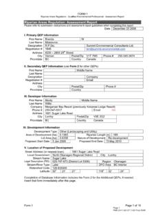
2 Require a report for all riparian areas from a Qualified Professional identifying environmentally valuable resources and wildlife values other than fish, including but not limited to amphibians and wildlife corridors. The report will identify measures to protect, enhance and restore ecosystem values and the Proper Functioning Condition of the watercourse or waterbody and riparian area . This report must:i. Identify environmentally valuable resources and wildlife values other than fish, including, but not limited to, amphibians and wildlife corridors; andii. Identify measures to protect, enhance and restore ecosystem values and the Proper Functioning Condition of the watercourse or waterbody and riparian For water bodies which contain fish or are connected to fish habitat, as defined by the riparian Areas Regulation (RAR), a detailed assessment report must be prepared by a Qualified Professional, in accordance with the RAR in support of a DEVELOPMENT PERMIT D R A F T CITY OF COLWOOD OFFICIAL COMMUNITY PLAN 139for DEVELOPMENT within 30 m of the water body.
3 Colwood Creek, Millstream Creek, Latoria Creek, Selleck Creek, Bee Creek, Lookout Brook and Joe s Creek are known to have fish present. A single report may be prepared which covers both RAR and City requirements. In compliance with the provincial requirements, the RAR report must:i. Clearly identify the width of the streamside protection and enhancement area (SPEA) to be protected, and measures necessary to protect the integrity and function of the SPEA;ii. Include an explanatory plan or reference plan prepared by a BC Land Surveyor which delineates the identified streamside protection and enhancement area ; iii.
4 Include measures to protect the root zones of trees within the SPEA and along the SPEA boundary, and protect the trees from windthrow. A report from a qualified professional ( Professional Forester, ISA Certified Arborist) will be required as part of the RAR report if the Qualified Professional does not have such expertise;iv. Be prepared in accordance with the joint EGBC/ABCFP/CAB professional practice GUIDELINES titled Legislated riparian Assessments in BC as amended from time to time; v. Protect water quality and natural systems by leaving stream banks intact and not altering slopes and vegetation.
5 Vi. Provide leave strips of adequate width, a minimum of 30 metres (100 feet) adjacent to watercourse and foreshore to be maintained in a natural state; andvii. If the subject property is adjacent to a ravine, steep slope or other known hazard area , including those shown in Figure 19, provide a report certified by a geotechnical professional or professional engineer, that identifies any natural hazards along watercourses or waterbodies (including groundwater discharge), as part of the RAR riparian area Regulation (RAR) report may not be required where a prior RAR report has been done within the previous two years.
6 Such reports are only valid if the site conditions have not changed and the proposed DEVELOPMENT remains substantively unchanged. If a suitable report is available, the proponent will be required to provide a letter from a Qualified Professional confirming that site conditions (existing and proposed) have not changed with respect to the impact on the riparian area and to provide a detailed riparian Management D R A F T CITY OF COLWOOD OFFICIAL COMMUNITY PLANc. In general, no part of a SPEA may extend on to a newly-created private residential lot. In special circumstances, the City may allow SPEAs on private lots with the registration of a covenant and/or provision of right-of-way access for municipal City issuance of a DEVELOPMENT PERMIT is subject to notification from the Province that a copy of the assessment report with the proper certifications has been submitted to the riparian area Regulation Notification System.
7 E. A post- DEVELOPMENT assessment report must be provided by a Qualified Professional upon completion of the project, which certifies that the prescribed measures have been satisfactorily completed, before the security for ecological restoration and enhancement is returned to the The only activities permitted in riparian buffer areas are management of invasive species, ecological restoration/enhancement, wildfire interface treatments and modification of hazard trees, as approved by Colwood, or activities expressly authorized by the Province of BC. g. Trails may be permitted within the riparian buffer.
8 Trails must be unpaved and must not result in the significant removal of native vegetation or disruption of wildlife, provided that the RAR applies to the In alignment with the Water Sustainability Act, DEVELOPMENT permits issued with regard to road and driveway construction will ensure that: i. watercourse crossings are located to minimize disturbance of riparian areas and streambanks;ii. wherever possible, bridges are used instead of culverts for crossings of watercourses; and iii. culverts are sited to allow unrestricted movement of fish and amphibians in both directions.
9 Where desirable, culverts may be designed to encourage in-stream storage of water. Culverts that are sized to maintain natural width of watercourses such as arch or D shaped culverts shall be used in areas identified as fish and/or wildlife habitat,i. All stormwater or treated sewage effluent discharged into or through a riparian area must first be treated to prevent pollution from sediments, oils and greases, nutrients or other pollutants entering the water body or riparian Areas of land specified in the PERMIT , in addition to the SPEA, must remain free of DEVELOPMENT , except in accordance with any conditions contained in the PERMIT .
10 D R A F T CITY OF COLWOOD OFFICIAL COMMUNITY PLAN 141 For projects that cannot meet the above riparian buffer requirements, the City will consider an alternative approval process. Consideration will be given to narrower riparian buffers only if the proponent can demonstrate a significant net ecological benefit and the maintenance of the watercourse and riparian buffer in a state of Proper Functioning Condition (PFC). Any applications to relocate or fill any portion of a watercourse or water body must first be approved by the Province of BC per the Water Sustainability Act, and Fisheries and Oceans Canada or other senior government agencies (as applicable).