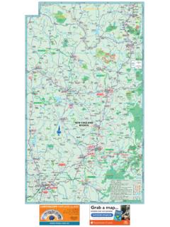
Transcription of PLACE NAMES ALONG GUYANA’S ROADS (Source: Adapted from ...
1 1 PLACE NAMES ALONG guyana S ROADS (Source: Adapted fromGazetteer of guyana , published by Lands and Surveys department and the German Agency for Technical Cooperation, Georgetown, 2001)1. ESSEQUIBO COAST ROADN orthwards from Supenaam RiverPlace NameKilometresMilesSupenaam River00 Good T s s en van of Belle and s - Berks LEGUAN ISLAND(a) Southeast Coast road North-eastwards from EnterprisePlace (b) South-westwards from EnterprisePlace NameKilometresMilesEnterprise00La s Adventure or Witte Anna85 Goodman s (c) Northwest coast roadNorth-westwards from Enterprise via Cross RoadPlace Truro or (d)
2 Cross road North-westwards from EnterpriseSouthwest SidePlace name KilometresMilesLa WAKENAAM ISLAND(a) - Northwest coastNorth-eastwards from Good SuccessPlace NameKilometresMilesGood Success jetty00 Good Cross and Cross (b) Southeast coast roadSouth-westwards from Good Success via Regent Cross RoadPlace NameKilometresMilesGood Success jetty00 Noitgedacht4 (c) North-eastwards from Good Success via Regent Cross RoadPlace NameKilometresMilesGood Success Belle s WEST COAST DEMERARAFrom Vreed-en-HoopPlace NameKilometresMilesVreed-en-Hoop Police s Forest85La , River21135.
3 RIGHT BANK ESSEQUIBO RIVER From Vreed-en-Hoop, left bank Demerara RiverPlace NameKilometresMilesVreed-en-Hoop Police Station00 Boerasirie de or Johanna Lawrence or Big Hope or or WEST BANK DEMERARA RIVER From Vreed-en-HoopPlace NameKilometresMilesVreed-en-Hoop Police Patrick Park Fortuin Vieira River Harbour One or Two Gezusters or (Wales Estate) Jonge Rachael (Wales Estate) la and s en NUMBER ONE CANAL ROADLeft Bank Demerara River From Vreed-en-Hoop(a) Northern SidePlace NameKilometresMilesVreed-en-Hoop Police Station00La Parfaite door en en Ridders NUMBER ONE CANAL ROADLeft Bank Demerara River From Vreed-en-Hoop(b) Southern SidePlace NameKilometresMiles9 Vreed-en-Hoop Police Station00L Heureuse NUMBER TWO CANAL ROADLeft Bank Demerara River From Vreed en Hoop(a) Northern SidePlace NameKilometresMilesVreed-en-Hoop Police (b)
4 Southern SideVreed en Hoop Police Station00 Cottage or Little en EAST BANK DEMERARAFrom Georgetown10 PLACE NameKilometresMilesParliament Buildings, La , Park, Park, Doom River Harbour Park, Peters Park, Peters Park, Providence, Three or Mocha de en of at Huis te Coverden2918 Den - Linden Highway River International SOESDYKE - LINDEN HIGHWAYR ight Bank Demerara River from GeorgetownPlace NameKilometresMilesParliament Buildings, Georgetown00 Soesdyke Junction, Demerara Toll or Long Branch River River River Toll Station9559 Karakara River , Linden, Demerara NUMBER THREE OR MOCHA CANAL ROADR ight Bank Demerara River from Georgetown(a) Northern SidePlace NameKilometresMilesParliament Buildings, Georgetown00 Sage en Bosch (b)
5 Southern SideParliament Building, EAST COAST DEMERARA ROADFrom GeorgetownPlace NameKilometresMilesParliament Buildings, Georgetown 00 Thomas Air Air Gardens, Cummings Lodge85 University Gardens, Cummings Lodge85 Atlantic Ville, Cummings Lodge85 Grahams Hall, Cummings Gardens, Ogle Gardens, Park, s Gardens, Brothers - Montrose Acres, Ressouvenir Bonne Park, La Bonne Park, Hall2113 Melanie Damishana2113 Enterprise2113 Bachelors , s or Chapman s Intent3723 Mahaica en No.
6 No. River s s s s or River Souci6641 Letter River LEFT BANK MAHAICA RIVERFrom GeorgetownPlace NameKilometresMilesParliament Buildings, s Bonne Grove452815. LEFT BANK MAHAICONY RIVERFrom GeorgetownPlace NameKilometersMilesParliament Buildings, Georgetown00L of WEST COAST BERBICE ROADFrom GeorgetownPlace NameKilometresMilesParliament Building, Georgetown00 Abary River (No. 42) (No. 30) 29 (No. 28) s (Bath Settlement) (Bath Settlement) Jib (Bath Settlement) Edward (Sir James) Stelling LEFT BANK BERBICE RIVERFrom GeorgetownPlace NameKilometresMilesPublic Buildings Stelling (Numbers 6 and 7) Stelling (Number 8) (Number 9)
7 En RIGHT BANK BERBICE RIVERFrom New AmsterdamPlace NameKilometresMilesGovernment House, New Amsterdam00 Stanleytown, New Park, s s Creek2918 Plegt en Ma RIGHT BANK CANJE RIVERFrom New AmsterdamPlace NameKilometresMilesGovernment House, New Banana s Lust s Forest or Saint en LEFT BANK CANJE RIVERFrom New AmsterdamPlace NameKilometresMilesGovernment House, New Amsterdam00 Stanleytown Savannah, New s Erven, New , Anna , Anna William Coffee of EAST COAST BERBICE ROADFrom New AmsterdamPlace NameKilometresMiles21 Government House, New Amsterdam00 Queenstown, New River 2 4 5 7 9 Lewis 11 13 15 Susannah85 Number 17 19 21 23 25 27 29 31 33 East 35 37 39 CORENTYNE COAST ROADFrom New AmsterdamPlace NameKilometresMilesGovernment House, New Amsterdam00 Number 2 Kilcoy (western portion) 4 Chesney (eastern portion)
8 6 Hall Bush Polder Bush 28 Bush Lot 29 30 31 Philippi3723 Number 32 33 Wellington 34 35 36 37 38 39 40 Epsom (western portion) 40 Dingwall (eastern portion) 41 Java4528 Number 42 43 Bush Polder 44 Goed 48 Rising 49 Mary s 50 53 57 Dead Tree Farm5836 Number 58 Dead Tree LEFT BANK CORENTYNE RIVERFrom New AmsterdamPlace NameKilometresMilesGovernment House, New Amsterdam00 Number 63 64 65 New 68 69 70 71 Little 72 Hong 73 Clonbrook or La 74 Stockholm or 75 Spring 76 78 Eliza and 80 Skeldon7446 Number 1804 (Crabwood Creek area) 1806 (Crabwood Creek area) 1805 (Crabwood Creek area) 1803 (Crabwood Creek area)
9 CORENTYNE COAST: BLACK BUSH POLDER INTERSETTLEMENT road From New AmsterdamPlace NameKilometresMilesGovernment House, New Amsterdam00 Black Bush Polder road Junction, Bush Polder road Junction, BARIMA-BARAMA road From Barima RiverPlace NameKilometresMilesArakaka, Barima River00 Barima Mine85 Manikuru , Barama BARIMA-WANAINA ROADFrom Left Bank Barima RiverPlace Barima River (opposite Morawhanna)00 Mabaruma Hill Hill DETERMINATION TRAILFrom Barim RiverPlace NameKilometresMilesFive Stars, Barima River00 Green River2918 Determination, Barama ECLIPSE road , Barima RiverPlace NameKilometresMilesLanding Below Falls, Barima River00 Landing Above Falls, Barima FIVE STARS TRAIL.
10 Barima RiverPlace NameKilometresMilesArakaka00 Junction of Trail with Old is Man Walk Hill2113 Whana River2918 Still in Hope KAITUMA-ARAKAKA TRAILLeft Bank Barima RiverPlace NameKilometresMilesKaituma Landing00 Sebai Man Landing291831. KOKERITE TRAILP lace NameKilometresMilesLanding, Barama River00 Imotai River, Waini KUMAKA - KWABANNA ROADP lace NameKilometresMilesKumaka, Moruka River00 Bemichi , Waini MATTHEW S RIDGE - PORT KAITUMA ROADP lace NameKilometresMilesMatthew s Ridge Airstrip00 Pakera Reservoir85 Manikuru River Bridge (Arakaka) Kaituma, Kaituma, BARTICA-POTARO ROADFrom Permanent Mark No.