Transcription of Planning Principles & Design Considerations - Indiana
1 Planning Principles & Design Considerations Planning Principles & Design Considerations .. 3 Preservation & Protection Natural Site Design .. 5 Preservation of Natural Vegetation .. 7 Riparian Buffer Zones .. 9 Wetlands .. 13 Floodplains .. 15 Steep Slopes .. 17 Karst .. 19 Land/Site Utilization .. 23 Soil Properties .. 25 Reduce Limits of Clearing & Grading .. 29 Fit the Design to the Existing Terrain .. 33 Utilize Undisturbed Areas & Natural Buffers .. 35 Planning Principles .. 37 Creative Development Design .. 39 Roadway Design .. 43 Building Footprints .. 47 Parking Lot Footprints .. 49 Setbacks & Frontages .. 53 Natural Drainageways vs. Storm Sewers .. 55 4 CHAPTER October 2007 Chapter 4 1 Above photo source: Natural Resources Conservation Service, Iowa This page was intentionally left blank.
2 P roject Planning , Design , and layout can begin once all site information and data has been collected and analyzed. The first step in Planning , Design , and layout is to develop a set of construction plans including a comprehensive site plan. A site plan is a graphical depiction showing the layout of a project. Site plans typically include the location, Design , and specifications for roads, streets and parking areas; storm water management systems, wastewater management systems, utilities, and other infrastructure; structures; landscaping and common areas; and other facilities associated with the project. Development of the site plan should take into consideration all of the information collected during the site assessment and data collection process. When making Planning , Design , and layout decisions, it is extremely important to take advantage of the strengths and overcome the limitations of project site features identified in the assessment process.
3 Adapting a plan Design to existing site conditions and the natural features of the landscape can greatly reduce the project s environmental impacts. Storm water management, including erosion and sediment control and post-construction pollution prevention measures, needs to be an integral part of the site Planning process and not just an afterthought. Again, it is extremely important to take into consideration details for land clearing, grading, and cut and fill operations that will be used during the construction process when developing the site plan. Therefore, the best approach to developing a set of comprehensive construction plans is to prepare the site plan and storm water pollution prevention plan simultaneously. This section contains several basic Planning Principles and Design Considerations that should be reviewed and incorporated into the site Planning process whenever possible.
4 Using these Principles and Design Considerations will help reduce environmental impacts and minimize project construction costs. The following illustrations show a comparison of conventional Design versus a Design that incorporates Planning Principles and consideration for the natural site features. Planning Principles & Design Considerations October 2007 Chapter 4 3 Conventional Design Source: Georgia Stormwater Management Manual, 2001 Source: Georgia Stormwater Management Manual, 2001 Improved Site Design Planning Principles & Design Considerations 4 Chapter 4 October 2007 O ne of the first activities that should be performed at a project site is a site assessment of resource issues.
5 This process includes inventory and data collection of the resources that are associated with the project site. This process is described in more detail in Chapter 2 of this manual. This section provides an in depth discussion of key natural features that may be encountered at a project site. The intent of this section to provide an understanding of each of these resource features and issues with an emphasis on protection. Incorporating these natural features into the Design and layout of the project site can minimize the overall impact of the project. Benefits include but are not limited to a reduction of impervious surfaces, decreased generation of pollutants, and treatment of storm water runoff. PRESERVATION & PROTECTION NATURAL SITE Design October 2007 Chapter 4 5 This page was intentionally left blank.
6 Key Benefits Vegetation absorbs the energy of falling rain. Dense root structures hold soils in place and increase the soil s absorptive capacity. Plant roots hold soil particles in place and preserve and promote development of soil structure, resulting in increased soil permeability which increases the soil s ability to absorb storm water runoff. Vegetation also: Slows the velocity of runoff and acts as a filter to trap sediment. Serves as a buffer zone against noise. Enhances aesthetics of the area. Provides areas where wildlife can remain undisturbed. Provides a source of shade during summer months. May add to the value of residential and commercial properties. Usually requires less maintenance than planting new vegetation. Planning Consideration Extremely well-suited for use in areas prone to high rates of soil erosion where other soil erosion control measures would be difficult to establish, install, or maintain.
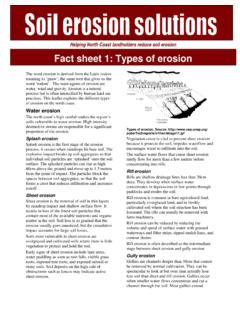
7 Use in areas where it is desirable to reduce storm water runoff sheet flow velocities. Can be used to protect unique or endangered plant species. Preservation of Natural Vegetation The preservation of natural vegetation during construction provides natural buffer zones, protects soils from water and wind erosion , removes sedi-ments and other pollutants from storm water runoff, and is aesthetically pleasing. This technique can be applied to all types of sites. PRESERVATION & PROTECTION NATURAL SITE Design October 2007 Chapter 4 7 Discussion Soil erosion is a leading cause of water quality problems in Indiana . It impacts water quality by degrading the habitat of aquatic organisms and fish, promotes the growth of nuisance weeds and algae, and decreases its recreational value. During construction, if disturbed land is left unprotected its erosion potential increases, storm water runoff volumes and sediment loadings increase, and the potential for surface water degradation increases.
8 The preservation of vegetation should be planned before any site disturbance begins. Planners should note the locations where vegetation should be preserved and consider this when determining the location of roads, buildings, or other structures. Highly visible barricades and signs should be erected to protect vegetation boundaries selected for preservation. Preventing damage is less costly than correcting it. Planning should include the maintenance requirements of the existing vegetation. Based on soil types and climate, different species will require different maintenance activities such as mowing, fertilization, irrigation, pruning, and weed/pest control. These activities should be performed regularly during construction. PRESERVATION OF NATURAL VEGETATION 8 Chapter 4 October 2007 Riparian buffer zones are natural vegetative zones along creeks, streams, channels, or other water-bodies.
9 They typically consist of tree, shrub, and grass plantings. Riparian buffer zones help: Maintain the integrity of stream channels and shorelines. Remove pollutants such as suspended solids, phosphorous, nitrates, trace metals, pesticides, and hydrocarbons from storm water runoff. Remove nutrients and other pollutants from subsurface flow through filtering and plant uptake. Riparian buffer zones supply food, cover, and shade (thermal protection) to fish and other wildlife. Riparian buffer zones provide: Green space and wildlife corridors. Recreational areas such as parks and walking trails. Use along fields, housing developments, industrial and commercial sites, etc. where it is desirable to protect streambanks and drainage channels and to decrease nonpoint source pollution of waterbodies. Can be used along streams and drainage channels where it is desirable to preserve native vegetation and buffers both during and after active land- disturbing activities.
10 Well suited for setting aside areas for wildlife food and habitat. Source: Natural Resources Conservation Service, Iowa Riparian Buffer Zones Key Benefits Planning Consideration PRESERVATION & PROTECTION NATURAL SITE Design October 2007 Chapter 4 9 Riparian buffer zones are typically found connecting a stream system and a people-based system such as agriculture, housing, or industry. From the water s edge and continuing up slope, the area can be viewed in zones. The three-zone buffer concept is the most common type of riparian buffer zone system. Zone 1 is a mix of undisturbed, native trees and provides bank stabilization as well as shading and protection for the stream. This zone may also include wetlands and any critical habitats. Zone 2 is a transition zone consisting of native trees, shrubs, and grasses. This area can be used for various purposes such as timber harvest-ing, wildlife habitat, and outdoor recreation.