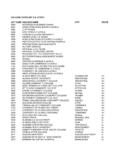
Transcription of Raleigh Greenway Map
1 Capital Area Greenway System The Capital Area Greenway (CAG) system is a network of linear parks, located along rivers, creeks and streams, that provide opportunities for conservation, recreation and connecting people to Raleigh s parks and other community features. Greenway trails can also follow along utility and railroad corridors when natural corridors are unavailable to make a trail connection. The system has over 100 miles of paved and unpaved trails and over 270 miles of protected stream trails typically include a 10-foot wide asphalt path that can be used for recreational activities such as hiking, biking, Raleigh s Parks, Recreation and Cultural Resources Department Welcomes You!The purpose of Raleigh Parks, Recreation and Cultural Resources Department is to actively encourage, provide, promote and protect quality leisure, recreation and cultural opportunities, facilities and environments that are essential for the enhancement of the lives of our citizens.
2 We would like to invite you to plan a visit to one of our many parks, trails and recreation facilities that make up the Raleigh Parks System. Whether you are planning a family picnic, outdoor adventure or want your children to participate in a unique program with dozens of activities from which to choose, Raleigh Parks, Recreation and Cultural Resources has the perfect fit for you! If you are a Raleigh native, just getting settled in, or a visitor, we hope you will take some time to enjoy the wonderful opportunities that await you. We look forward to seeing you in the parks and on the trails!inline skating, jogging and strolling. These paths can also be used as a means of getting to destination points such as home, work, school, parks and shopping centers without the use of a framework of the CAG system includes Walnut Creek, Crabtree Creek and their tributaries to the west of the Neuse river and Richland Creek, Harris Creek and their tributaries to the east of the Neuse river .
3 Many of the city s major ecological features can be experienced in their natural state along these water courses. We invite you to experience this network of interconnected trails whether for it be for recreation, wildlife viewing, and Numbers In case of emergency call 911 Police non-emergency Greenway Maintenance (daytime hours) Greenway Volunteer Program Greenway Planning For additional maps IDMILEAGESURFACEFEATURES AND AMENITIESDESCRIPTIONPARKING AREASPARK FACILITIESA bbotts Creek Great Blue Heron habitat Connects to Falls river Shopping Center Connects to North Wake Landfill District Park, Neuse river Trail, Simms Branch Trail, and Durant Nature PreserveFollows Abbotts Creek from the Neuse river Trail to Simms Branch Trail near the intersection of Durant Road and Cub Trail. The trail is connected by sidewalk along two sections of Falls river Avenue and along Durant , 3, 4, 53, 54, 83 Discover Our Parks Creek Park (Q-8) Anderson Point Park (U-25) Annie Louise Wilkerson, MD Nature Preserve Park (O-5) Apollo Heights Park (N-26)Baileywick Park (H-8) Barwell Road Park (T-30) Biltmore Hills Park (L-28) Brentwood Park (O-18)Brier Creek Park (upper left off map) Brookhaven Park (F-15) Buffaloe Road Athletic Park (U-17) Carolina Pines Park (H-28) Cedar Hills Park (L-14) Chamberlain Park (H-22) John Chavis Memorial Park (L-25) Davie Street Park (L-25) Dorthea Dix Park (I-25) Durant Nature Preserve Park (P-10) Eastgate Park (L-16) Edna Metz Wells Park (I-23) Eliza Pool Park (J-27) Fallon Park (K-20) Forest Ridge Park (Q-1) Fred Fletcher Park (J-22) Glen Eden Pilot Park (F-18) Green Road Park (O-16) Halifax Park (K-22) Hill Street Park (P-20) Honeycutt Park (L-9)
4 Horseshoe Farm Nature Preserve Park (U-11) Hymettus Woods Park (H-20) Isabella Cannon Park (H-22) Jaycee Park (H-22) John P. Top Greene Park (K-25)Kaplan Park (O-25) Kentwood Park (E-24) Kingwood Forest Park (M-28) Kiwanis Park (L-19) Lake Johnson Park (D-27)Lake Johnson Nature Preserve Park (D-27) Lake Lynn Park (E-11) Lake Wheeler Park (bottom Left off map)Lassiter Mill Park (I-18) Laurel Hills Park (E-18) Leesville Park (C-11) Lions Park (M-22)Longview Park (N-23)Lt. Col. George F. Marshall Memorial Park (G-17) Marsh Creek Park (R-19) Method Park (E-22) Milburnie Park (T-21)Millbrook-Exchange Park (N-13) Mordecai Historic Park (K-22) North Hills Park (I-17) Oakwood Park (L-23) Optimist Park (J-14) Peach Road Park (I-29) Powell Drive Park (C-24)Pullen Park and Theatre In The Park (H-24) Roberts Park (M-25)Rose Garden and Little Theatre (H-23) Sanderford Road Park (N-29) Shelley Lake Park (H-14) Southgate Park (N-27) Spring Forest Road Park (R-14) Strickland Road Park (C-8) Tarboro Road Park (L-24)Thomas G.
5 Crowder Woodland Center (C-25) Walnut Creek (North) Softball Complex (Q-25) Walnut Creek (South) Amphitheater (Q-28) Walnut Creek Wetland Center (M-27)Williams Park (H-13) Windemere Beaver Dam Park (H-20) Wooten Meadow Park (E-14) Worthdale Park (P-26) Baileywick Connects to Baileywick Park and Baileywick Elementary SchoolConnects from Strickland Rd to Baileywick Road by passing through Baileywick Dam Connects to Hymettus Woods Park and Windemere Beaver Dam ParkA natural surface trail located adjacent to Beaver Dam Creek between Wade Avenue and Devonshire Drive that passes through Windemere Beaver Dam Park. The trail is connected by a sidewalk along Dixie Ridge Connects to Walnut Creek Softball ComplexA wide sidewalk that connects Poole Road to the Walnut Creek Softball Complex (Walnut Creek North Park). Centennial Bikeway Connects to North Carolina Farmers Market and NC State University Centennial Campus Connects to Walnut Creek TrailA multi-purpose path adjacent to Centennial Parkway on the NC State University Centennial Campus.
6 Crabtree Creek TrailC-16 L-19 Connects to the Crabtree Valley Mall Connects to Kiwanis Park, Historic Lassiter Mill and North Hills Park Connects to Neuse river Trail, Mine Creek Trail and House Creek Trail Follows Crabtree Creek northwest from the Neuse river Trail beginning at Anderson Point Park ( miles); to Kiwanis Park ( miles); to Historic Lassiter Mill ( miles); to North Hills Park ( miles); to Mine Creek Trail ( miles); to House Creek Trail ( miles); to Crabtree Valley Mall ( miles); to Lindsay Drive ( miles). The trail is connected by sidewalks at N. Raleigh Boulevard, Oxford Road, Lassiter Mill Road, Northhampton Street, Hertford Street. Section of unpaved natural trail between Hertford Street following Crabtree Creek to the , 19, 20, 21, 22, 23, 24, 40, 41, 46, 47, 48, 50, 51, 52, 60, 61, 62, 63, 64, 65, 66, 67, 68 East Fork Mine Creek Connects to Shelley Lake to the south via Mine Creek Trail and Honeycutt Creek Trail to the north (at Strickland Road)Follows East Fork Mine Creek upstream from the confluence of Mine Creek to the north side of Strickland Road.
7 The trail is connected by sidewalks along Longstreet Drive, Six Forks Road, Newton Road, Clear Brook Drive, Mourning Dove Road, Running Cedar Trail and Strickland Road. 11, 97 Edwards Mill Connects to PNC Arena Connects to Richland Creek Trail and Reedy Creek Trail A multi-purpose path along Edwards Mill Road from Trinity Road to Reedy Creek Street Connects to Jaycee and Isabella Cannon ParksA natural surface trail that connects Jaycee Park to Isabella Cannon Park. The trail is connected by sidewalks along Gardner Street from Van Dyke Avenue to Kilgore , 69 Hare Snipe Creek Scenic views across lake Connects to Lake Lynn Loop Trail, Wooten Meadow Park, Lake Lynn Park and Community Center Follows Hare Snipe Creek from Wooten Meadow Park to Lake Lynn Park. The trail is located adjacent to Leesville Road from W. Millbrook Road to Lynn Road. The trail continues via sidewalk along the north side of Lynn Road to Lake Lynn parking entrance.
8 The trail continues along the west side of Lake Lynn Loop to its end at Lake Lynn Park and Community Center. 9, 10, 55, 81 Honeycutt Creek and Unpaved Portion of trail from Raven Ridge Rd to Durant Road is located on game lands managed by the Wildlife Resource Commission Please be aware that seasonal hunting occurs on this property Connects to Honeycutt Park Connects to the Mountains-To-Sea Trail at the south shore of Falls Lake and East Fork Mine Creek Trail No bicycles on unpaved section The unpaved section follows Honeycutt Creek from Raven Ridge Road to Durant Road, continues as a paved multi-purpose path along Honeycutt Road to Honeycutt Park. The trail continues through a pedestrian tunnel underneath I-540 through the Bent Tree subdivision to Strickland Road. The trail is connected by sidewalks along Carriage Tour Lane and Strickland Road. 7, 97 House Creek Connects to Glen Eden Park Connects to Crabtree Creek Trail and Reedy Creek Trail Follows House Creek along the I-440 beltline between the Crabtree Creek Trail at Crabtree Valley Mall and Reedy Creek Trail at Wade Avenue.
9 24, 25, 26, 94 Lake Johnson East Scenic views of the lake Connects to Walnut Creek Trail (north side) A loop trail around the east side of Lake Johnson. The loop trail passes through Lake Johnson Park and Lake Johnson Nature , 33, 34 Lake Johnson West Scenic views of the lake No bicycles permitted Connects to Walnut Creek Trail (north side)A loop trail around the west side of Lake Johnson. The loop trail passes through Lake Johnson Park and Lake Johnson Nature , 32, 33 Lake Lynn Connects to Lake Lynn Park and Community Center Connects to Hare Snipe Creek Trail A loop trail around Lake , 10, 55 Little Rock Connects to the Walnut Creek Wetland Center, City Cemetery, Chavis Park and downtown Connects to the Walnut Creek Trail Follows Little Rock Creek from the Walnut Creek Wetland Center to downtown. The trail passes through historic Chavis Park, connects to the Martin Street Connector and terminates at E.
10 Hargett Street. 36, 37, 70, 74 Marsh Creek TrailO Large river Birch trees along trail in Brentwood Park Connects to Brentwood Park and Brentwood Elementary Follows Marsh Creek through Brentwood Park between Glenraven Drive and Ingram Street Connector sidewalk connection between Little Rock Trail at Chavis Way to downtown. Mine Creek and Unpaved Large granite rock outcrop between Sawmill Road and East Fork Mine Creek Trail Exceptional bottom land forest river Birch located near Lynn Road Ironwood trees and Umbrella Magnolia between W. Millbrook Road and North Hills Drive Connects to Shelley Lake Loop Trail Connects to Crabtree Creek Trail, Snelling Branch Trail and East Fork Mine Creek Trail Follows Mine Creek north from the confluence with Crabtree Creek along the east side of Shelley Lake to Sawmill Road. The trail is an unpaved natural surface trail from the junction of East Fork Mine Creek Trail to Sawmill Road.