Transcription of Record Sheet and Report Templates Risk Assessment …
1 Record Sheet and Report Templates Risk Assessment Forms & Other Guides Guide 23. BAJR Practical Guide Series David Connolly March 2009 (revised). held by authors Templates , conventions and guides This guide is designed to help provide sample Record sheets, convention sheets and template Risk Assesment form. You can either print them out as is, or use them to create your own to t your speci c needs. It is not meant to be prosciptive , but rather give you the tools to work with. This work could not have been created without the MoLAS archaeological site manual which is a guide to the compilation of archaeological site records drawn, written or photographed in the course of eldwork. It should enable any archaeologist to undertake most recording and excavation tasks without the need for further reference. The manual is arranged in sections in a logical sequence from simple contexts such as deposits and cuts, through the associated activity of environmental sampling to more complex features such as masonry and timber structures.
2 Further sections deal with specialised aspects of eldwork, such as skeleton and co n recording, nds recovery, photography and surveying, and the manual concludes with speci cations for the contents of a site archive. This is the third edition of the manual. It is produced by the Museum of London Archaeology Service, which was created in 1991 by the merger of the Department of Greater London Archaeology and the Museum's former Department of Urban Archaeology, who published the original two editions. Authors: Various Series: Surveys and handbooks Published by: MoLAS, London 1994. ISBN 0-904818-40-3. Rb128pp. bl/wh ills. Price: from here: The 1994 edition is also available online here as a pdf : 5A53 FFDC1F94/0 This guide was produced by David Connolly, BAJR ( ). Special thanks to MoLAS and YAT, whose own methods of recording formed the basis for many of these Templates and also for shaping my thoughts over the past 28 years of contracting archaeology. 1. Templates , conventions and guides Contents Introduction 1.
3 Quick Checklist 3. Stratigraphy and Harris Matrix 4. Site planning: the drawn Record 5. Site planning: Conventions 6. Site Recording forms introduction 7. Context Sheet Skeleton Sheet Building Record Sheet Worked Stone Sheet Context List Photo List Finds List samples List Project Reporting Introduction 18. Structured Report template 19. template Risk Assessment 26. 2. Templates , conventions and guides Quick Checklist General: 1. Get a Site grid even if it is just a single base line essential for plans. 2. Check the exact details of the site requirements so there are no surprises. 3. Have you got enough Tools, Context Sheets, Photo Sheets, Cameras, Sample and Finds Bags, Ranging Rod, Level & Staff 4. Will you need more people to complete the work to the highest standard? Just about ne - is not OK! Context Record : 1. Each Site has a Code. 2. Each trench has a Number. 3. Each Feature has a Context Number. Fill. Layer, Structure, Cut. 4. Remember that a feature is discrete if ll numbers are given, make sure there is a cut number to go with them.
4 5. Try and keep the site matrix up to date 6. In the site diary keep a Record of each context sign them out this allows quick access to data. 7. Try to keep records completed. - Thinking that you will remember to complete it later does not work. Site Diary: 1. Record your thoughts and notes during the day. 2. If you have additional people there then note who is there 3. Sketches are good 4. The site diary should Record your thought process So if later in the excavation you contradict a previous thought, that's ne. Plans: 1. Keep a Record of each plan, scale, date and who drew it in the Site Diary 2. The plan should be 1:20 normally (though 1:50 is ne for a large site). 3. Make sure you have a plan that shows the extents of the site located accurately to the grid and tied in to structures nearby. 4. The plan should have at least the following details: Plan Number North Arrow Grid Coords (if required). Levels (reduced and written on the plan). Context numbers (mark cuts, walls, etc next to the number).
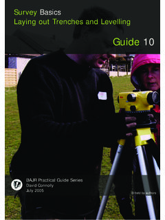
5 If you have a section mark it on the plan so it can be located Dash-Dot-Dot-Dash (edge of excavation) Dash-Dot-Dash (Internal edge of excavation) Solid Hatch (Cut) Lightning Hatch (Natural Slope). Finds: 1. Mark the bag with Date, Code, Trench, Context, Name Photos: 1. Fill in the Photo Record on the sheets as you take the photos Levels : 1. Set up dumpy and ensure it is level. 2. Set staff on TBM (temporary Bench Mark) - This can either be arbitrary OR based on the OS heights MaOD). 3. Person at level reads staff - this reading is backsight (BS). 4. Instrument Height (IH) is determined by ADDING TBM to BS. 5. Now person with staff places the base of staff on whatever is being levelled - plan, section , small nd etc. 6. Person at dumpy level now reads the measurement on staff, this is Foresight (FS). 7. Reduce level to nd out the actual height at the base of the staff by subtracting the FS from the IH. ie TBM= + BS = IH IH - FS = a reduced level of a good source for benchmarks is here: 3.
6 Templates , conventions and guides Stratigraphy and Harris Matrix Introduction: The Harris matrix or Winchester seriation diagram is a tool used to depict the temporal succession of archaeological contexts and thus the sequence of deposition on a dry land' archaeological site. The matrix re ects the relative position and stratigraphic contacts of observable stratigraphic units, or contexts. The Matrix was developed in 1974 in Winchester, England, by Dr. Edward Cecil Harris. Stratigraphy is the basis of archaeology, where you must accurately Record the sequence of events of each feature on a site, which has been assigned a context number. The example beow is a simple example to illustrate how a matrix is completed. 001. A horizontal subsoil layer 002. A horizontal layer over and on both TOPSOIL sides of wall 003. 003. A stone wall built into foundation 001 cut 006. 004. A clay oor abutting wall 003. 005. A horizontal layer, probably the same 002002 002. 004. as 006. 006.
7 A horizontal layer, probably the same as 005. wall 007. 005 007. Back ll of the wall construction cut 003 006 (sometimes called construction trench). cut 008. Trample in the base of cut 009. 009 formed by workmen's boots constructing 011 the structure wall 003. 009. Construction cut for wall 003. 008 010. Cut for a ditch that predates the wall cut construction 003 and the layers 005/006. 012 010 011. Final back ll of ditch (secondary ll). 012. Initial ditch ll, probably silting up 013 during its use. (primary ll). 013. Horizontal layer containing artefacts of previous occupation Natural: Sterile ground formed before NATURAL. human occupation of the site It may be best to think of creating the sequence as a narrative, where you tell The order in which these events the story in a logical language: occurred would be drawn in the The Natural was there before man appears on the site, and then the thick layer following Harris matrix [013] is laid down, with some artefacts in it, then later, a ditch [010] is cut through it which starts to ll up [012] until it is eventually deliberately lled up to the 001.
8 Top [011]. After this, time passes and layer [005] builds up over the site, and it is from this level that people cut a trench [009] as a foundation, but very soon 002. after, they tramble mortar and other construction debris into the base [008]. 004. They build wall [003] into the trench and then back ll with material [007]. Once the wall has been built, and the ground cleared, they lay a oor [004] inside the 007. building that laps up over the wall base. After the building has fallen out of use and the area is lled with a covering layer [002] very little happens, until the soil 003. continues to build up [001] and evetually, the topsoil covers everything. 008. Of course the golden rulle is to link what you know, and don't try to link what 009. you can't even if you think they are the same layer ( It is acceptable to see the layer [002] on either side of the wall as one but it is NOT to see layers [005] and 005 006. [006] as the same, as although they look the same, are the same thickness and 011.)
9 The same level, they are not connected. Never assume. which is why the matrix splits at that level, before returning to the line. If you think about it, you can't 012. tell whether [006] was laid down after or before the cut [010] and ll took place 010. - hence the form of the matrix - however, note that an equals sign has been used to suggest a direct relationship. 013. 4. Templates , conventions and guides Site planning: the drawn Record Basic Conventions for Planning Limit of Excavation : Internal edge of Excavation : Edge of Context : Edge of Context indeterminate : Level marked on plan or section : Context Number : 3005. (trench number followed by 3 digit context number). 001. Small FInd : Sample : 001. Cut Hatch : Closer together for steeper slope Length shows breaks of slope. Slope Hatch : Limestone : LS. Sandstone : SS Br Br Brick : or Br Tile : T T T. Cobble : draw as seen Gravel / Pebble Sand : s s Clay (as inclusion) : Clay (pure) : Mortar : Shell : Bone : draw as seen and write bone next to it Ash : v v v v v v v Charcoal : Peat : Coal : +++ ++.
10 Plaster : Wood : 5. Templates , conventions and guides Basic Conventions for Planning Drawing a cut Cut edge Cut edge with step Vertical edge Undercut Change of slope Undercut &. return slope Standard site plan Sheet context/plan number 125. + + + + + +. edge of trench grid points feature + +. 3. 125 1. + +. 2. + +. + +. Reduced Levels 1 reduced plan levels 2 grid reference plan extends into square to left 3 +50E/120N + + + number above context/plan + present one+. Context Number 125 123. Notes Drawn by DC. Checked by MS x x 125. Feature extends and has been cut by several other postholes Date 14/02/2009. Scale 1:20. context/plan number belowpresent one This Sheet shows a typical single context plan (where each feature is drawn on a separate plan where the context is the plan number) however, you can also use this for keeping a track of plan numbers if you are drawing in a multiphase plan. It is important to know what you will do, and how you will do it, and remain consistant.