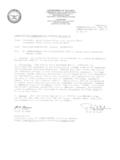
Transcription of Request for Proposal – Land Survey
1 Request for Proposal land Survey DATE: March 3, 2016 PROJECT NAME Scott Nelson Property OWNER Shoalwater Bay Indian Tribe Box 130 Tokeland, WA 98590 360-276-6766 SURVEYOR (Name, Legal Status and Address, Email, Phone) _____ _____ _____ _____ Is the surveyor licensed in the State of Washington ( ) Yes ( ) No Is the surveyor currently CFED certified or enrolled in the CFED Training Program ( ) Yes ( ) No Request FOR Proposal The Owner requests the Surveyor to submit to the Owner a Proposal for a land Survey of the property described below. The Surveyor shall submit the Proposal by attaching here tothe material required, and returning two signed copies of this document to the Owner. The Surveyor shall include with the Proposal a statement defining any proposed deviations from the requirements of this document, including additions, deletions, exceptions and revisions. If the Owner accepts the Proposal , all two copies of this document will be signed by the Owner; one will be returned to the Surveyor.
2 Upon execution and receipt by both parties, this document shall form the Agreement between the Owner and the Surveyor. The Surveyor shall hold the Proposal open for acceptance by the Owner for a period of 60 calendar days after the date of submittal to the Owner. Proposals will be evaluated and award of a contract for surveying services shall be made on the basis of the fee and qualifications that best meet the interests of the owner. Proposals will be received until April 8, at 3:00 , at the Office of: Shoalwater Bay Indian Tribe Holly Blake 2373 Tokeland Road Tokeland, WA 98590 PROPOSALS RECEIVED AFTER April 8, 2016at 3:00 , WILL NOT BE CONSIDERED. Proposals shall be clearly marked, Surveying Proposal Do Not Open . Any questions regarding this RFP should be directed to Holly Blake, Special Projects and in email format to: closing date. land Survey Proposal ARTICLE 1 GENERAL PROVISIONS TIME Subject to any limitations stated in this Proposal , the specified land Survey shall be completed and the drawing(s) and report(s) delivered to the Owner within 60 calendar days after written authorization to proceed is received, barring circumstances beyond the Surveyor's control that force a delay.
3 In such instance, the Surveyor will inform the Owner of the cause of the delay. COMPENSATION The Surveyor shall attach the lump sum fee to this Proposal . The cost of the land Survey (including the furnishing of all materials, surveying equipment and computers, labor and any required insurance) shall be based n the method(s) checked below: (X) a stipulated sum for all services based on this Proposal , with adjustments to the stipulated sum being computed in accordance with the Surveyor's attached rate schedule if changes in the work are authorized in writing prior to work being completed; BILLING AND PAYMENT Billing for the Survey shall be as checked below: (X) to the Owner's address above, with a copy to Holly Blake; Payment shall be made as follows: 50 % payment upon completion and of the requirements itemized in this RFP. 50% payment upon acceptance and approval of Survey by BLM and/or Natural Resources Director. INSURANCE The Surveyor shall provide and maintain insurance coverage for claims under Workers' Compensation Acts; claims for damages because of bodily injury, including personal injury, sickness or disease, or death of employees or of any other person; and from claims for damages because of injury to or destruction of tangible property, including loss of use resulting there from.
4 The Surveyor's Proposal shall state the coverages and limits of liability of professional liability insurance that will be maintained for protection from claims arising out of the performance of professional services. Certificates of Insurance evidencing the above coverages shall be made available at the Owner's Request . PROTECTION OF PROPERTY The Surveyor shall contact the Owner for information regarding the site and shall take all reasonable precautions to prevent damage to property, visible and concealed, and shall reasonably restore the site to the condition existing prior to the Surveyor's entry, including, but not limited to, repair of fences, lawns and plantings. QUALIFICATIONS All services shall be performed by qualified personnel under the supervision of a professional licensed or otherwise qualified by the state to practice land surveying, and the document(s) submitted shall bear the Surveyor's seal and statement to that effect.
5 USE OF SURVEYOR'S DRAWINGS It is understood that the Owner, or Owners Representative, may reproduce the Surveyor's drawings without modification and distribute the prints in connection with Owner needs without incurring obligation for additional compensation to the Surveyor. ACCURACY STANDARDS Precision of the Survey shall be based on the positional accuracy concept. The Surveyor shall recommend in the Proposal positional accuracy limits and error of closure limits for the property being surveyed. ARTICLE 2 PROPERTY INFORMATION PROVIDED BY OWNER ABBREVIATED LEGAL DESCRIPTION: LOT 1 IN 11-14-11 COMMON DESCRIPTION: These tax map numbers consist of (1) parcel of land that the Owner currently owns. Assessor s property tax parcel No 78034016006 PROPERTY LINES AND ACCESS Property lines and means of access are shown on the attached drawings . Site access is provided by the arrangement checked below: (X) The Owner has title to this property and the right of entry for this Survey .
6 ARTICLE 3 DRAWING REQUIREMENTS Requirements for land Survey drawings are as indicated below. (X) Drawings shall note all dimensions and elevations in: (X) imperial units at appropriate scale. (X) Drawing sheets shall be trim size 24 x 36 with left binding edge and .5 borders. (X) Show NORTH arrow and locate magnetic North: (X) directed to the top of the sheet; (X) Include legend of symbols and abbreviations used on the drawing(s). () Spot elevations on paving or other hard surfaces shall be to the nearest .01 foot; on other surfaces, to the nearest .10 ( ) Boundary and topographic information, where both are required, shall be on the two separate drawings () State elevation datum on each drawing: () use NVD 88; (X) State Coordinate System on each drawing: (X) use Washington State Plane South NAD 83, feet. (X) Furnish to the Owner three paper prints and two mylar copies of each drawing. The Surveyor shall sign and seal each drawing and shall state that to the best of the Surveyor's knowledge, information and belief, all information thereon is true and accurately shown.
7 Also furnish to the Owner a electronic Computer Aided Drawing compatible with AutoCAD. Electronic drawing must be georeferenced to the correct coordinate system. ARTICLE 4 land (BOUNDARY) Survey REQUIREMENTS Survey requirements shall be established as indicated below. (X) Show boundary lines, giving length and bearing (including reference or basis) on each straight line; interior angles, radius, point of tangency and length of curved lines. Unless otherwise prohibited by law, where no monument exists, set permanent iron pin (monument) or other suitable permanent monument at property corners; drive pin adequately into ground to prevent movement and mark with wood stake; state on the drawing(s) whether corners were found or set and describe each. (X) Furnish a legal description that conforms to the record title boundaries. Prior to making this Survey and insofar as is possible, the Surveyor shall acquire data including, but not limited to, deeds, maps, certificates or abstracts of title, section line and other boundary line locations in the vicinity.
8 (X) Reconcile any discrepancies between the Survey and the recorded legal description. (X) Give area in square feet if less than one acre; in acres (to .01 acre) if over one acre. If required by Section , use equivalent metric units. (X) Note identity, jurisdiction and width of adjoining streets and highways, width and type of pavement. Identify street monuments and show distance to the nearest intersection. (X ) Plot location of structures on the property. Dimension to property lines and other buildings. Note vacant parcels as VACANT. Describe building materials and note number of stories. (X) dimension perimeters in feet and decimals to .05 foot; (X) Show encroachments, including cornices, belt courses, etc., either way across property lines. (X) Describe fences and walls and locate them with respect to property lines. (X) Include identification of party walls. (X) Show recorded or otherwise known easements and rights-of-way and identify owners (holders).
9 (X) Note planned rights-of-way and the nature of each. (X) Note planned street widenings. ( ) Show individual lot lines and lot block numbers; show street numbers of buildings if available. ( ) Show zoning of property. If more than one zone, show the extent of each. Show zoning of adjacent property and property across the street(s) or highway(s). ( ) Show building line and setback requirements, if any. ( ) Give names of owners of adjacent property. ARTICLE 5 TOPOGRAPHICAL Survey REQUIREMENTS All lines of levels shall be checked by separate check level lines, or on previous turning points or benchmarks. Topographical Survey requirements shall be established as indicated below. If required by Section , use equivalent metric units. ( ) A minimum of one permanent benchmark on site for each four acres and a description and elevation to nearest .01 foot. ( ) Contours at one (1) foot intervals; error shall not exceed one-half contour interval.
10 ( ) Spot elevations at street intersections and at fifteen (15) feet on center of curb, sidewalk and edge of paving, including far side of paving. If elevations vary from established grades, also state established grades. ( ) Plotted location of structures, paving and improvements above and below ground. ( ) Floor elevations and elevations at each entrance of buildings on the property. ( ) Utility information. The following information is to be shown based on record information and on surface evidence. Inadequate record data requiring the surveyor to employ techniques of subsurface exploration to locate utilities will be an additional service subject to Owner approval. ( ) Location, size, depth and pressure of water and gas mains, central steam and other utilities including, but not limited to, buried tanks and septic fields serving, or on, the property. ( ) Location of fire hydrants available to the property and the size of the main serving each.