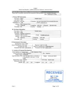
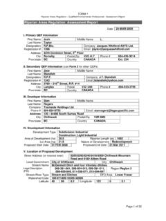
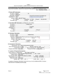
Transcription of Riparian Areas Regulation Assessment Methods
1 Schedule Riparian Areas Regulation Assessment Methods 1 Table of Contents 1. Introduction to the RAR Assessment 5 The Assessment 5 Preparing an Assessment 6 Contents of an Assessment 8 Description of Fisheries Resources and Riparian Results of the Riparian Assessment Site Measures to Protect and Maintain the SPEA (Detailed Methodology Only)..9 Environmental Professional Sign-off and Submitting an Assessment 11 Does the RAR Apply to the 11 Types of Streams under the Riparian Areas Day-Lighting of Conducting a Simple 15 Determining the Status of Existing and Potential 15 Determining if the Stream is 19 Information Sources to Confirm Fish Determining Fish Fish Absence Based on Stream Man Made Barriers to Fish Methodology to Confirm Fish Determining Stream 21 Calculating the SPEA for the Simple 22 Laying out the SPEA Under the Simple 24 Permanent Wide
2 Establishing the SPEA on the Top of Conducting a Detailed 26 Step 1 Determining Reach 27 2 Step 2 Measuring Channel 28 Step 3 Measuring Stream 30 Step 4 Determining Channel 31 Step 5 Determining Site Potential Vegetation Type (SPVT).. 33 Creating Polygons for Determining the Zones of 36 Large Woody Debris, Bank and Channel Stability for Large Woody Debris for Lakes and Litter Fall and Insect Drop for Streams, Wetlands and Shade for Streams, Lakes and Calculating the SPEA Width using the Detailed Measures to protect the Integrity of the 47 Addressing Danger Trees in the Slope Protection of Trees in the Preventing Encroachment in the Sediment and Erosion control during Stormwater Floodplain Establishing the SPEA on the 54 High Water Outer Edge of High Water Mark for Figures 1-1 Assessment area .
3 7 1-2 Assessment area for Ravines .. 7 2-1 Example of Determining of Vegetation Category for Simple Assessment .. 17 2-2 Determining SPEA Width for Vegetation Category 1/Non-Fish Bearing/Non-Permanent and Vegetation Category 2/Fish Bearing .. 23 2-3 Determining SPEA Width for Vegetation Category 3/Non-Fish 23 2-4 Example of Wide Lot Scenario .. 24 3-1 Illustration of the Riparian Assessment area , Zones of Sensitivity (ZOS), Stream Protection and Enhancement area (SPEA) and Measures Under the Detailed Assessment .. 26 3-2 Indicators of Bank-Full Width for Streams.
4 29 3-3 Calculating Average Channel Width and Channel Slope .. 30 3 3-4 Determining Channel Type .. 32 3-5 Creating Vegetation 35 3-6 Overall SPVT Segment Designations .. 36 3-7 Layout of LWD, Bank and Channel Stability ZOS .. 38 3-8 ZOS for Litter Fall and Insect Drop .. 40 3-9 Zones of Sensitivity for Shade .. 41 3-10 Determining the Resulting 42 3-11 Determining the SPEA for a Stream with Various SPVTs .. 43 3-12 Stratify SPVT Around Perimeter of Feature .. 44 3-13 SPEA Determination Around Lakes, Ponds and 45 3-14 Determining Channel Width for a Constructed Ditch.
5 56 Tables 2-1 30 M 15 2-2 Average Potential Riparian Width and Vegetation Category for the Simple 16 2-3 Examples of Permanent 18 2-4 Streamside Protection and Enhancement area Widths for the Simple Assessment .. 22 3-1 Site Potential Vegetation 34 3-2 Zone of Sensitivity for Channel and Bank Stability Based on Channel Type, Channel Width, and 37 3-3 Lakes and Wetlands ZOS to Provide LWD and Bank Stability .. 39 3-4 Determination of Zone of Sensitivity for Litter Fall and Insect Drop for Streams, Lakes and 39 3-5 Zone of Sensitivity for Shade for Streams, Lakes and Wetlands.
6 41 3-6 Characteristics of Channelized Streams and Ditches .. 46 3-7 SPEA Widths for Ditches .. 47 3-8 Slope Instability Indicators .. 50 Box 2-1 Fisheries Information 19 Appendix 1: Electronic 57 Appendix 2: QEP Skill 58 Appendix 3: Fish Sampling 66 4 1. Introduction to the RAR Assessment Methods The Riparian Areas Regulation , enabled by the Fish Protection Act, came into effect on March 31, 2005. This Assessment methodology is attached as a Schedule of the Regulation and ensures that assessments are conducted to a standard level and that the standard reporting format is followed.
7 This methodology requires a Qualified Environmental Professional (QEP) to provide an opinion in an Assessment Report that the development will not result in a harmful alteration of Riparian fish habitat. Through this report the QEP helps to plan any new development so that it will avoid impacting fish habitat. The Assessment Report, submitted electronically to provincial and federal governments, facilitates monitoring and compliance Prior to conducting an Assessment QEPs should be also be familiar with the Riparian Areas Regulation process which can be found in the Riparian Areas Regulation Implementation Guidebook and with the science rationale for this methodology, both of which are available on the MOE website.
8 The Regulation is based on current science regarding fish habitat, while recognizing the challenges in achieving science-based standards in an urban environment. These supporting documents provide context and principles of the Regulation and should be reviewed by QEPs prior to preparing an Assessment Report. This methodology provides the intended technical interpretation of several definitions found within the Fish Protection Act and the Riparian Areas Regulation ; QEPs should ensure they are familiar with these interpretations prior to preparing an Assessment Report.
9 The Assessment Methods This methodology has been developed to provide direction to Qualified Environmental Professionals (QEPs) on how to develop an Assessment Report to meet the provisions of the Riparian Areas Regulation (RAR). (b) the individual s area of expertise is recognized in the Assessment Methods as one that is acceptable for the purpose of providing all or part of an Assessment report in respect of that development proposal, and (c) the individual is acting within that individual s area of expertise Riparian Areas Regulation definition Assessment report means a report prepared in accordance with the Assessment Methods to assess the potential impact of a proposed development in a Riparian Assessment area and which is certified for the purposes of this Regulation by a qualified environmental professional Riparian Areas Regulation definition qualified environmental professional means an applied scientist or technologist, acting alone or together with another qualified environmental professional, if.
10 (a) the individual is registered and in good standing in British Columbia with an appropriate professional organization constituted under and Act, acting under that association s code of ethics and subject to disciplinary action by that association, 5 Preparing an Assessment Report An Assessment Report contains the results of a Riparian Assessment . Two assessments options may1 be available to the proponent to determine the applicable Streamside Protection and Enhancement area (SPEA) width. They are as follows: 1. The Simple Assessment considers whether the stream is fish-bearing, the nature of stream flows and the status of streamside vegetation in determining the SPEA width.
