Transcription of SHUTTLE STOPS Welcome to - Yosemite.com
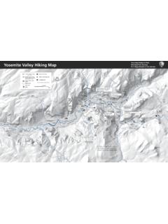
1 Day Use Parking yosemite VillageThe AhwahneeDegnan s DeliVisitor CenterLower yosemite fall yosemite Lodge/ Camp 4 yosemite Lodge Sentinel BridgeLeConte Memorial/ Housekeeping CampBike & Raft RentalsCurry Village Curry Village ParkingUpper Pines Campground Happy IslesMirror Lake TrailheadStables & North Pines CampgroundPines CampgroundsEl Capitan Picnic Area El Capitan BridgeSentinel BridgeYosemite ValleyFree SHUTTLE System1E3E4A. yosemite FallsB. Keep Bears WildC. Tunnel ViewD. Glacier PointE. Happy Isles F. Visitor Center/MuseumG. Valley Loop TrailParkingRestroomsPicnic AreaHotelCampingWater StationHiking TrailBike/Raft RentalGift ShopMedical ClinicInformation}}}KEYY osemite LodgeCamp 4 yosemite Village &Visitor CenterTa f tPointRibbonFallEl CapitanLowerYosemite FallUpperYosemite FallEaglePeakMiddleBrotherMedicalClinicN orthDomeMirrorLakeHalfDomeNevadaFallJohn Muir Trail/Mist TrailVernalFallSentinel Dome & Taft PointTrailheadFour MileTrailSentinelFallsSentinelRockSentin elDomeWelcome to yosemite Valley Glacier PointThe AhwahneePohonoTrailAuditorium & TheaterAnsel AdamsGalleryWildernessCenterPost OfficeYosemiteCemeteryIndianVillageYosem iteMuseumDegnan s.
2 Deli & CafeThe LoftHabitat YosemiteNational Park ServiceHeadquartersVillage StoreVillage GrillSports ShopVillage GarageYosemite Art CenterVisitor Center, Lost & Found, yosemite Conservancy Bookstore2459110 yosemite VillageMedical CenterGlacierPointRoadSwinging BridgeNorthside DriveSouthside DriveSentinelBeachHappyIslesHousekeeping CampCurry VillageNorth PinesLowerPinesUpper PinesE5E2E123678495101112161713a18141915 202113bROADV alley ShuttleEl Capitan SHUTTLE (summer only)Hiking TrailRivers and FallsShuttle onlyOne-way TrafficTwo-Way Traffic}}}}}}}} yosemite Conservancy at work in the ValleyDEFBACGT unnelView}}}BridalveilFallDeweyPointCroc kerPointStanfordPointIllilouetteFallEl CapitanBridge}CathedralBeachEl CapitanPicnic AreaHorsetailFallLowerBrotherTO CURRY VILLAGE}TO yosemite LODGE}TO THE AHWAHNEE}\ yosemite FallsVisitor Center/MuseumHappy IslesValleyLoop TrailTunnel ViewGlacier PointBearLockers 111214151617181913a13b109E21 23456 78 SHUTTLE STOPSE12120E3E4E5To Cloud s Rest,Little yosemite Valley, andHalf Dome}AT MWashburnPointClark Point ||Easy (flat and short)Bridalveil mi ( km) round-trip; 20 minutes, elevation change: 80 ft (24 m)A paved trail leads from the Bridalveil parking area to the base of this waterfall.
3 Lower yosemite fall wheelchair accessible; dry in late summer and mi ( km) loop trail; 30 minutes, elevation change: 50 ft (15 m); SHUTTLE stop #6 Begin at the Lower yosemite fall trailhead. Seasonally spectacular views of yosemite Falls. Cook s Meadow Loop wheelchair accessible1 mi ( km); 30 minutes, elevation change: mostly level; SHUTTLE STOPS #5, #6, #9, or #11 Walk along the bike path toward Lower yosemite fall . At SHUTTLE stop #6, cross the street and follow the bike path. Mirror Lake Trail dry in summer and fall2 mi ( km) to the lake and back, 5 mi (8 km) loop around the lake; 1-4 hours, elevation change: 100 ft (30 m); SHUTTLE stop #17 Begin at Mirror Lake Trailhead. A paved trail leads directly to Mirror Lake. The loop follows Tenaya Creek beyond the lake, and crosses two bridges after the Snow Creek Trail junction.
4 It then returns on the other side of Mirror Lake. Accessible via vehicle with accessibility (flat and long)Valley Loop mi ( km) full loop; mi ( km) half loop; hours; elevation change: mostly level; SHUTTLE stop #6 From the Lower yosemite Falls area, head west along the bike path until you see signs for the Valley Loop Trail. The half loop crosses the Merced River at El Capitan Bridge and returns to yosemite Village on the south side of the river. For the full loop, continue past El Capitan toward Bridalveil fall , cross the river at the Pohono Bridge, and return to yosemite Village. Vernal fall mi ( km) round trip; hours; elevation change: 400 ft (120 m); SHUTTLE stop #16 Begin at Happy Isles and cross the river. An excellent view of Vernal fall is visible from this (steep and long)upper yosemite fall and Columbia mi (12 km) 6 10 hours round trip; elevation change 2,600 ft (790 m); SHUTTLE stop #7 Start at Camp 4.
5 Turn left on the Valley Loop Trail. Trailhead will be on your right. Columbia Point offers a nice view about 1 mi ( ) up the trail and an elevation gain of 1000 ft (300m). Four Mile Trail mi ( km) one way to Glacier Point; 3-4 hours one-way; elevation change: 3,200 ft (975 m)Begin at the Four Mile Trailhead along Southside Drive. Trail maintains a continuous steep grade with spectacular views. To hike back to the Valley, either reverse your route or use the Panorama trail to descend to Happy Isles. If you want to hike one way arrange transportation back to the Valley from Glacier Point. Bus tickets available seasonally at any concessionaire tour desk. Panorama mi ( km) one way; 6-8 hours; elevation change: 3,200 ft (975 m)Begin at the Glacier Point parking area. After descending 1,300 ft (400 m) to Illilouette fall during the first 2 miles ( km), the trail climbs 800 ft (240 m) to the Panorama Cliff ridge line and descends 600 ft (175 m) to the John Muir Trail above Nevada fall .
6 A left turn follows the John Muir Trail downhill for mi ( km); a right turn follows a mi ( km) trail across the top of Nevada fall to the Happy Isles Trailhead. Vernal & nevada Falls/Mist TrailTop of Vernal fall : mi ( km) round trip; 3 hours; elevation change: 1000 ft (300 m)Top of Nevada fall : mi ( km) round trip; 5-6 hours; elevation change: 2000 ft (610 m)Begin by following directions listed for the Vernal fall footbridge. Past the Vernal fall footbridge, the Mist Trail and the John Muir Trail diverge. To hike directly to the top of Vernal fall , follow the Mist Trail miles ( km) up a steep granite stairway. Prepare for slippery footing and waterfall spray. Nevada fall is mi ( ) up the steep switchbacks beyond the Mist Trail. The John Muir Trail can be used to hike this corridor in a loop or as a less direct ascent.
7 Portions of the John Muir and Mist Trail are closed in winter. Half dome cables up and trail open May mi ( km) round trip; 10-12 hours; elevation change: 4800 ft (1463 m); SHUTTLE stop #16; permit required. Daily lottery available two days prior to hiking date. Apply at or by calling Via Mist Trail 14 mi ( km) round-trip; via John Muir Trail mi ( km) round-trip; via Mist and John Muir Trails mi ( km). Begin at Happy Isles. Follow the Mist Trail or John Muir Trail to Nevada fall . Continue on the trail, following the signs to Half Dome. The last 900 feet (275 m) of trail is a very steep climb up the east side of Half Dome. Cables assist hikers on the final 400 ft (122 m). Do not begin this ascent if: 1) the cables are down, 2) there is any chance of rain (moisture makes the granite too slick for safety), or 3) there is any chance of Meadow, Bridalveil Creek, and dewey Point elevation change: 300 ft (91m)Bridalveil Creek: 4 mi ( km) round-trip; 2-3 hoursdewey Point: mi ( km) round-trip; 3-4 hoursBegin at McGurk Meadow trailhead miles (12 km) east on Glacier Point Road.
8 The trail leads downhill miles ( km) to McGurk Meadow. One mile ( km) beyond the cabin the trail intersects with the Pohono Trail; turn left for Dewey Point and right for Bridalveil Creek. sentinel dome mi ( km) round-trip; 2 hours; elevation change: 400 ft (122 m)Begin at Sentinel Dome/Taft Point miles ( km) east on Glacier Point Road. Can also be hiked in a loop via Taft Point mi ( km) round-trip; 2 hours; elevation change: 200 ft (60 m)Begin at Sentinel Dome/Taft Point trailhead (see above). Take left turn onto Taft Point Trail and The Fissures. Can also be hiked in a loop via Sentinel Meadow to view of Mount starr King 3 mi ( km) round-trip; 2-3 hours; elevation change: 250 ft (76 m)Begin at Mono Meadow Trailhead, miles (17 km) east on Glacier Point Road. The trail descends steeply to Mono Meadow.
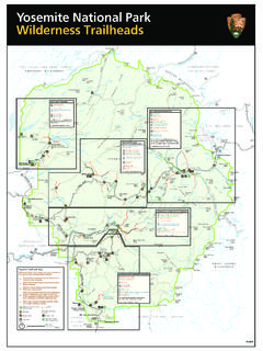
9 Follow the trail from the east end of the meadow to a clearing with magnificent views of the Clark Range, Mount Starr King, and Half Lake mi (20 km) round-trip; 5-8 hours; elevation change: 1,600 ft (490 m)Begin at Ostrander Lake Trailhead, 9 miles (14 km) east on Glacier Point Road. A steep elevation gain opens up to High Sierra views. A short ascent leads to Ostrander mi ( km) one way, 8-10 hours, elevation change: 3,700 ft (1,130 m)Begin at Glacier Point parking area or Tunnel View parking area. The trail is most commonly hiked one-way from Glacier Point, but can be used to hike the entire scenic south rim of the Valley. Day Hikes in yosemite Valley:Glacier Point Road Hikes:12014041120souTHEnTranCEarCH roCKEnTranCEBIG oaKF LaTEnTranCETIoGaPassEnTranCEyosEMITEVaLL EyHETCH HETCHyGLaCIErPoInTWaWonaTuoLuMnE MEadoWsYosemiteNational ParkGet Involved: Volunteer in the Park!
10 Looking for a hands-on way to give back to yosemite ? yosemite volunteers experience the privilege of serving in a World Heritage Site while participating in work projects for a week or assisting visitors with park information for a month. Visit for more Workshops Inspired by the Beauty of YosemiteSlow down, soak in the views and create a lasting memory. From children s programs to outdoor workshops, daily offerings Welcome all abilities. Stop by the yosemite Art Center in yosemite Village or call for schedule. Classes are offered April-October. yosemite Conservancy has been helping to preserve and protect yosemite for more than 90 years. With support from donors we have provided over $90 million in grants to the park for nearly 500 completed projects. Everywhere you look in yosemite , you ll see evidence of your donations at work.