Transcription of SNA needs to know each block of the DD-175 T/D …
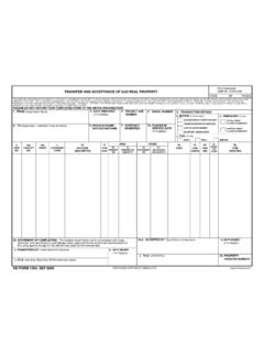
1 Slide 3. SNA needs to know each block of the DD-175 . -Ensure that they are using the general planning when filling out the DD-175 . T/D code per the general planning 4-6. Types of flight Plan per the general planning 4-11. Item (4) TYPE FLIGHT PLAN- Enter I (IFR) or V (VFR) as appropriate for that segment. Do not combine IFR and VFR route segments on the same line. Enter D (DVFR) for VFR. flights conducted in the accordance with Air Defense Identification Zone procedures in the appropriate Enroute Supplement. 1. Filing Altitudes: Semi-circular rules: IFR within controlled airspace as assigned by ATC. IFR outside controlled airspace semi-circular rules apply. VFR above 3000' AGL unless otherwise authorized by ATC, semi-circular rules apply. Void Time: This is for administrative purposes only.
2 It has nothing to do with SAR. 2. Slide 4. Lost Communications: 3. Give the SNA a scenario, to help ensure they have a working knowledge of the lost comm. procedures. 4. Slide 5. Fuel planning : OPNAV Minimum Fuel Requirements Fuel planning . All aircraft shall carry sufficient usable fuel, considering all meteorological factors and mission requirements as computed be-low: a. If alternate is not required, fuel to fly from take-off to destination airfield, plus a reserve of 10 per-cent of planned fuel requirements. b. If alternate is required, fuel to fly from takeoff to the approach fix serving destination and thence to an alternate airfield, plus a reserve of 10 percent of planned fuel requirements. c. In no case shall the planned fuel reserve after final landing at destination or alternate airfield, if one is required, be less than that needed for 20.
3 Minutes of flight, computed as follows: (1) Reciprocating engine-driven aircraft. Compute fuel consumption based on maximum endurance operation at normal cruise altitudes. (2) Turbine-powered fixed-wing/tilt-rotor air-craft. Compute fuel consumption based on maximum endurance operation at 10,000 feet. (3) Turbine-powered helicopters. Compute fuel consumption based on operation at planned flight altitude. d. Minimum fuel reserve requirements for specific model aircraft shall be contained in the appropriate NATOPS manual. Delays. Any known or expected traffic delays shall be considered time en route when computing fuel reserves. If route or altitude assigned by air traffic control causes or will cause planned fuel reserves to be inadequate, the pilot shall inform ATC.
4 Of the circumstances, and, if unable to obtain a satisfactory altitude or routing, alter destination accordingly. Note: This is for planning purposes only! There is no requirement to be on deck with 19 Gallons. 5. Slide 6. Alternate Requirements: Not only have the SNAs know the chart out of OPNAV 3710 but ensure you give them an alternate airfield and tell you what the weather has to be at that airfield. 6. Slide 7. NOTAMS. (AIM 5-1-3). 7. (GP 2-1). 8. Slide 8. WEATHER. 9. 10. 11. 12. 13. 14. OPNAV STATES: Severe Weather Watch Bulletins. The National Weather Service Storm Prediction Center issues unscheduled Weather Watch (WW) bulletins as graphical advisories for the Continental United States whenever a high probability exists for severe weather. The Air Force also issues scheduled Military Weather Advisories (MWA) in graphical form for the same geographic areas.
5 Both provide estimates of the potential for convective activity for a specific time period, will be provided to pilots or certified crewmembers upon request, and are included with all briefings. An Air Force MWA does not constitute a Storm Prediction Center WW. Except for operational necessity, emergencies, and flights involving all-weather research projects or weather reconnaissance, pilots shall not file into or through areas for which the Storm Prediction Center has issued a WW unless one of the following exceptions apply: a. Storm development has not progressed as forecast for the planned route. In such situations: (1) VFR filing is permitted if existing and forecast weather for the planned route permits such flights. (2) IFR flight may be permitted if aircraft radar is installed and operative, thus permitting detection and avoidance of isolated thunderstorms.
6 (3) IFR flight is permissible in positive control areas if VMC can be maintained, thus enabling aircraft to detect and avoid isolated thunder- storms. b. Performance characteristics of the aircraft permit an en route flight altitude above existing or developing severe storms. Note It is not the intent to restrict flights within areas encompassed by or adjacent to a WW area unless storms have actually developed as forecast. 15. Daily Flight Schedule. A signature Slide 9 by the reporting custodian or other appropriate SIGNING THE DD 175 authority Signing the Flight Plan on the daily flight schedule, when used in lieu of Pilot in Command/Formation a flight plan form, signifies that preceding items Leader. (a). Except when a daily flight schedule is used in through (h) shall be assured prior to flight.
7 Lieu of Flight Plan Approval. The pilots in a flight plan form, the pilots in command of a naval aircraft or formation leaders command/formation are leaders shall sign the flight plan for their flight. authorized to approve the flight plan for their For pro-posed multipiloted aircraft, the pilot in flight or modification thereof. command/formation FLIGHT PLAN MODIFICATION. leader may choose to delegate this responsibility Modification of a written flight plan shall be to a accomplished NATOPS qualified pilot/NFO. Regardless, the only with the concurrence of the pilot in pilot command. in command/ formation leader is responsible for FLIGHT planning . compliance with items a through h. Preflight planning . Before a. The flight has been properly authorized. commencing a flight, the pilot in command shall b.
8 Adequate flight planning data, including be familiar with all NOTAM available information appropriate to the intended service, was available for complete and accurate operation. planning . Such information should include but is not c. The flight will be conducted in accordance limited to available weather reports and with forecasts, governing directives and adherence to criteria NOTAMs, fuel requirements, terminal for instrument fuel requirements and weather minimums. procedures (to include proper use of non-DOD. d. Each pilot in a formation flight has received approaches), the alternatives available if the flight cannot required weather briefing. be completed as planned, and any anticipated e. The pilot in command/each pilot in a traffic formation delays.
9 In addition, the pilot in command and flight possesses a valid instrument rating if any mission portion of the flight is to be conducted under commander (when there is one designated) shall IMC conduct a risk assessment prior to the flight or in positive control areas or positive control route segments. f. Passengers have been properly briefed and manifested. g. Proper weight and balance forms, if applicable, have been filed. h. The pilot in command acknowledges responsibility for the safe and orderly conduct of the flight. 16. Slide 10. Chart Trivia Slide 11. (IFR Enroute Low Altitude Chart). (T) - Frequency protection usable range at 12,000 AGL 25NM. HAWTHORNE - Name of Controlling FSS. R-2516/R2517 -Restricted Areas [D]* -Airspace Class (* Part-time, or established by NOTAM).
10 L* -Lighting Available (* Part-time or on request). ORCUT -MCA. _ -VOR Changeover Point (Y) -TACAN must be placed in Y to receive distance info (L) -Pilot controlled lighting -(underline) No voice transmitted on this frequency Slide 12. ------ -Refer to Los Angeles (Terminal Area) Chart Mode C Veil H -HIWAS. San Diego non-standard Class B. T TWEB. San Diego San -FSS Co-located 17. Slide 13. -FSS Receive freq only RIVERSIDE -Controlling FSS name MCA on V264. Describe 29 Palms Airfield Slide 14. Minimum reception altitude Compulsory reporting point ARTCC/ADIZ/TIME ZONE BOUNDARY. Slide 15. ABQ NAVAID Symbology Albuquerque ARTCC Frequency Slide 16. Special Flight Rules Area 18. Slide 17. Airspace Classes Class A: Dimensions: (FAR ) 18,000 MSL up to and including FL 600, including the airspace overlying the waters within 12 nm of the coast of the 48 contiguous States and Alaska, and designated international airspace beyond 12 nm of the coast within areas of domestic radio navigational signal or ATC radar coverage, and within which domestic procedures are applied.

