Transcription of Stormwater Drainage Design Guidelines 2019
1 1 Stormwater Drainage Design Guidelines 2019 2 Contents 1. Purpose .. 3 2. Background .. 3 3. Design Requirements .. 3 On Site Detention .. 3 Region 1 - CBD and Growth Areas .. 4 OSD Design Parameters Region 1 .. 4 Integrated Water Cycle Management Region 1 .. 5 Region 2 - Non Growth Areas .. 5 OSD Design Parameters Region 2 .. 5 Integrated Water Cycle Management Region 2 .. 6 Region 3 Fishermans Bend .. 6 4. Construction of a Council Drain .. 6 Design Requirements .. 7 Ownership and Maintenance .. 8 As Constructed Drawings .. 8 5. Legal Point of Discharge Process .. 8 6. Groundwater Management.
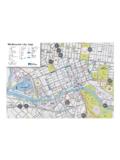
2 8 Appendix 1 .. 9 Map of City of Melbourne Drainage regions .. 9 Appendix 2 .. 10 City of Melbourne Drainage Specification January 2012 .. 10 Approved Drain Connection Pipe Types .. 13 3 1. Purpose The purpose of this document is to outline the Stormwater Drainage Design requirements for developments within the City of Melbourne. 2. Background The City of Melbourne manages an extensive network of Stormwater Drainage assets, made up of approximately 365 kilometres of underground drain and 15,000 Drainage pits. There are a number of significant challenges in managing this network, such as the effects of climate change, aging infrastructure, increased development and greater community expectations in terms of reducing flood risk and responding to reports of flooding.
3 The effects of climate change 1are predicted to result in a % increase in rainfall intensity as well as a metre rise in sea level by the year 2100. These effects, in combination with the highly impervious nature in some of the municipality s lower lying areas (Southbank, CBD South, Docklands and Fishermans Bend) result in a likely increase in flood risk. The City of Melbourne is mitigating this flood risk through the following means: A proactive annual program of Drainage upgrades and renewal works Increasing catchment permeability through Council s Total Watermark and Urban Forest Strategies Restricting the flow rates discharged from new development sites Promoting the use of Integrated Water Cycle Management in Council s capital works program and through planning permit requirements on developments Drainage data collection program to facilitate flood modelling of the Council Drainage network Progressively increasing the capacity of drains and pump stations to a 5% Annual Exceedance Probability (AEP)
4 Standard Flood risk is a product of both the likelihood of a flood event, and the consequences of such an event occurring. It stands therefore that flood risk can be reduced by either reducing the likelihood of flooding (through increased Drainage capacity, or reducing runoff for example), reducing the consequences of flooding (through increased awareness and preparedness at flooding hot spots ), or a combination of both. 3. Design Requirements For the purposes of these Guidelines , the municipality is broken into three distinct regions, each of which has its own specific Drainage Design requirements for new developments. The Drainage Design requirements for development in each area are outlined below.
5 On Site Detention The primary purpose of On-Site Detention (OSD) Systems within the City of Melbourne is to limit the rate of discharge from a site to the legal point of discharge, freeing up capacity in the Council Drainage network to reduce flooding during more extreme rainfall events. This is achieved by controlling post development flow rates to a pre-determined level, and temporarily storing excess runoff in storage tanks or pipes within a site boundary. The key elements of an OSD System are: A runoff collection system consisting of gutters, downpipes, pits and pipes. A runoff storage area (Oversized Pipe, Tank, etc.)
6 1 4 A flow control device (Multicell, Orifice Pit or Pump) to allow discharge to the Legal Point of Stormwater Discharge at the predetermined rate Region 1 - CBD and Growth Areas This region includes the Melbourne Central Business District as well as the Southbank, Arden-Macaulay, Docklands and CBD North growth areas. With the exception of residential extensions and single dwelling development, all developments within this region will be subject to the following Drainage Design requirements: OSD Design Parameters Region 1 The two key calculations required for the Design of an OSD System are: Permissible Site Discharge (PSD) The purpose of the PSD is to limit the site discharge to a pre-determined rate.
7 Within Region 1 (CBD and Growth Areas), the PSD is calculated as the runoff generated from the pre-developed site during a 20%2 AEP Design storm event of 5 minute duration. The PSD is calculated using the Rational Method Formula: PSD (litres/s) = 3600A x I x C52020 Where, 20C = 20% AEP Runoff Coefficient = x [Fimp x + (1-Fimp) x ] Fimp = Fraction Impervious for Pre-Developed Site 520I = Rainfall Intensity for 20% AEP event of 5 minute duration (mm/hr) A = Site Area (m2) Site Storage Requirement (SSR) The SSR in Region 1 (CBD and Growth Area) is calculated from the post development runoff generated from a 100 year ARI rainfall event.
8 A range of storm durations needs to be considered when calculating the SSR. Typically storm durations ranging from 5 minutes to approximately 2 hours will need to be considered to determine the maximum SSR which is to be adopted for the Drainage Design . The calculations may be undertaken either by applying Boyd s Method for peak flood estimation (Outlined in Australian Rainfall & Runoff Section , 1987) for a suitable range of storm durations or by using a computer program such as OSD4. Where OSD4 is being used to calculate the required SSR, City of Melbourne s Drainage Engineer should be contacted to provide Tc (catchment time of concentration) and Tso (travel time taken from site to outlet).
9 SSR = [DQ1 PSD] x 60 x D x Where: D = Storm Duration (Ranging from 5 minutes to 120 minutes) DQ1 = 1% AEP runoff for storm duration D minutes 5 PSD = Permissible Site Discharge (Outlined above) = Factor to account for increased rainfall intensity due to climate change Integrated Water Cycle Management Region 1 The City of Melbourne, through its town planning approval process, requires all new developments with an increase in floor area in excess of 50 m2 to incorporate Integrated Water Cycle Management (IWCM) principles into Stormwater Drainage Design . This approach can serve the dual purpose of providing temporary flood storage on a lot scale, while also reducing the demand for potable water supply.
10 Where a rainwater tank is proposed within a development to comply with these IWCM requirements, and a daily justifiable demand for harvested rainwater reuse on site is identified, this regular drawdown in water level from the tank may offer the opportunity for on-site detention storage to be incorporated within the IWCM Design . The volume of detention storage that can be offset within a rainwater tank is site specific, and dependent on variables such as roof area, daily demand and tank size. Region 2 - Non Growth Areas This region includes the more established suburbs of Kensington, North Melbourne, Parkville, Carlton North, East Melbourne, Jolimont and South Yarra.