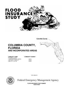
Transcription of SUWANNEE COUNTY, FLORIDA - …
1 SUWANNEE county , FLORIDA AND INCORPORATED AREAS COMMUNITY COMMUNITY NAME NUMBER SUWANNEE county 120300 (UNINCORPORATED AREAS) BRANFORD, TOWN OF 120301 LIVE OAK, CITY OF 120301 PRELIMINARY SEPTEMBER 29, 2006 Federal Emergency Management Agency FLOOD INSURANCE STUDY NUMBERS 12121CV000A SUWANNEE county NOTICE TO FLOOD INSURANCE STUDY USERS Communities participating in the National Flood Insurance Program have established repositories of flood hazard data for floodplain management and flood insurance purposes.
2 This Flood Insurance Study (FIS) may not contain all data available within the repository. It is advisable to contact the community repository for any additional data. Part or all of this FIS may be revised and republished at any time. In addition, part of this FIS may be revised by the Letter of Map Revision process, which does not involve republication or redistribution of the FIS. It is, therefore, the responsibility of the user to consult with community officials and to check the community repository to obtain the most current FIS components. Initial Countywide FIS Effective Date: Revised Countywide FIS Dates: i TABLE OF CONTENTS Page Purpose of Study.
3 1 Authority and Acknowledgments ..1 Coordination ..2 AREA Scope of Study ..3 Community Principal Flood Flood Protection Measures ..7 ENGINEERING Hydrologic Hydraulic Analyses ..9 Vertical FLOODPLAIN MANAGEMENT Floodplain Boundaries ..12 Floodways ..13 INSURANCE FLOOD INSURANCE RATE OTHER LOCATION OF BIBLIOGRAPHY AND ii TABLE OF CONTENTS continued Page FIGURE Figure 1 - Floodway Schematic.
4 14 TABLES Table 1 - Historical Floods on the SUWANNEE Table 2 - Summary of Discharges ..9 Table 3 - Floodway Table 4 - Community Map EXHIBITS Exhibit 1 - Flood Profiles SUWANNEE River Panels 01P-05P Santa Fe River Panel 06P Exhibit 2 - Flood Insurance Rate Map Index Flood Insurance Rate Map 1 FLOOD INSURANCE STUDY SUWANNEE county , FLORIDA AND INCORPORATED AREAS INTRODUCTION Purpose of Study This Flood Insurance Study (FIS) investigates the existence and severity of flood hazards in, or revises and updates previous FISs/Flood Insurance Rate Maps (FIRMs)
5 For the geographic area of SUWANNEE county , FLORIDA , including the Town of Branford, City of Live Oak and the unincorporated areas of SUWANNEE county (hereinafter referred to collectively as SUWANNEE county ). This FIS aids in the administration of the National Flood Insurance Act of 1968 and the Flood Disaster Protection Act of 1973. This FIS has developed flood risk data for various areas of the county that will be used to establish actuarial flood insurance rates. This information will also be used by SUWANNEE county to update existing floodplain regulations as part of the Regular Phase of the National Flood Insurance Program (NFIP), and will also be used by local and regional planners to further promote sound land use and floodplain development.
6 Minimum floodplain management requirements for participation in the NFIP are set forth in the Code of Federal Regulations at 44 CFR, In some States or communities, floodplain management criteria or regulations may exist that are more restrictive or comprehensive than the minimum Federal requirements. In such cases, the more restrictive criteria take precedence and the State (or other jurisdictional agency) will be able to explain them. Authority and Acknowledgments The sources of authority for this FIS are the National Flood Insurance Act of 1968 and the Flood Disaster Protection Act of 1973.
7 This FIS was prepared to include the unincorporated areas of SUWANNEE county and the Town of Branford in a countywide format. Information on the authority and acknowledgments for this countywide FIS, as compiled from their previously printed FIS report, is shown below. SUWANNEE county (Unincorporated Areas): The hydrologic and hydraulic analyses for the FIS report dated January 6, 1988, were performed by the Army Corps of Engineers (USACE), Jacksonville District, for the Federal Emergency Management Agency (FEMA), under Inter-Agency Agreement No.
8 EMW-E-1153, Project Order No. 1. This study was completed in April 1985. 2 Branford, Town of: The hydrologic and hydraulic analyses for the January 16, 1987, FIS report were obtained from the FIS for the unincorporated areas of SUWANNEE county . For this countywide FIS, revised hydrologic and hydraulic analyses were prepared for FEMA by URS Corporation under contract with the SUWANNEE River Water Management District (SRWMD), a FEMA Cooperating Technical Partner (CTP).
9 The digital base map files were derived from Geological Survey (USGS) Digital Orthophoto Quadrangles, produced at a scale of 1:12,000 from photography dated 2004. The coordinate system used for the production of the digital FIRM is State Plane in the FLORIDA North projection zone, referenced to the North American Datum of 1983. Coordination Consultation Coordination Officer s (CCO) meetings may be held for each jurisdiction in this countywide FIS. An initial CCO meeting is held typically with representatives of FEMA, the community, and the study contractor to explain the nature and purpose of a FIS, and to identify the streams to be studied by detailed methods.
10 A final CCO meeting is held typically with representatives of FEMA, the community, and the study contractor to review the results of the study. For the unincorporated areas of SUWANNEE county , an initial CCO meeting was held on May 6, 1983. Representatives of FEMA, the Study Contractor, and the SRWMD were in attendance. On February 18, 1987, the results of the FIS were reviewed and accepted at a final CCO meeting attended by representatives of the Study Contractor, FEMA and the community. For the Town of Branford, a final CCO meeting was held on February 26, 1986, and was attended by representatives of the community and FEMA.