Transcription of TABLE OF CONTENTS - Tzonline
1 TABLE OF CONTENTS . Pages SECTION LAND, PEOPLE AND Geographical 1. Land Area .. 1. Topography and Drainage:.. 2. Climate, Soils and Vegetation .. 3. Agro - Economic Zones:.. 4. Administrative Units .. 7. 8. Population Characteristics .. 9. Migration and 23. SECTION REGIONAL Introduction:.. 28. Regional GDP and Per Capita 29. PRODUCTIVE 31. 31. 42. Natural Resources .. 50. 66. Industry and 66. SECTION III ..67. ECONOMIC 67. 67. Railway Transport .. 74. Air Services .. 74. Communication 74. Energy .. 75. i SECTION IV ..77. SOCIAL SERVICES ..77. EDUCATION: .. 77. Primary Education.
2 77. Secondary 84. Adult Education .. 87. HEALTH .. 89. Introduction .. 89. Morbidity and Mortality .. 90. Health 90. Child 92. Maternal 93. Infant and Under Five 97. Child Nutrition 104. 105. Life 106. WATER S UPPLY .. 107. Introduction .. 107. Rural Water 110. Urban Water Supply .. 112. 116. SECTION V .. 118. OTHER DEVELOPMENT RELATED ISSUES .. 118. W OMEN IN DEVELOPMENT .. 118. 119. NGOS A CTIVITIES IN THE REGION .. 120. DONOR 122. ii SECTION 124. POTENTIAL INVESTMENT 124. A GRICULTURE .. 124. 124. FORESTRY .. 125. 127. M 127. INDUSTRIAL DEVELOPMENT .. 127. 128. COMMUNICATION 128.
3 ENERGY .. 128. HEALTH .. 128. W ATER SUPPLY .. 129. EDUCATION .. 129. W OMEN DEVELOPMENT .. 130. ANNEXES. ANNEX A .. 131. Tabora Region in a 131. ANNEX B .. 145. Igunga District Summary (1996).. 145. ANNEX C .. 150. Nzega District Summary (1996) .. 150. ANNEX D .. 155. Tabora (and Sikonge) District Summary (1996).. 155. ANNEX E .. 161. Urambo District Summary 161. iii ANNEX F .. 167. GENERAL INFORMATION ABOUT TANZANIA .. 141. 142. Land 143. Arable Land:.. 169. 169. Mountain summits (metres above sea level).. 169. 170. SOCIAL SERVICES .. 171. Health 171. 171. NATIONAL PARKS.
4 172. iv FOREWORD. 1. As we approach the 21st Century the problems facing rural areas in developing countries like Tanzania are numerous and formidable. Social and Economic services are deteriorating and proving to be unsustainable; school enrollment rates are declining; food situation is precarious; infant and maternal mortality rates continue to be high; unemployment is on the rise triggering off mass migration of youth from the rural areas into already overcrowded urban centres; in Tabora Region, for example, land pressure is escalating and deforestation is going on at an alarming rate.
5 2. This situation has arisen because of many factors including ill - prepared rural development programmes and weak monitoring and supervision of the implementation of development programmes and sectoral strategies. The observed shortcomings in the policy formulation, project identification, design, and implementation in the developing countries is in turn attributed to lack of reliable and adequate data and information on the rural development process. 3. The publication of Regional Socio-economic Profiles series by the Planning Commission in collaboration with Regional Commissioner's offices should be viewed as a fruitful attempt towards finding solutions to the existing problem of data and information gap.
6 4. The Regional Profile series cover a wide range of data and information on geography, population, social economic parameters, social services, economic infrastructure and v productive sectors. The publications so far have proved to be of high demand and a vital source of information to many policy makers, planners, researchers, donors and functional managers. The Planning Commission has found it a worthwhile effort to extend the exercise to cover even more regions. Readers are invited to make suggestions and constructive criticisms which can assist in improving the quality and effectiveness of future Profiles.
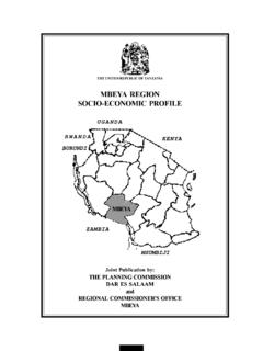
7 5. I would like to take this opportunity to acknowledge with thanks once again the financial support of the Royal Norwegian Embassy which facilitated the preparation of the Tabora Region Socio-Economic Profile. I would also like to thank both the Planning Commission and Tabora Regional Planning Staff who put a lot of effort into ensuring the successful completion of this task. Nassoro W. Malocho (MP). MINISTER OF STATE. PLANNING AND PARASTATAL SECTOR REFORM. May, 1998. vi SECTION I. LAND, PEOPLE AND CLIMATE. Geographical Location Tabora Region is located in Mid-Western part of Tanzania on the central plateau between latitude 40-70 South and longitude 310 - 340 East.
8 The region shares a border with Shinyanga region in the North, Singida region in the East, Mbeya and Rukwa regions in the South while the Western border is shared with Kigoma region. Land Area Tabora region has an area of 76,151 representing 9% of the land area of Mainland Tanzania. A total of 34,698 are Forest Reserves and 17,122 are Game Reserves. Fig. 1 Land classification in Tabora region Game Reserves 33%. Forest Reserves 67%. 1. Topography and Drainage: (i) Topography: The south west and north central portions of the region are divided by a watershed which runs from east to west.
9 From the water-shed gently rolling country bisected by broad badly defined drainage lines (known as mbugas) drain to Ugalla River in the south west and the Igombe and later the Malagarasi River and Lake Sagara which form the western boundary of the region. In the north east, the topography is better defined but again the actual drainage line drain into Wembere River and its tributaries and eventually into lake Kitangiri. Most of the region lies at altitude between 1,000 and 1,500 metres with only two small areas in the northwest and south-east rising to some 1,800 metres above sea level.
10 (ii) Drainage: Tabora region is drained by the two river systems of the Malagarasi and the Manonga - Wembere. The Malagarasi drains the southern and western part of the region into Lake Tanganyika and out into the Atlantic. The Manonga drains into the inland Lake Eyasi. The extensive Malagarasi swamp covers the extreme western part of the region. The sedimentary Bukoba formation forms a dominant ridge line which block the drainage to the west resulting in the swampy lowland and broad Mbuga filled valleys which penetrates deeply into the south - central area of the region. The flat low-lying areas are significant from hydrogeologic point of view.